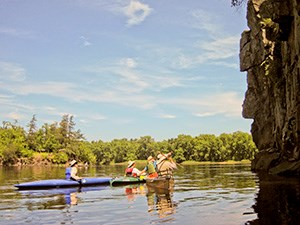
NPS/Ammann Gorgeous GorgesTrip DetailsDistance: 6.6 Miles
River DescriptionExplore the geology of the St. Croix Dalles: a deep gorge of basaltic rock formed thousands of years ago. This area has been the site of many historic events from steamboat building to giant log jams of the lumber era. Below the Dalles the river widens and vast mussel beds lie below the water. About two miles south of the Wisconsin Interstate State Park another set of basalt cliffs rise from the water and offer another chance to paddle beneath steep rock walls. Note that it is illegal to dive or jump from these or any other cliffs along the St. Croix. During periods of good precipitation, a paddle through Close's Slough, past Franconia Landing (river left), offers opportunities for solitude in wooded floodplains. There is plenty of wildlife to be seen and hidden lakes to be explored. In the main channel, stop at one of the sand bars for lunch. At the end of this stretch, the Osceola Bridge comes into view and picturesque sandstone bluffs rise alongside it. Just past the bridge on the Minnesota side of the river is Osceola Landing. CampingTo camp in this stretch of the St. Croix, you will need a camping permit. River Level ConsiderationsThis section of river can be floated spring through fall with easy paddling and little dragging. Motorized boats should use caution during periods of low water. Go to the River Conditions page for more information. Along the Way
Wisconsin Interstate State Park and Minnesota Interstate State Park lie across the river from each other, emphasizing the importance of this area to both states.
Multi-Day ExtensionCombining this stretch with the section of river below Osceola Landing (Map 9) make for an easy 2 to 3 day trip, with relatively flat water the entire distance. Special camping regulations extend to this area of the St. Croix River requiring a camping permit. Return to Ranger Recommended Paddles |
Last updated: July 7, 2025
