Last updated: May 30, 2023
Place
Wallula Gap National Natural Landmark
NPS Justin Radford
Quick Facts
Significance:
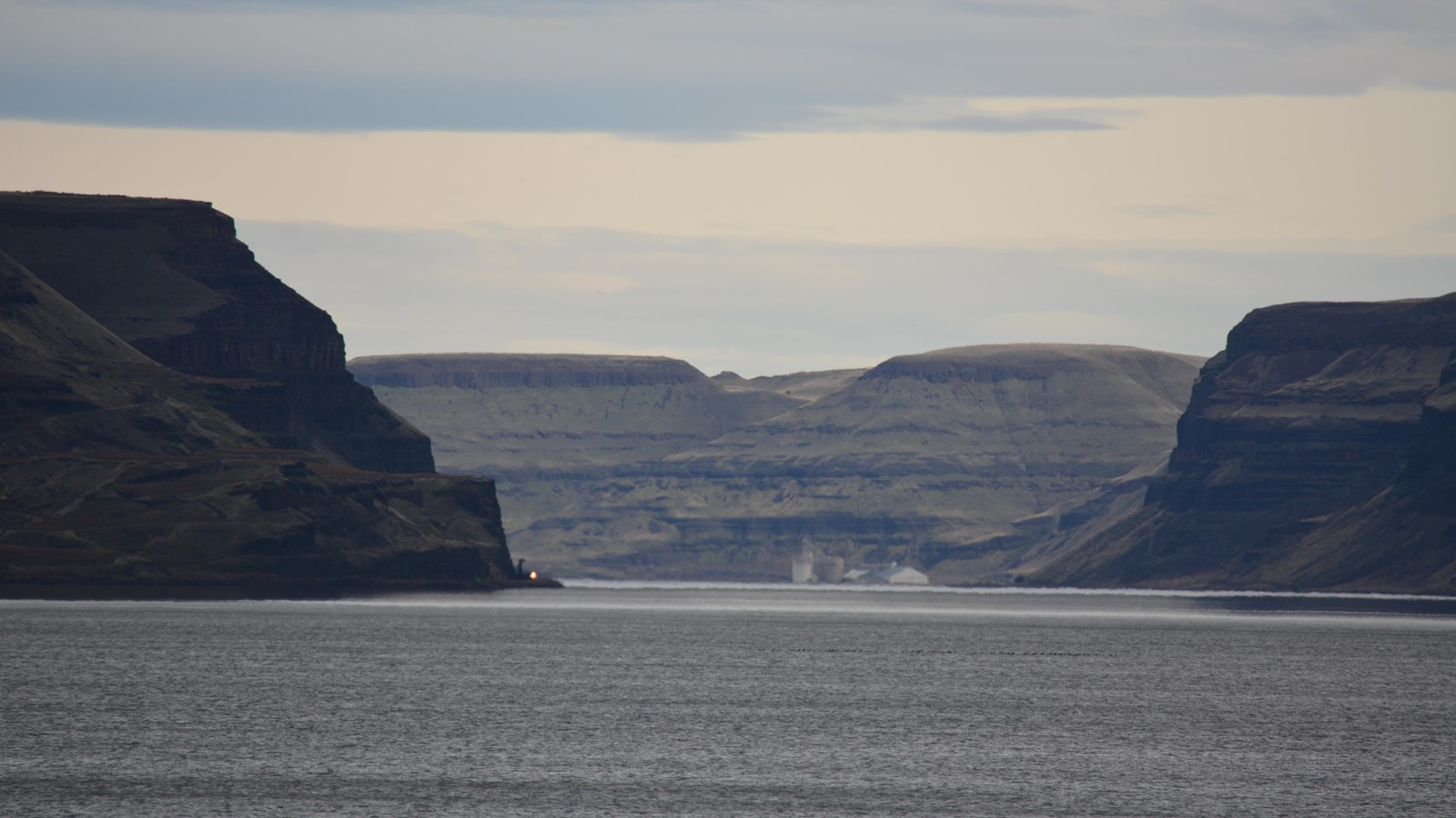
All of the flood waters that cut the channeled scablands of southeastern Washington from the Bonneville and Spokane floods were channeled through Wallula Gap. More than 833 cubic kilometers (200 cubic miles) of water per day were delivered to a gap that could discharge less than 166 cubic kilometers (40 cubic miles) per day, causing the remaining water to pond in the Pasco Basin and the Yakima and Touchet Valleys, to form Lake Lewis. This outlet of Wallula Gap, constricted in a relative sense only, (i.e. since it is more than 1.6 kilometers [1 mile] from rim to rim) controlled the discharge from the Pasco Basin and is dramatic and illustrative evidence of the magnitude of these flood waters.
Designation:
National Natural Landmark
OPEN TO PUBLIC:
No
Amenities
1 listed
Scenic View/Photo Spot
The Horse Heaven Hills are the southern border of the Central Basin area of the Columbia Basin and the Wallula Gap is the opening through which all of the Columbia and Snake River waters escape the basin. Wallula Gap is the largest, the most spectacular, and the most significant of the several large water gaps through basalt anticlines in the Columbia Basin. During the Pliocene and early Pleistocene the thick basalt flows of what is now southern Washington were wrinkled and uplifted into a long northeast-southwest trending anticlinal ridge which we call the Horse Heaven Hills. The uplift of this structure was more rapid than the ability of the ancestral Columbia River to downcut, thus a great lake, Lake Lewis, was impounded in the Pasco Basin area. The remains of the lake beds formed in this lake are the Ringold Formation. Once Lake Lewis was filled to overflowing, it established an outlet over the lowest saddle in the ridge at the location of Wallula Gap. The Columbia then poured down the steep south flank of the Horse Heaven Hills anticline in cascades and waterfalls which eroded slowly downward and headward until the ridge was completely breached. Wallula Gap was formed and the waters of Lake Lewis, along with considerable quantities of the Ringold sediments, drained down the Columbia Gorge into the sea. During the late Pleistocene the greatly increased meltwaters from the ice sheets and Cascade glaciers caused floods, perhaps annually; this encountered the constriction of Wallula Gap. Also, the gap was possibly dammed by jammed icebergs and ice cakes, causing the temporary and intermittent rebirth of Lake Lewis. This ephemeral lake left bottom deposits called the Touchet Beds. These giant floods filled the basin with a great temporary lake, which rapidly drained out through Wallula Gap. At the height of the Ice Age Floods the water flow through Wallula Gap has been estimated at 166 cubic kilometers (40 cubic miles) per day, a rate nearly twice the combined flow of all the present rivers on earth.