


Last updated: September 12, 2026
Place
Upper Crossing of the South Platte River
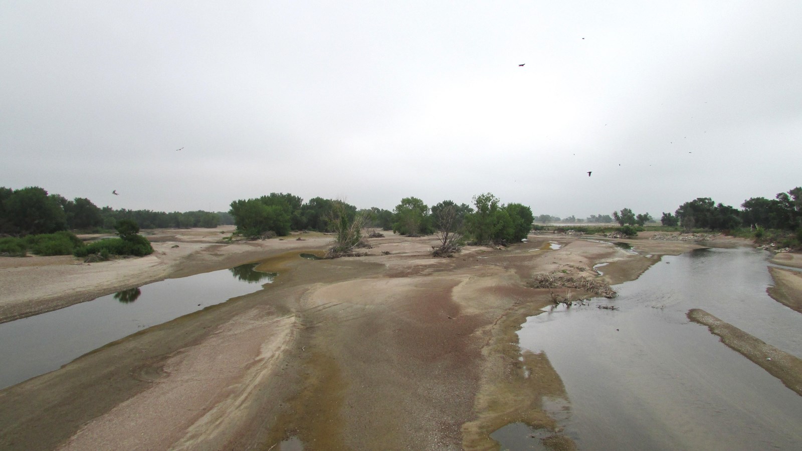
Photo/Chris Light, from Wikimedia Commons
Quick Facts
Location:
California Hill turnout, north side of US-30, about 4.5 miles west of Brule, Nebraska. California Hill Marker GPS 41.091 -101.9788666667 Crossing was about a mile southeast of the marker. If traveling westbound on I-80, Mile Marker 114 is approximately where the trail crossed the present freeway.
Significance:
“Upper Crossing,” located west of Brule, Nebraska, was the original South Platte Crossing used by Oregon- and California-bound travelers in the 1840s. It continued to see heavy use throughout the emigration era, although several later crossings were developed farther west.
Designation:
Historic site on the Oregon and California National Historic Trails.
MANAGED BY:
Turnout: Nebraska Department of Transportation. Crossing site: private
Amenities
2 listed
Historical/Interpretive Information/Exhibits, Parking - Auto
The Platte River splits at present-day North Platte, Nebraska, with the North Platte bending northwesterly toward Fort Laramie and the South Platte curving southwesterly toward Denver. Emigrants who had been traveling along the south side of the Platte had to cross the south fork to follow the Oregon and California trail.
There were several places to do that, but the river ford west of today’s Brule was the most heavily used. Commonly known as the Upper Crossing—although 2 other fords lay downstream—it also appeared in emigrant accounts and published trail guides under 5 additional names. Other fords were sometimes called “Upper Crossing,” as well. This inconsistent, casual use of crossing names poses challenges for researchers trying to identify exactly where an emigrant party forded the South Platte.
Emigrant journals, though, describe closely similar conditions and experiences at all the crossings: a broad, braided, sand-choked stream with swift, muddy water 1 to 3 feet deep, and a riverbed chock-full of surprise hazards.
Francis Parkman, who traveled the Oregon Trail in 1846 and likely used the Upper Crossing at Brule, called the channel “one great sand-bed, about half a mile wide.” He described fording as an arduous ordeal:
First the heavy ox-wagons plunged down the bank and dragged slowly over the sand-beds; sometimes the hooves of the oxen were scarcely wet by the thin sheet of water; and the next moment the river would be boiling against their sides, and eddying around the wheels. Inch by inch they receded from the shore, dwindling every moment, until at length they seemed to be floating far out in the middle of the river.
At one point, the mule cart carrying their belongings began sinking in quicksand, and the men had to ride out and pry it free.
The journal of Margaret Frink, whose 1850 company evidently used a lower crossing near O’Fallon’s Bluff, captured the commotion and uncertainty of fording the South Platte:
A great many other wagons and people were crossing at the same time – mule teams, horse teams, ox teams, men on horseback, men wading and struggling against the quicksands and current, many of them with long poles in their hands, feeling their way. Sometimes they would be in shallow water only up to their knees; then, all at once, some unlucky one would plunge in where it was three or four feet deep.
The deafening noise and halloing that this army of people kept up, made the alarm in the river more intense. The quicksand and the uncertainty of depth of water kept all in a state of anxiety. Our horses would sometimes be in water no more than a foot deep; then, in a moment, they would go down up to their collars.
From the California Hill turnout on US-30 west of Brule, look southeast to see the general location of the Upper Crossing. For a closer look at the river, drive west about 4 ½ miles and turn south on US-138 through Big Springs. The highway crosses the river south of town.
Site Information
Location (California Hill turnout, north side of US-30, about 4.5 miles west of Brule, Nebraska. California Hill Marker GPS 41.091 -101.9788666667 Crossing was about a mile southeast of the marker. If traveling westbound on I-80, Mile Marker 114 is approximately where the trail crossed the present freeway.)