Last updated: June 6, 2022
Place
Arizona: Seligman Historic District

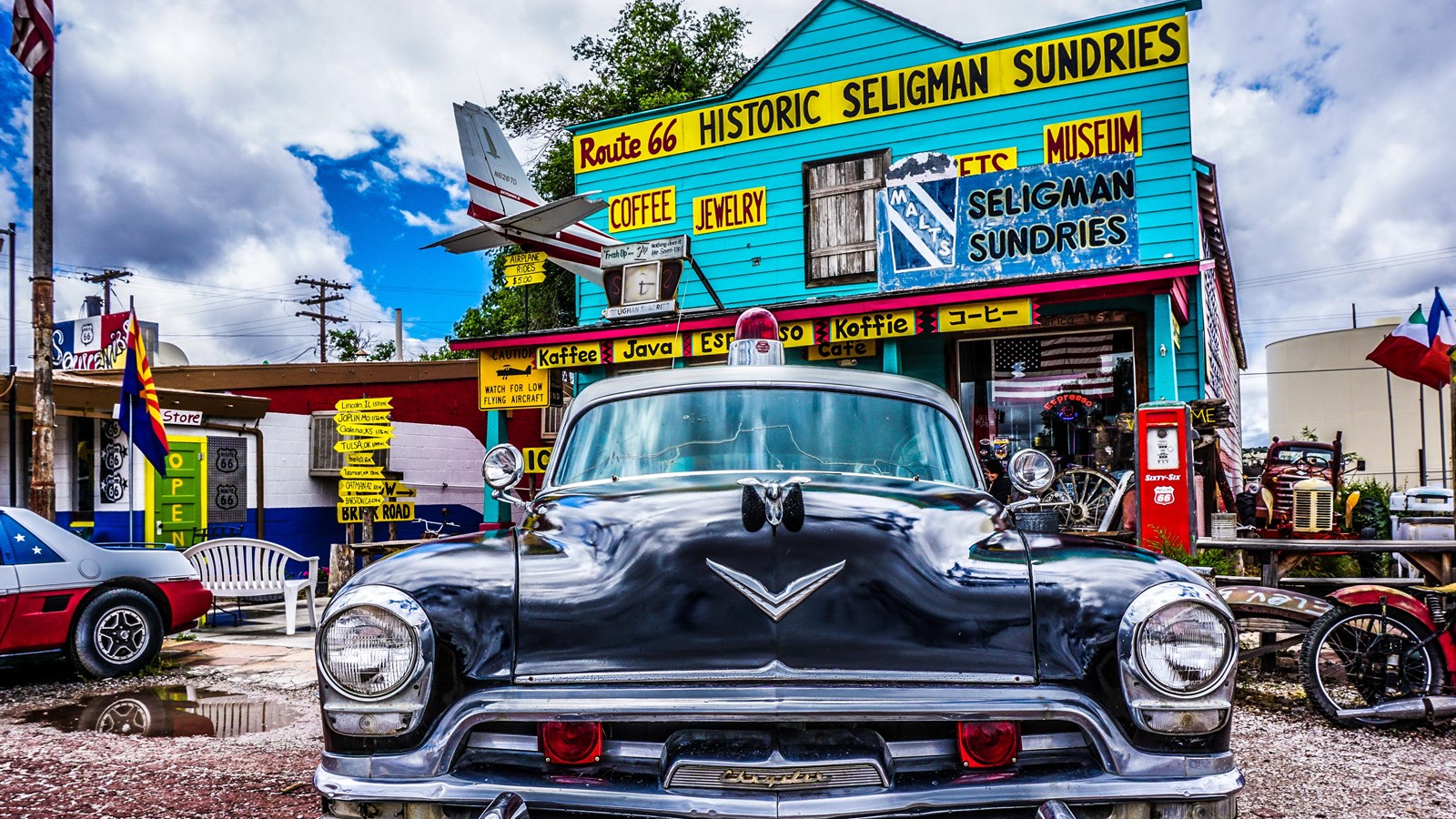
Photo courtesy of Rhys Martin
Seligman Commercial Historic District is the commercial heart of the small community of Seligman, Arizona and the commercial center of Northern Yavapai County. First a railroad center, Seligman’s commercial core grew when Route 66 came through in 1926. The district is an important reminder of how transportation systems influenced the development of communities in the American West. The district contains a significant collection of railroad and auto related commercial architecture. Seligman offers today’s travelers a real understanding of what kinds of commercial establishments were available to motorists travelling the Mother Road.
Seligman got its start when James A. Lamport, a land surveyor, obtained a homestead claim in 1895 along the Atlantic and Pacific Railroad and laid out a grid of 300-foot-square blocks along the tracks. In the first decade of the 20th century, the Old Trails Highway, the first true transcontinental roadway through northern Arizona, came through Seligman along Railroad Avenue beside the tracks, then zigzagged along Havasu, Main, and Chino Streets. This same corridor became Route 66 from 1926 until 1933. After that time, Route 66 took a new more direct east-west route along Chino Street, eliminating the zigzags.
The Arizona Highway Department reported that more than 500,000 out of state cars travelled Route 66 in 1937, but Seligman experienced its real heyday after World War II, when returning veterans and other motorists hit the road and made the Southwest a popular tourist destination. Seligman’s businesses lured travelers along Route 66 with their exuberant slogans, signs, neon lights, and other gimmicks, until Interstate 40 opened in 1978, bypassing Seligman and signaling the end of the heyday of the Mother Road.
In the Seligman Commercial Historic District, the 50-foot wide 1926 to 1933 alignment of Route 66 follows two blocks along Railroad Avenue and one block along Main Street between Railroad Avenue and Chino. Driving this segment gives today’s visitors an opportunity to experience what Route 66 looked like in its infancy.
The early 20th century commercial buildings along the streets of the district are similar to those from the same period in small towns across America. Most are one story with central, sometimes recessed, entries; transomed windows; sloping or flat canopies; and tall parapets. Examples include Pitts General Merchandise Store and the the U.S. Post Office from 1903, Pioneer Hall and Theatre and the Seligman Garage from 1905, and Seligman Pool Hall from 1923.
After the 1933 rerouting of Route 66, commercial buildings in the district became more ostentatious and exuberant manifestations of the roadside architectural style. The Deluxe Inn, Snow Cap Drive-In, Supai Motel, Nomad Motel, Canyon Shadows Motel, Aztec Motel, and Copper Cart Restaurant exemplify this change. Automobile dealerships like Olson’s Chevrolet and the Studebaker Agency, and repair shops such as Donovan’s 1-Stop Garage and the Snow Cap Drive-in attest to the popularity of the automobile. Snow Cap Drive-In, with its neon lights and visual appeal, is one of the best examples of roadside architecture in northern Arizona. Donovan’s Texaco Station, Olson’s Shell Station, the Richfield Oil Station, the Studebaker Agency, and Olson’s Chevrolet are illustrations of the petroleum or automobile company franchises that sprung up along Route 66.
After Interstate 40 bypassed Seligman in 1978, commercial activity in the district declined steeply. A group of local business people successfully lobbied the State of Arizona to designate Route 66 as a Historic Highway in 1987, and Seligman’s Chamber of Commerce started promoting the town as the “Birthplace of Historic Route 66.” The National Park Service Route 66 Corridor Preservation Program provided a grant to document and nominate the district to the National Register of Historic Places. National Register listing of the district in 2005 focused additional public attention on Seligman and the value of preserving the significant historic resources that illustrate its history.
Seligman Historic District is located in Seligman, AZ. The district is roughly bounded by First and Lamport Sts. and Picacho and Railroad Aves. Chino St., now renamed Historic Route 66, is the main east-west artery, and Main St. the primary north-south street in the district. The 1926 alignment of Route 66 begins at the corner of Lamport St. and East Railroad Ave., and extends along E. Railroad Ave. to Main St. then north on Main St. to the corner of Main and Chino Sts.
See the Seligman Historic District National Register nomination form.
