



Last updated: May 14, 2026
Place
Santa Fe Plaza
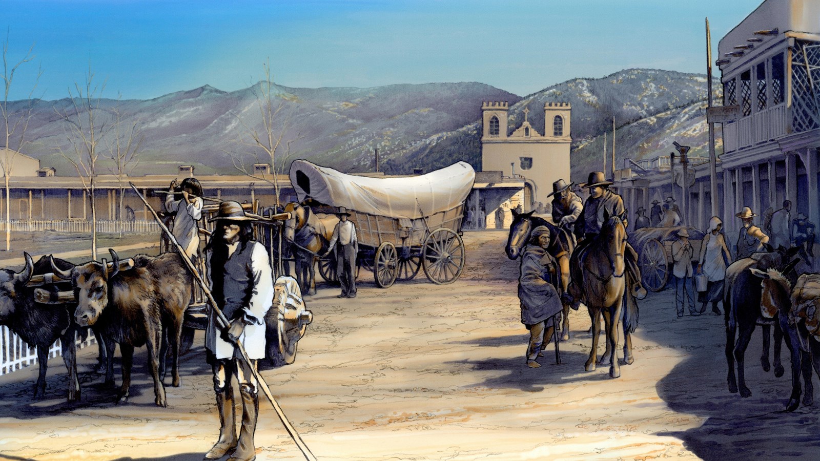
NPS Image/Bruce MacPherson
Quick Facts
Location:
Historic Santa Fe Plaza, Santa Fe, New Mexico.
Significance:
The spatial, economic, and social center of Santa Fe, the plaza has witnessed over 400 years of Santa Fe’s unique history.
Designation:
National Register of Historic Places 1966; National Historic Landmark 1960; Historic site on the Santa Fe, Old Spanish, and El Camino Real de Tierra Adentro NHTs.
MANAGED BY:
Amenities
1 listed
Historical/Interpretive Information/Exhibits
In the spring of 1610, Governor Pedro de Peralta laid out the city of Santa Fe around a central plaza, located at a place local Tewa residents called ogaponge (“over at the shells by the water”). It provided a place for soldiers to drill and merchants to gather, but the plaza—a swampy area sheltered by large cottonwoods—also set the shape and social order of the new city. According to Spanish planning laws, the Catholic Church received first choice of lots fronting the plaza, and the government second. The remaining lots went to prominent citizens.
The plaza has witnessed over 400 years of Santa Fe’s unique history. During the 1680 Pueblo Revolt, Spanish colonists took refuge inside the casas reales (government buildings) on the plaza. The victorious Pueblo rebels expelled Spaniards for 12 years, during which time they turned the plaza into one large multistory pueblo, arranged around two central squares—each with a kiva. Our next glimpse of the plaza comes courtesy of the earliest known map of Santa Fe, made in 1766 by José de Urrutia, which shows the plaza as a simple square encircled by the Palace of the Governors, a chapel, and some single-story residences.
The plaza’s next major change came in 1821, when newly-independent Mexico opened trade with the United States via the Santa Fe Trail. Almost overnight, the plaza became the hub of a vast network linking Missouri River markets with New Mexico, California, and Chihuahua (via El Camino Real de Tierra Adentro). People, animals, wagons, and trade goods—all fresh off the trail—dominated the space. An 1837 account of the plaza mentions “all kinds of vehicles,” plus “teamsters, camp cooks, roustabouts, horses, mules, burros, pigs, and goats.”
Soon, American soldiers would join the scene, and the U.S. took control of New Mexico during the Mexican-American War. On the morning of August 19, 1846, Gen. Stephen W. Kearney announced himself military governor on the plaza—in the same place where rebellious Puebloans laid siege to Spaniards over 160 years earlier. A second map of Santa Fe followed, featuring an American flag waving in the central square.
Further U.S. influence arrived via the Santa Fe Trail, which brought the materials necessary to re-create popular American architecture. Milled lumber and fired bricks replaced the region’s rough-hewn vigas and sun-dried adobes. By the close of the 1850s, commercial buildings—many owned by trail traders—lined three sides of the plaza. These new complexes featured post offices, law offices, and banks, further reminders of the territory’s incorporation into the United States. The plaza itself received a major makeover in 1862, adding radial walkways, picket fencing, and a gazebo reminiscent of many American town squares.
The Atchison, Topeka, & Santa Fe Railroad arrived in 1880, signaling the demise of the Santa Fe Trail. Yet the plaza remained the town’s economic center, and became its tourist hub, as well. In the early 20th century, local boosters created a new architectural style to capitalize on Santa Fe’s Puebloan and Spanish history. This Spanish Pueblo Revival style came to define the plaza landscape and, by the 1980s, tourist-centered buildings dominated the district. Taken together, the plaza and the surrounding buildings form a well-maintained historic district that tells the story of Santa Fe’s transition from frontier outpost to modern tourist destination.
Site Information
Location (Bounded by Palace Ave and the Palace of the Governors on the north, San Francisco St. on the south, Washington Ave. on the east, and Lincoln Ave. on the west., Santa Fe, New Mexico.)
More Site Information
El Camino Real de Tierra Adentro National Historic Trail
Santa Fe National Historic Trail
Old Spanish National Historic Trail
El Camino Real de Tierra Adentro, Old Spanish Trail, Santa Fe Trail: Santa Fe, New Mexico Itinerary
Santa Fe is the oldest capital city in the US, founded in 1610, and the highest in elevation at 7,000 ft. The city is the historic hub of the southwest, connecting three national historic trails: El Camino Real de Tierra Adentro, the Santa Fe Trail, and the Old Spanish Trail. This tour leads your from the busy plaza and other major tourist locations to lesser known sites along quiet, old Santa Fe streets.