Last updated: April 30, 2026
Place
Rabbit Ears Mountain
NPS Photo
Quick Facts
Location:
North West of Clayton, New Mexico
Significance:
Rabbit Ears Mountain was a guiding landmark for Santa Fe Trail travelers on the Cimarron Route
Designation:
National Historic Landmark
OPEN TO PUBLIC:
No
MANAGED BY:
Private; can be viewed from Kiowa National Grassland and the Santa Fe Trail National Scenic Byway
Amenities
1 listed
Historical/Interpretive Information/Exhibits
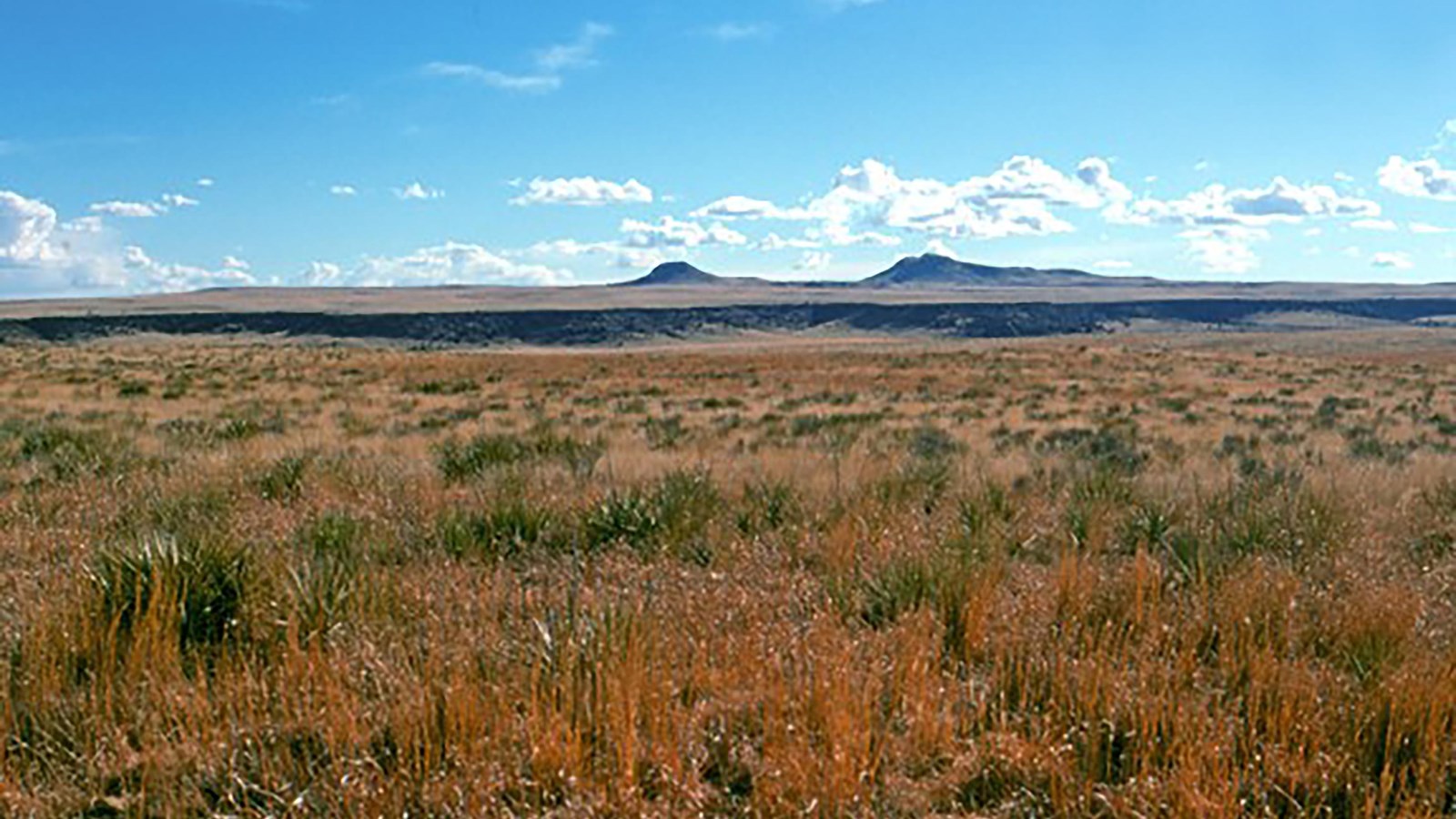
Thirty miles in the distance, the double peak of Rabbit Ears Mountain directed travelers on the Cimarron Route of the Santa Fe Trail toward their destination. Visible across the prairies in present-day Oklahoma and Eastern New Mexico, the mountain was a vital landmark for guiding weary, disoriented travelers and a sign that restorative water, grazing grass, and wood were near.
Part of the Raton-Clayton Volcanic Field, Rabbit Ears was formed by basaltic lava flow, creating a challenging terrain ranging from level plain to rocky ridges and ravines. Travelers were rewarded for navigating the topography with necessary resources and respite. Three major campsites exist near the mountain: McNees Crossing, Rabbit Ears Creek Camp, and Turkey Creek Camp. If resources were plentiful, travelers would stay in the area a few days to rest and replenish their energy before continuing their journey. Westbound travelers still had around 200 miles to travel before reaching Santa Fe.
Rabbit Ears Mountain is a double-peaked formation created by past basaltic lava flow. The irregular peaks rise above a midgrass prairie. Some accounts suggest the two peaks look like rabbit ears (leading to its name), but most historical accounts attribute the name to Chief Orejo de Conejos (Rabbit Ears) who was killed on the mountain in a battle with Spanish colonizers in 1717.
Site Information
Location (North West of Clayton, New Mexico)
Today, Rabbit Ears Mountain is part of private land, but visitors can view it from other accessible places: Clayton Lake State Park, McNees Crossing, Kiowa National Grasslands, and the Santa Fe Trail National Scenic Byway.