



Last updated: September 11, 2026
Place
Plum Creek Massacre Site & Historic Plum Creek Cemetery
NPS Photo
Quick Facts
Location:
South side of Platte River, about 10 mi southeast of Lexington, Neb. Plum Creek Massacre Site, north side of 748 Rd, ½ mile east of C Rd. GPS interpretive turnout: 40.671197 -99.577025 Historic Plum Creek Cemetery, ½ mile west of the massacre site turnout, on the west side of B Rd, north of 748 Rd. GPS 40.67255 -99.6058
Significance:
Cheyenne warriors attacked 3 freighting wagon trains in this vicinity on August 8, 1864, killing 11 men and taking a woman and a child captive. Historians identify this attack as the beginning of the 1864-1869 Plains Wars.
Designation:
Historic site on the California and Oregon National Historic Trails.
MANAGED BY:
Amenities
3 listed
Historical/Interpretive Information/Exhibits, Information Kiosk/Bulletin Board, Parking - Auto
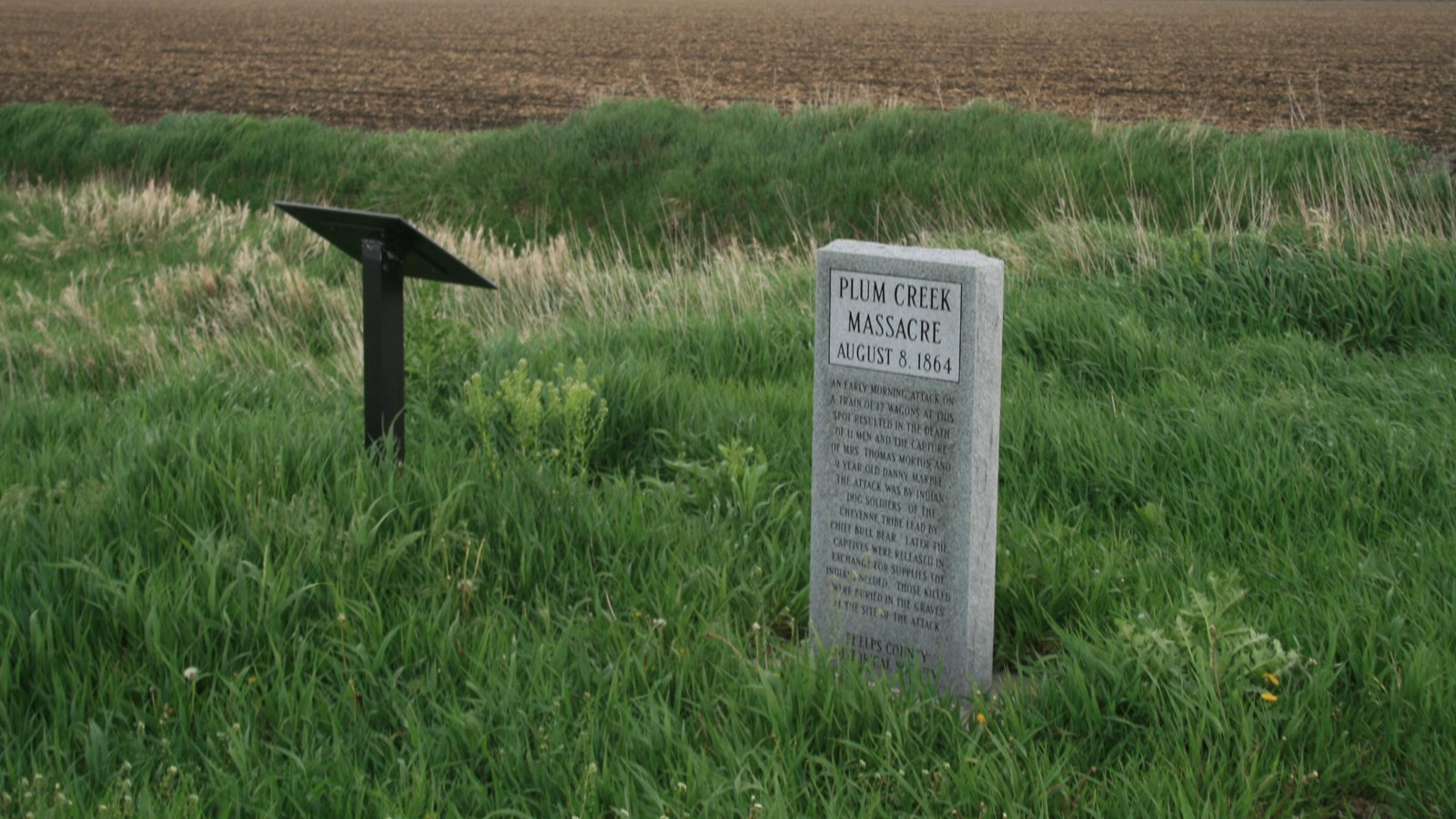
The Plum Creek Massacre was part of a series of coordinated raids by Cheyenne, Sioux, and Arapaho warriors along Plum Creek and the Little Blue River from August 7 through August 10, 1864. A monument and historical sign at a turnout beside 748 Rd mark the vicinity of the massacre, and additional monuments at nearby Historic Plum Creek Cemetery commemorate those who died in the attacks.
On August 8, 1864, a band of about 100 elite Cheyenne Dog Soldiers destroyed several small freighting outfits, today known collectively as the Kelly-Morton-Marble party, 3 miles east of Plum Creek Station. Historians identify this Plum Creek Massacre, in which 13 teamsters were killed and a woman and a child taken captive, as the beginning of the 1864-1869 Plains Wars.
The following morning, a late-arriving detachment of soldiers buried 11 of the slain men in an unmarked trench near where they fell, in the vicinity of the present-day markers along 748 Rd. In a separate unmarked grave, now lost to time, soldiers buried 2 teamsters who had been traveling half a mile ahead of the freight wagons.
Nine-year-old Danny Marble lived among his captors for roughly 37 days before the US army secured his release in September. He died of typhoid fever in November, before he could be reunited with his mother in Council Bluffs, Iowa. Nineteen-year-old Nancy Morton, widowed by the attack, was ransomed twice, but warriors snatched her back each time after receiving their payoff. Following some 6 months in captivity, she escaped in February 1865 with a trader sent by the US Army to arrange a third ransom. The trader had hidden fresh horses along their return route, enabling the pair to outrace their pursuers. Nancy remarried later that year and lived until 1912, though she continued to suffer from injuries sustained during the attack at Plum Creek 48 years earlier
According to the Phelps County Historical Society, Historic Plum Creek Cemetery, located 1 ½ miles west of the Plum Creek Massacre site, has more than 200 unmarked graves, including burials outside of the graveyard fence. The cemetery was in use by 1845 and perhaps earlier. At least 13 soldiers who died in Indian attacks in 1864-1865 are believed buried there, along other victims from the 1864 Plum Creek raids and trail travelers who died from violence or natural causes in this area.
At the cemetery, visitors will find additional information about the Plum Creek Massacre, a monument honoring its victims, a Pony Express monument, and the original gravestone of Sarepta Gore Fly, who died of unknown causes while traveling east along the trail in 1865. Sarepta is not buried here—her gravestone was discovered nearby on the prairie and placed here before the dedication of the cemetery in 1930, and her actual burial place is unknown. A historical sign at the cemetery tells her story.
Site Information
Location (South side of Platte River, about 10 mi southeast of Lexington, Neb. Plum Creek Massacre Site, north side of 748 Rd, ½ mile east of C Rd. GPS interpretive turnout: 40.671197 -99.577025 Historic Plum Creek Cemetery, ½ mile west of the massacre site turnout, on the west side of B Rd, north of 748 Rd. GPS 40.67255 -99.6058)