



Last updated: September 11, 2026
Place
Plum Creek Historical Trail Swale
NPS Photo
Quick Facts
Location:
South of Rd 749, on Plum Creek between Rd 437 and Rd 436, approximately 6 miles southeast of Lexington, Nebraska. GPS vicinity on Rd 749: 40.68441 -99.67158
Significance:
This is one of several swales created by wagon and stagecoach traffic at the crossing of Plum Creek in Phelps County, Nebraska.
Designation:
Historic site on the California and Oregon National Historic Trails.
OPEN TO PUBLIC:
No
MANAGED BY:
Private
Amenities
1 listed
Historical/Interpretive Information/Exhibits
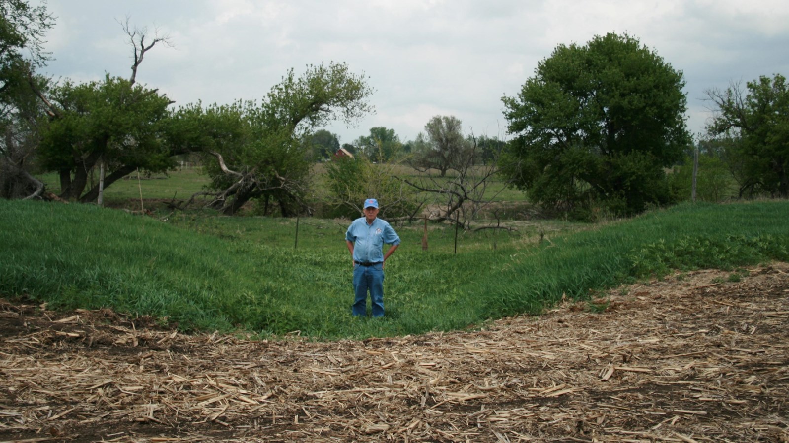
On private farmland south of Road 749 in Gosper County, Nebraska, a 5- to 6-foot-deep wagon swale survives where oxen and mules once pulled heavy wagons across Plum Creek.
Wagon swales are broad, trough-like linear depressions with rounded edges and sloping sides, like the Plum Creek swale shown in the accompanying photograph. They formed as draft animals dug in their iron-shod hooves into the earth while hauling wagons up hillsides and stream embankments or slipping down the opposite slope. Over time, erosion softened the swales’ contours, giving them their characteristic sloping sides and rounded edges.
Swales also developed on level ground in areas with loose, sandy soil, as found in Nebraska’s Sand Hills and deserts of the arid West. There, hooves and wheels stirred up dust, that breezes deposited beside the trail. This process sometimes built low berms – raised banks of accumulated sediment—along the edges of the swale.
Site Information
Location (South of Rd 749, on Plum Creek between Rd 437 and Rd 436, approximately 6 miles southeast of Lexington, Nebraska. GPS vicinity on Rd 749: 40.68441 -99.67158)