Last updated: May 19, 2026
Place
Medano Creek
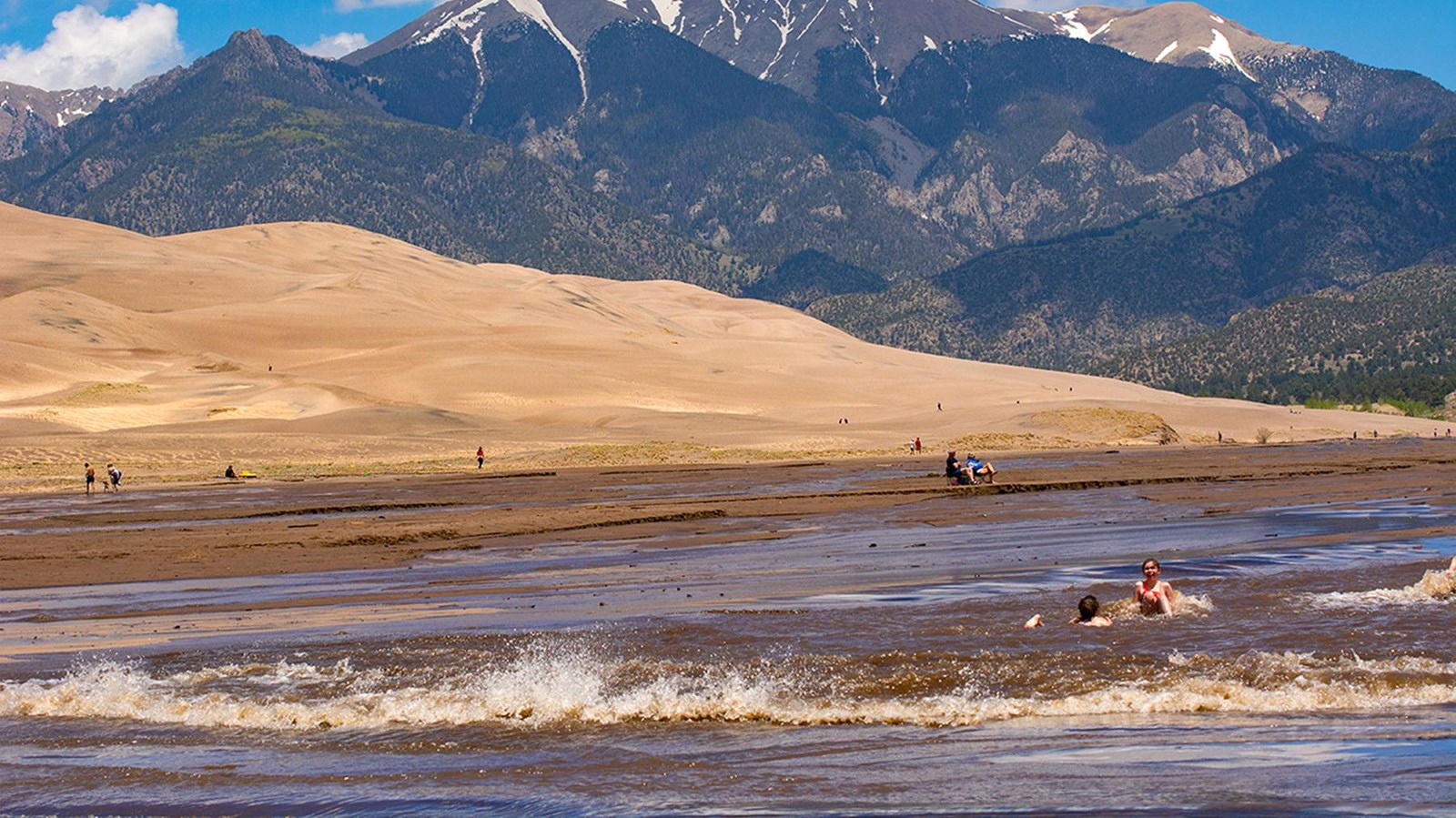
NPS/Patrick Myers
Quick Facts
Location:
South edge of dunefield
Significance:
Best location in the world to experience 'surge flow', a rare hydrological phenomenon
Designation:
National Park and Wilderness Area
Amenities
21 listed
Baby Changing Station, Beach/Water Access, Benches/Seating, Historical/Interpretive Information/Exhibits, Parking - Auto, Parking - Boat Trailer, Parking - Bus/RV, Picnic Shelter/Pavilion, Picnic Table, Restroom, Restroom - Accessible, Restroom - Seasonal, Scenic View/Photo Spot, Toilet - Flush, Toilet - Vault/Composting, Trailhead, Trash Dumpster, Trash/Litter Receptacles, Water - Bottle-Filling Station, Water - Drinking/Potable, Wheelchairs Available
Medano Creek is a popular seasonal stream enjoyed by all ages. On this page you'll learn what to expect month-by-month in an average year, and how the rare phenomon 'surge flow' works. You can also link to current and forecast creek conditions, and a video about the creek showing surge flow waves.
Medano Creek Month-by-Month in an Average Year
April is the second snowiest month of the year at Great Sand Dunes, but there are also some sunny days with highs in the 60s F. Spring is the windy season throughout the southwestern United States, especially afternoons, though mornings are usually calm. The creek begins to trickle down as the snow on the Sangre de Cristo Mountains melts. By late April the creek may be a few inches deep. Cottonwood trees and willows along the creek are not yet leafed out.
Late May is near the peak of Medano Creek's annual flow. While it is still springtime and winds may arise, especially in the afternoon, May temperatures are generally moderate, with highs in the 60s-70s F. However, snow is still possible at this elevation in May! Trees and bushes along the creek leaf out. There may be some "no-see-ums" (tiny biting gnats), but mosquitoes are rarely out in May. Late May and early June are the best opportunity to experience "surge flow", where waves up to about 20 inches (50 cm) high flow down across the sand. In wet years with good peak runoff, children can float down the waves on flat inflatable toys. Water comes out of the mountains cold, but warms up significantly when the sun shines on it for a few hours as it spreads across the sand. Because of the creek's popularity, late May and early June weekends are extremely crowded, with long lines of traffic, overflowing parking lots, a crowded beach, and full campgrounds. If possible, plan your visit on a weekday this time of year.
June brings warmer temperatures for water play and generally pleasant conditions the first week of June. But as the creek becomes much lower and warmer around the second week of June, mosquitoes emerge in large numbers. Move away from vegetation, to the far side of the creek to avoid the worst of the mosquitoes: they don't like open sand, but prefer to be near shady bushes and trees. By late June, the water level will be fairly low, only 1 or 2 inches (1-5cm). Because of the creek's popularity, late May and early June weekends are extremely crowded, with long lines of traffic, overflowing parking lots, a crowded beach, and full campgrounds. If possible, plan your visit on a weekday this time of year.
In July, unless there are significant ongoing rains, the creek will begin to retreat back toward the mountains, drying up at the main visitor area near the Dunes Parking Lot. It will continue to gently flow (1/2" - 1" deep) along the eastern edge of the dunefield, near the Castle Creek picnic area. Castle Creek is accessible by high clearance 4WD vehicle on the Medano Pass Primitive Road. Visitors without 4WD may also access the creek in late summer by hiking approximately 2 miles (3.5 km) up the creekbed from the Dunes Parking Lot, or approximately 0.7 miles (1km) from the Point of No Return parking area. Mosquitoes usually disappear after the water retreats. July is the warmest month at the park, with average highs in the low 80s F.
In August and September, the creek will likely be completely gone from the main visitor area near the Dunes Parking Lot. It may continue to gently flow (1/2 to 1 inch or 1-2cm deep) along the eastern edge of the dunefield, near the Castle Creek Picnic Area. Castle Creek is accessible by high clearance 4WD vehicle on the Medano Pass Primitive Road. Visitors without 4WD may also access the creek late summer by hiking approximately 2 miles (3.5 km) up the creekbed from the Dunes Parking Lot, or 0.7 miles (1km) from the Point of No Return parking area. Mosquitoes typically disappear along with the creek.
Surge Flow - A Rare Phenomenon
Medano Creek is one of the few places in the world where one can experience surge flow, a stream flowing in rhythmic waves on sand. Three elements are needed to produce the phenomenon: a relatively steep gradient to give the stream a high velocity; a smooth, mobile creekbed with little resistance; and sufficient water to create surges. In spring and early summer, these elements combine to make waves at Great Sand Dunes. As water flows across sand, sand dams or antidunes form on the creekbed, gathering water. When the water pressure is too great, the dams break, sending down a wave about every 20 seconds. In wet years, waves can surge over a foot (30 cm) high!
The requested video is no longer available.