Last updated: April 21, 2026
Place
McNees Crossing
NPS Photo
Quick Facts
Location:
Located on New Mexico Highway 406, 3.5 miles west of the Oklahoma state line, then 1.5 miles south of the small community of Moses, NM, 88415. On a private ranch road, approximately 1 mile after crossing Corrumpa Creek/N. Canadian River.
Significance:
The crossing was an essential resource for water, grass, and wood, all necessities for trail travel.
Designation:
National Historic Landmark (Part of Rabbit Ears (Clayton Complex) NHL)
MANAGED BY:
Amenities
1 listed
Historical/Interpretive Information/Exhibits
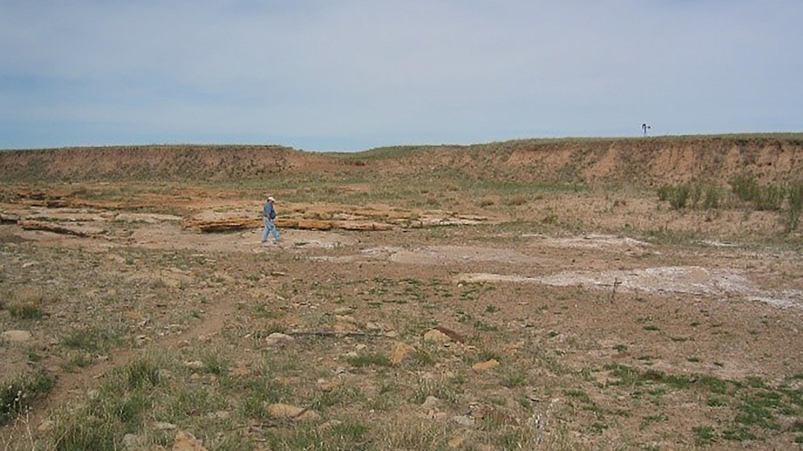
In the sweltering, dry prairies of the Santa Fe Trail’s Cimarron Route, every water source was indispensable. The Corrumpa Creek, just within present-day New Mexico, was a welcomed refreshment for weary trail travelers. If coming from Missouri, travelers were guided to Corrumpa Creek by the site of Rabbit Ears Mountain, an indispensable landmark and sign of much needed resources. Amidst the loose sandy banks of the creek, a natural rock shelf provided easy passage at what came to be known as McNees Crossing.
The crossing bears the name of a young trader who, along with a fellow traveler named Monroe, rode ahead of their caravan and stopped to rest at the crossing in 1828. While napping, the two men were shot by American Indians in view of the approaching caravan. McNees passed away and was buried at the crossing while Monroe survived the thirty-mile journey to Upper Spring before passing. While burying Monroe, the travelers were approached by a group of six American Indians who likely had no knowledge of the shooting. Josiah Gregg’s account of the incident suggests, “It is more than probable . . . that the Indians were not only innocent but ignorant of the outrage that had been committed, or they would hardly have ventured to approach the caravan.” Angered and seeking revenge, a traveler shot at the unaware American Indians, leading to more gunfire and the death of five people. In Gregg’s words, it was a “dreadful catastrophe.”
Three years later, in 1831, Gregg attended an Independence Day celebration at McNees Crossing. The celebration may be the first of its kind held in present-day New Mexico. A marble marker erected by the American Legion in 1921 commemorates the 4th of July event.
Site Information
Location (Located on New Mexico Highway 406, 3.5 miles west of the Oklahoma state line, then 1.5 miles south of the small community of Moses, NM, 88415. On a private ranch road, approximately 1 mile after crossing Corrumpa Creek/N. Canadian River. )
Access
Visitors gain access through a gate onto private grazing land. Visitors must close the gate behind them to keep livestock on the appropriate land.