Last updated: October 10, 2024
Place
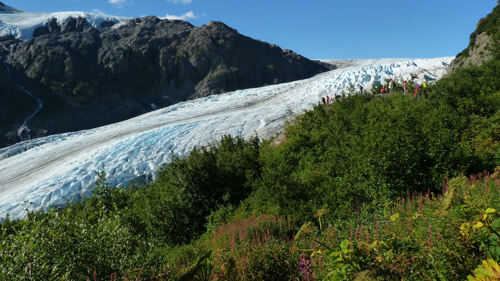
Marmot Meadows
NPS Photo/ M Stokstad
Quick Facts
Amenities
1 listed
Scenic View/Photo Spot
About 1/3 of the way up the Harding Icefield Trail, the surrounding forest opens up to Marmot Meadows. Although named for Hoary Marmots that were often seen here, they are less common now due to more plants growing and covering the land. Marmot Meadows offers some spectacular views of Exit Glacier from above it.
To get to Marmot Meadows, start at the trailhead for the Harding Icefield Trail. Marmot Meadows is roughly 1.3 miles up the trail. The trail is quite steep, averaging roughly 1000 feet of elevation for every mile. Be sure to bring plenty of water and warm clothes, as weather can quickly change. Before hiking here, check the Current Conditions page on our Park's website.
To get to Marmot Meadows, start at the trailhead for the Harding Icefield Trail. Marmot Meadows is roughly 1.3 miles up the trail. The trail is quite steep, averaging roughly 1000 feet of elevation for every mile. Be sure to bring plenty of water and warm clothes, as weather can quickly change. Before hiking here, check the Current Conditions page on our Park's website.