



Last updated: June 11, 2026
Place
Hope Valley, Carson Route
NPS Photo
Quick Facts
Location:
4 mi. east of Carson Pass at Pickett’s Junction, intersection of CA-88 and CA-19, California.
Significance:
Discharged members of the Mormon Battalion, heading to Salt Lake City after serving in the Mexican-American War, found and named this sub-alpine meadow in 1848 while scouting a new wagon route through the Sierra Nevada. In 1854, Ira M. Luther opened a new connecting trail, used for 5 weeks by the Pony Express, linking Hope Valley to Echo Lake/Johnson Pass.
Designation:
Hope Valley Wildlife Area & Fishing Access; Historic site on the California and Pony Express NHTs.
Amenities
6 listed
Dock/Pier, Historical/Interpretive Information/Exhibits, Parking - Auto, Toilet - Vault/Composting, Trailhead, Wheelchair Accessible
Westbound emigrants nearly collapsed in relief after stumbling out of tortuous Carson Canyon into this stunning, broad valley, filled with meadow grasses, flowers, and a rippling spring. The valley, lying at 7,100 feet elevation on the east slope of Sierra Nevada, has been known and occupied by the Northern Washoe since time immemorial. Discharged members of the Mormon Battalion, heading east from California to join the Latter-day Saints in Salt Lake City, came upon it in July 1848 while opening a new wagon trail through the Sierra Nevada. Disheartened after discovering the murder of three of their scouts at Tragedy Springs, the 46-member party found some solace here. Henry William Bigler wrote that the group named the place Hope Valley, “as we began to have hope.” It has been known by that name ever since.
The wagon trail opened by the battalion party provided an alternative to the rugged Truckee Route, at that time the only other wagon trail through the Sierra. Because it followed the West Carson River, the battalion trail became known as the Carson River Route. Many westbound travelers who went this way camped at Hope Valley and wrote about it in their journals, particularly noting the valley’s beauty and the chill of its nighttime air.
Margaret Frink recorded in 1850,
“In the afternoon we resumed our scrambling over the rocks and boulders that constituted the road [in Carson Canyon], and continued until sundown, when to our great relief, we had gotten out of the granite jaws of the mountain and had come to an open, level, beautiful valley, sprinkled over with trees. This is known as Hope Valley, which we thought an appropriate name.”
Charles True recalled of his 1859 visit,
“The fairyland appearance of this little valley caused us a thrill of rapture, an ecstasy of gladness and gratitude, as we lay on the turf in the shadow of green boughs, taking deep inhalations of pure cool air from off nearby snowbanks and drinking in the radiance of a perfect fall day.”
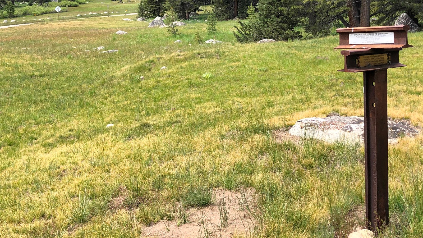
Today’s visitors can find original wagon swale, appearing as a shallow, linear depression, at the Pickett Junction equestrian staging area south of the intersection of CA-88 and CA-89. A brown, T-shaped trail marker stands alongside the swale. Then drive ¼ mile west on CA-88 to the Hope Valley Wildlife Area & Fishing Access, on the right. From the parking area and toilets, walk along the paved path to find an interpretive sign and more trail trace.
The brown, T-shaped marker also signifies the junction of the Carson Trail with the Luther Pass Trail. The Luther Pass Trail linked Hope Valley to another branch of the Carson Trail coming from over Daggett and Johnson passes. The Pony Express used the Luther Pass Trail in April 1860 before switching to a more direct route. A Pony Express monument is found in the field across the highway, opposite the equestrian staging area.
Site Information
Location (4 mi. east of Carson Pass at Pickett’s Junction, intersection of CA-88 and CA-19, California.)Safety Considerations