Last updated: March 21, 2026
Place
French Frank's Trail Segment
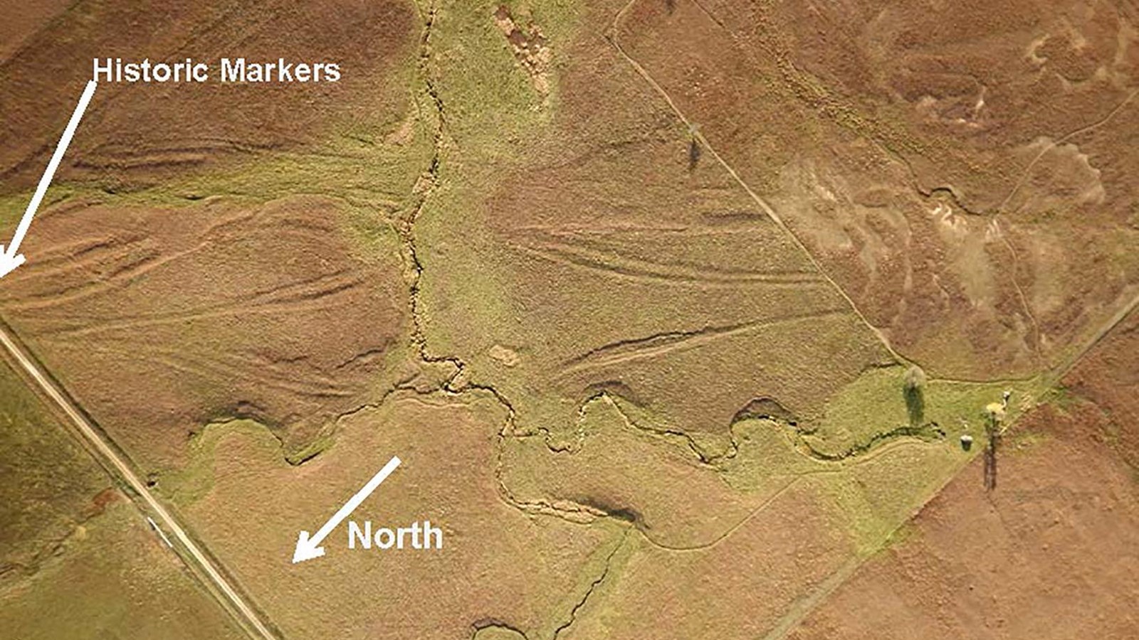
Photo/Brian Bird; Annotated/Steve Schmidt
Quick Facts
Location:
Rural Lehigh, Marion County, KS.
Significance:
From US Hwy 56, on the southeast side of Lehigh, KS, north 5.0 miles on Diamond Road to 250 Rd. West on 250 Rd 1.0 miles to Chisholm Trail Rd (a SFNHT sign and visible ruts can be seen on 250 Rd). South on Chisholm Trail Rd 0.5 mile to 245 Rd (a SFNHT sign can be seen on Chisholm Trail Rd). West on 245 Rd approx. 0.2 mile to a DAR marker and a SFNHT sign. SFNHT is running southwest from this location and is the “French Frank’s Trail Segment.”
Designation:
Certified Site
Amenities
1 listed
Historical/Interpretive Information/Exhibits
Five sets of two parallel ruts or swales fan-out across this property as horses, mules, oxen, freight wagons, mail stages, and soldiers sought different places to cross French Creek 1821-1866. The creek is named after Claude Francis Laloge (1831-1899, commonly known as French Frank) because he was a Frenchman and was the first settler on the creek, having filed on January 5, 1863 the first Homestead Entry in Marion County under the 1862 Homestead Act. French Frank operated a road ranche (1860’s convenience store) here 1861-1866. He was elected Constable when Marion County was organized in 1865.
This is the site of the Cottonwood Holes, the first water west of the Cottonwood Creek Crossing on the Santa Fe Trail, the water appearing in holes along and adjacent to French Creek. Being a ½-day travel from Cottonwood Creek (6 miles) this site provided a convenient place for the mid-day break to water and graze the animals and for travelers to partake of the noon meal. Susan Magoffin, the pregnant 18 year old wife of Santa Fe trader Samuel Magoffin and the second white woman to travel the Santa Fe Trail, “nooned it on the prairie with little water and no wood” and took a short siesta in the shade of the carriage here June 27, 1846. This site is listed in Capt. Randolph Marcy’s 1859 The Prairie Traveler, Itinerary II: “Water Holes-Water generally; no wood.” This site possibly noted by Matt Field, in summarizing his travels of July 15, 1839: “Since we left the Cotton Wood [Creek] we have traveled 15 miles over the most desolate prairie we have yet seen – we met water now and then in holes – tasteless and warm.”
Site Information
Location
- From US Hwy 56, on the southeast side of Lehigh, KS, north 5.0 miles on Diamond Road to 250 Rd.
- West on 250 Rd 1.0 miles to Chisholm Trail Rd (a SFNHT sign and visible ruts can be seen on 250 Rd).
- South on Chisholm Trail Rd 0.5 mile to 245 Rd (a SFNHT sign can be seen on Chisholm Trail Rd).
- West on 245 Rd approx. 0.2 mile to a DAR marker and a SFNHT sign. SFNHT is running southwest from this location and is the “French Frank’s Trail Segment.”
Parking adjacent to signs is on the shoulder of 245 Rd, an improved gravel road with very little traffic.