


Last updated: September 12, 2026
Place
Fort McPherson
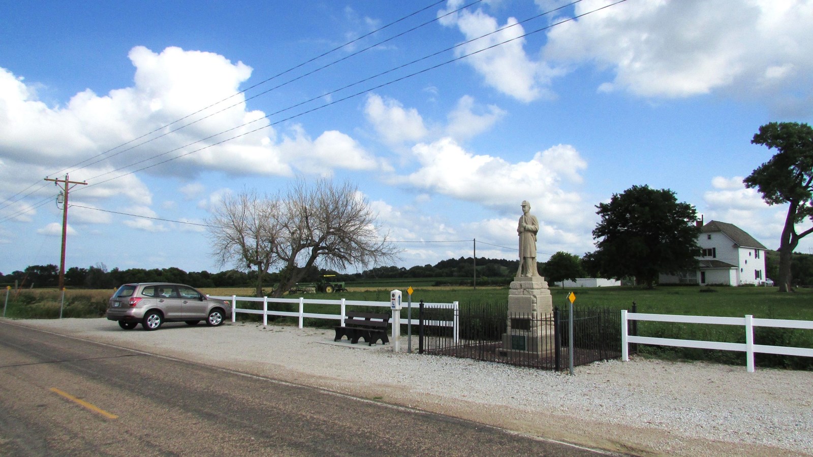
Photo/Chris Light, from Wikimedia Commons, File:Old Ft 2016-07-12 197.jpg - Wikimedia Commons
Quick Facts
Location:
Multiple locations: Ft. McPherson National Cemetery, 12004 State Spur 56A, Maxwell, NE. Ft. McPherson Soldier Statue, approx.. 20576 E Fort McPherson Rd, Maxwell, NE. GPS 41.016475 -100.51781. Ft. McPherson State Historic Marker, US-30 and S. Jackson Rd, ½ mile west of Maxwell, NE. GPS 41.0839, -100.5368166667 Lincoln County Historical Museum, 2403 N Buffalo Bill Ave, North Platte, NE. GPS 41.16025, -100.7899166667
Significance:
Fort McPherson was established by the US Army in 1863 emigrants, stagecoaches, freighters, and railroad workers along the “Great Platte River Road” from attack by Plains Indians.
Designation:
Historic site on the Oregon and California National Historic Trails.
MANAGED BY:
Various: Ft. McPherson National Cemetery – US Department of Veteran Affairs. Ft. McPherson soldier statue – [undetermined]. Ft. McPherson State Historic Marker – Lincoln County. Lincoln County Historical Museum – Lincoln County Historical Society
Amenities
7 listed
Benches/Seating, Historical/Interpretive Information/Exhibits, Information - Ranger/Staff Member Present, Parking - Auto, Parking - Bus/RV, Scenic View/Photo Spot, Wheelchair Accessible
In 1863, on the eve of the Plains Wars, the US army established Cantonment McKean in Nebraska’s Platte Valley, about halfway between Ft. Kearny and Ft. Laramie, to protect travelers, communications, and commerce along the Oregon and California Trails. The outpost, commonly called Fort Cottonwood, occupied 16 square miles at the mouth of Cottonwood Canyon, near a fortified stagecoach station called Cottonwood Springs Station. It was later renamed Ft. McPherson.
From 1863 to 1880, Ft. McPherson served as the base for many military campaigns and expeditions. Well-known figures were associated with the fort, including Lt. Col. George A. Custer, William F. Cody (“Buffalo Bill”), and Frank and Luther North and their Pawnee scouts.
Troops from Fort McPherson also protected railroad workers during the construction of the transcontinental railroad across Nebraska. After the railroad’s completion in 1869, wagon travel declined, and by 1880 the army began closing many now-unnecessary frontier posts. Ft. McPherson was abandoned that year, except for land retained as a national military cemetery. Remain from other decommissioned posts were transferred there, including those of 28 soldiers killed by Sioux in the 1854 “Grattan Massacre” near Fort Laramie, Wyoming.
Several sites and monuments associated with historical Fort McPherson are located between Maxwell and North Platte, Nebraska:
-
Ft. McPherson National Cemetery. Listed on the National Register of Historic Places, the cemetery was established in 1873 as a resting place for US Army personnel and Native American allies who died during the Plains Wars. It was later expanded to receive remains from other fort cemeteries. A white marble monument in Section B marks the mass grave of 28 soldiers killed by Sioux in the “Grattan Massacre.” The cemetery, open daily from dawn to dusk, is located at 12004 State Spur 56A, about 1 ½ miles south of I-80 Exit 190 for Maxwell.
-
Ft. McPherson Soldier Statue. This statue of a 19th century soldier stands on the former parade grounds where the fort’s flagpole once stood. From I-80 Exit 190, drive south on Spur 56A, passing Ft. McPherson National Cemetery, for about 2 miles. The road curves east and becomes Fort McPherson Rd. The monument is at a turnout about ½ mile ahead on the south side of the road.
-
Fort McPherson State Historical Marker. This large historical sign, erected by the State of Nebraska, stands at a turnout on US-30 about ½ mile west of Maxwell.
-
Lincoln County Historical Museum. Located at 2403 N Buffalo Bill Ave in North Platte, Nebraska, the museum’s “North Platte Canteen & Western Heritage Village” features historic buildings and structures, including an original Ft. McPherson cabin and flagpole. The museum is open seasonally; check the museum website for hours and admission.
Site Information
Location: (Multiple locations:
Ft. McPherson National Cemetery, 12004 State Spur 56A, Maxwell, NE. Ft. McPherson Soldier Statue, approx.. 20576 E Fort McPherson Rd, Maxwell, NE. GPS 41.016475 -100.51781.
Ft. McPherson State Historic Marker, US-30 and S. Jackson Rd, ½ mile west of Maxwell, NE. GPS 41.0839, -100.5368166667
Lincoln County Historical Museum, 2403 N Buffalo Bill Ave, North Platte, NE. GPS 41.16025, -100.7899166667)Oregon National Historic Trail
California National Historic Trail