Last updated: April 2, 2026
Place
Floresville El Camino Trail
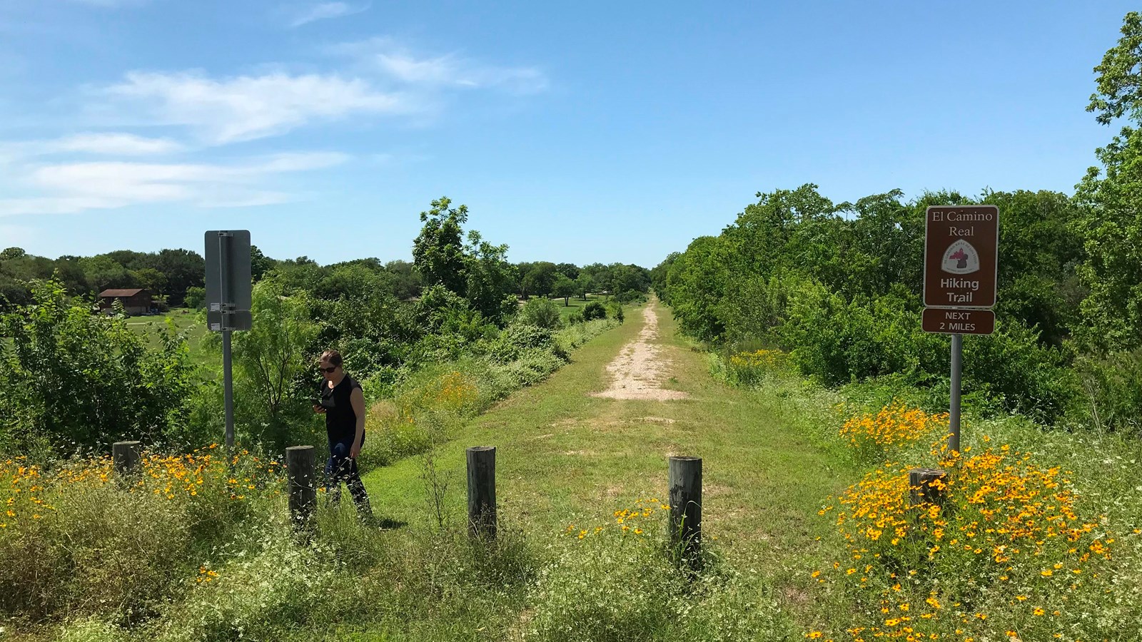
NPS Photo
Quick Facts
Location:
This 2.5 mile trail goes from Hospital Boulevard (US Highway 97) to the Riverbend Golf Course.
Significance:
This short walk provides a glimpse of two distinct eras of Texas history: 18th-century Spanish settlement and 19th-century railroad growth.
Designation:
Certified site
MANAGED BY:
Amenities
2 listed
Historical/Interpretive Information/Exhibits, Trailhead
Constructed in 2014, the Floresville El Camino Trail is the longest section of walkable trail along El Camino Real de Los Tejas. Built on the remains of an abandoned railroad corridor, the trail spans over two miles and cuts through the historic city of Floresville, around 35 miles southeast of downtown San Antonio.[1]
Floresville is the county seat of Wilson County, which is within the historical hunting range of several Native American groups, including Comanches, Tonkawas, and Lipan Apaches, and was the home of Coahuiltecan-speaking peoples for thousands of years before Spanish expeditions arrived in the area during the late 1500s. From 1718 to 1798, several parties of explorers and settlers passed through this region on La Bahia Road, a southern section of the larger El Camino Real system.[2] This path through modern-day Floresville became a principal route for both traveling missionaries and cattle drivers, dotted by small mission ranches like the Mission Espada and its Rancho de las Cabras (Ranch of the Goats) on the west bank of the San Antonio River.[3] Indigenous inhabitants of the mission practiced vocational skills, most notably blacksmithing, and spun traditional woolen fabrics on large looms kept on the mission grounds. The skills of these Native American artisans would prove crucial to the development of nearby San Antonio into a thriving township.[4]
Secular settlement in the region was not popularized until the arrival of the Flores family, Canary Islanders that had begun operating a cattle ranch called Chayopines in 1783. The settlement thrived in the ensuing decades. In 1827, second-generation rancher Francisco Antonio Flores de Abrego petitioned the governor in San Antonio for title to some of the land his family claimed. His request, citing his family’s history and accomplishments, reads as follows:
I make present that my deceased father, as well as myself after his death, have occupied and possessed in good faith, with our field goods and labor, the site on the west bank of the Rio de Bexar at the paraje named los Chayopines, and that finding myself this day with numerous family and some ganado mayor that came to me by inheritance from the said my deceased father, and that with my industry I’ve procured to conserve and augment in the hardest times of War and revolutions endured in this frontier…I ask His Lordship, that taking into consideration the merit and right that I have acquired over the said site due to all the previously exposed, to order the four sitios of land for labor and pasture furrowed… giving me the corresponding title over them.[5]
The government granted Flores’ request, and he built a new ranching headquarters six miles northwest of modern Floresville. Its chapel, graveyard, and adobe home (which still stands) quickly became the center of a new township, then named Lodi.[6] The Flores family remained in the town throughout the turmoil of the Texas Revolution, and several family members fought alongside the Texians for an independent state. The Flores ranch and Lodi were eventually combined into a new town in 1854 when Josefa Agustina Flores de Abrego, granddaughter of Francisco Antonio Flores, donated 200 acres of her family’s land to Wilson County. Per her request, this new town was named “Floresville” after her family.[7]
Floresville was surveyed and planned throughout the early 1870s and development accelerated in 1883 with the arrival of the San Antonio and Arkansas Pass Railway. The town was a model frontier township by the mid-1880s, home to some 400 people, two hotels, general stores, and even its own weekly newspaper, the Chronicle. By 1890, when Floresville was officially incorporated, the population had more than tripled to around 1,500. During the early 20th century, peanuts became a major industry, earning the town the title of “The Peanut Capital of Texas.”
Visitors walking the Floresville El Camino Trail today will pass through this historic frontier town and can experience the distinct periods of Spanish, Mexican, and American settlement in the region. Historical markers along the trail tell the story of its history, and the NPS offers audio descriptions for several sites along the route.
Site Information
Location (This 2.5 mile trail goes from Hospital Boulevard (US Highway 97) to the Riverbend Golf Course.)
More site information
Exhibit with Audio Description available
El Camino Real de los Tejas National Historic Trail
[1] El Correo, El Camino Real de los Tejas National Historic Trail Association, Winter 2021-2022, 12.
[2] Christopher Long, “Wilson County,” Handbook of Texas Online, accessed December 15, 2023, https://www.tshaonline.org/handbook/entries/wilson-county.
[3] Adriana Munoz Ziga, “Archival Research of the History of the Francisco Flores Ranch,” Journal of Texas Archeology and History, Volume 1, 2014, 129.
[4] “Mission Espada,” National Park Service, accessed June 16, 2023, https://www.nps.gov/saan/planyourvisit/espada.htm.
[5] Ziga, “History of the Francisco Flores Ranch,” 138-139.
[6] Claudia Hazlewood, “Floresville, TX,” Handbook of Texas Online, accessed December 15, 2023, https://www.tshaonline.org/handbook/entries/floresville-tx.
[7] “The Flores de Abrego Family and Floresville,” Historical Marker Database, accessed December 15, 2023, https://www.hmdb.org/m.asp?m=118697