



Last updated: June 18, 2026
Place
Dugway Station
NPS Photo
Quick Facts
Location:
The Dugway PX Station Site is about 62 miles as the crow flies from Eagle Mountain UT, or 19 miles southwest of Simpson Springs Pony Express Station on Simpson Springs-Callao Rd. The site area and stone monument are about 1.5 miles south of the road. Visitors can see the site area and perhaps the stone monument by stopping along Simpson Springs-Callao Rd to look due south at about GPS 41.019918 -113.972862. This suggested stopping place is about 0.8 mile southwest of a livestock water tank on the left.
Significance:
The Dugway Pony Express and Overland Stage station at this site and used in the early 1860s.
Designation:
Historic site on the Pony Express National Historic Trail.
MANAGED BY:
Amenities
2 listed
Parking - Auto, Scenic View/Photo Spot
English adventurer Sir Richard Burton, whose stagecoach stopped here for supper on September 27, 1860, found little admire at Dugout Station:
It was a mere “dug out” – a hole four feet deep, roofed over with split cedar trunks, and provided with a rude adobe chimney. The tenants were two rough young fellows – station master and express rider – with their friend, an English Bulldog. One of them had amused himself by decorating the sides of the habitation with niches and [carved] Egyptian heads….Water is brought to the station in casks….Three wells have been sunk near the station. Two soon led to rock; the third has descended 120 feet, but is still bone dry.
Water had to be hauled in a barrel from Simpson Springs, almost 20 miles to the northeast.
Horace Greeley, who passed through by stagecoach in 1859, the year before the Pony Express took over the mail route, called this dugout “about the forlornest spot I ever saw.” “The station keeper here lives entirely alone – that is, when the Indians will let him – seeing a friendly face but twice a week, when the mail stage passes one way or the other,” Greeley wrote. “He deeply regretted his lack of books and newspapers; we could only give him one of the latter.”
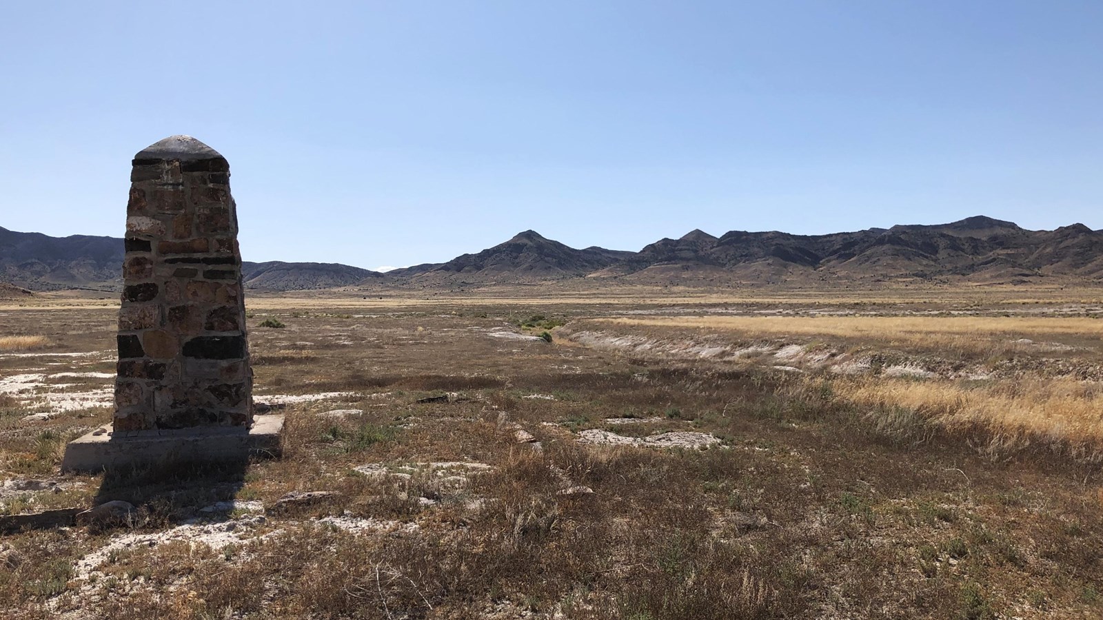
Members of the Civilian Conservation Corps in the 1930s built and dedicated a stone obelisk commemorating Dugway Station. The monument still stands and a steel fencepost north of it marks the location where the original station once existed. The surrounding landscape is still as forlorn as when Greeley passed through in 1859.
Site Information
Location (The Dugway PX Station Site is about 62 miles as the crow flies from Eagle Mountain UT, or 19 miles southwest of Simpson Springs Pony Express Station on Simpson Springs-Callao Rd. The site area and stone monument are about 1.5 miles south of the road. Visitors can see the site area and perhaps the stone monument by stopping along Simpson Springs-Callao Rd to look due south at about GPS 41.019918 -113.972862. This suggested stopping place is about 0.8 mile southwest of a livestock water tank on the left.)