Last updated: April 12, 2022
Place
Drumheller Channels National Natural Landmark
NPS
Quick Facts
Location:
W McManamon Rd, Othello, WA 99344
Designation:
National Natural Landmark
MANAGED BY:
Amenities
2 listed
Parking - Auto, Scenic View/Photo Spot
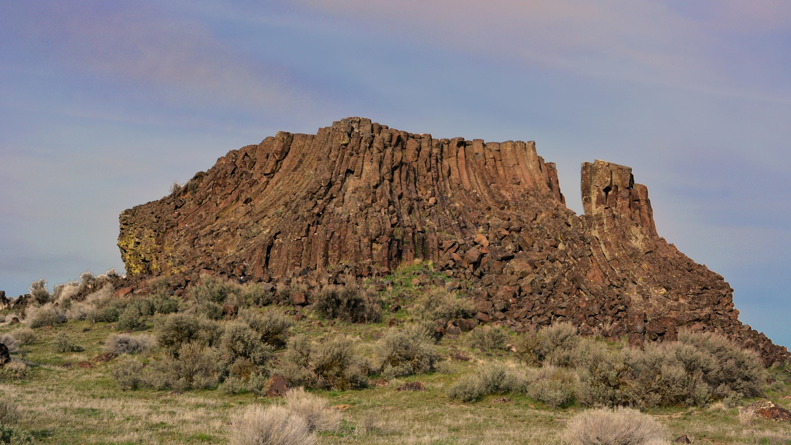
The Drumheller Channels are unique because no single channele or major cataract where formed. The Drumheller Channels are the most spectacular example in the Columbia Plateau of basalt "butte-and-basin" channeled scablands. This is an erosional landscape characterized by hundreds of isolated, steep-sided hills surrounded by a braided network of (usually) dry stream channels. The landscape is the result of dramatic modification of the Columbia Plateau volcanic terrain by late Pleistocene catastrophic glacial outburst floods—the Missoula Floods. These floods occurred at a scale remaining unparalleled on earth, either in the geologic record or in historical account.
During the last glaciation the Cordilleran Ice Sheet advanced southward at various times to impinge upon the northern margin of the Columbia Plateau. Occasionally, the Pend Oreille Lobe of the ice sheet plugged the Clark Fork River valley near the point where it now enters Pend Oreille Lake, Idaho. The resulting glacier-dammed lake (Glacial Lake Missoula) covered at its highest level an area of about 7,800 square kilometers (3,000 square miles) in western Montana and contained an estimated 2,100 cubic kilometers (500 cubic miles) of water with a depth of nearly 600 meters (2,000 feet) at the ice dam. At least two times, a violent collapse of the ice dam caused the waters of Glacial Lake Missoula to discharge rapidly downstream as catastrophic floods that spread across the flat basaltic terrain of the Columbia Plateau within a period of two or three weeks each time. Although the precise number of floods remains in question (i.e. as many as forty have been proposed), the incredible proportions of flood-related landforms on the plateau bear witness to the largest and most catastrophic of such events known to have occurred on the face of the earth, both in the geologic record and in historical account.
Upon reaching the Columbia valley, and blocked by the Okanogan Lobe of the ice sheet, the flood waters backed up and spread across the Columbia Plateau, spilling through the Grand Coulee and several other channel ways to the east in the upper Crab Creek drainage. Flowing south and westward, the water ponded in the Quincy Basin and then spilled partly into the Columbia valley to the west in three channel ways. In addition a slight down warp in the volcanic flows of the plateau in the southeast corner of the basin funneled the majority of flood water southward into Drumheller Channels, a structural saddle between the plunging Frenchman Hills anticline on the west and the upward tilting plateau to the east.
During the first floods through the channels the waters plunged ten meters/kilometer (50 feet/mile) for thirteen kilometers (8 miles), which provided the torrent with sufficient energy to tear away great masses of sedimentary and volcanic basement rocks: as much as 120 meters (400 feet) in some areas. Thick layers of the Plio-Pleistocene Ringold Formation (sandstones, siltstones, and clays representing stream deposits of an earlier Columbia River) were removed.In one spillway at least one flood spread over a 15 kilometer (9 miles) wide area and was more than 30 kilometers (100 feet) deep, carrying more than 400 cubic kilometers (100 cubic miles) of water at velocities up to 80 kilometers/hour (50 miles/hour).
The unusual landscape carved by the floods is characterized by hundreds of buttes separated from one another by a labyrinth of small, anastomosing dry channels and basins and so is termed “basin-and-butte scabland”. Total relief in this tract of about 13 kilometers (8 miles) by 13 kilometers is 180 meters (600 feet). Six main channels compose the Drumheller Channels; a dramatically underfit Crab Creek flows through the relatively wide, shallow center channel, while the others are pock-marked with rock basins and potholes. All wind southward toward the Othello Channels to the southeast and the Lower Crab Creek valley to the southwest. Other related scabland systems on the Columbia Plateau include the central Grand Coulee, the Sprague Channeled Scabland, the Rattlesnake Springs scablands of Moses Coulee, and other areas south of Cheney, Washington.
Prior to the development of the Columbia Basin Irrigation Project, the rock depressions of the Drumheller Channels was largely dry and supported sage-bunchgrass vegetation. Over one hundred lakes now occur within the site as a result of the impoundment of Lower Crab Creek in 1950, the consequent creation of the Potholes Reservoir to the north, and a concomitant rise in the ambient water table. As a result, more diverse flora and fauna now occur within the region. Eight habitat types have been identified within Columbia National Wildlife Refuge, including sagebrush, grassland, greasewood, cliff, willow woodland, sedge meadow, marsh, and lake.Drumheller Channels has become a resting, feeding, and wintering ground for twenty-three species of ducks and geese; occurrences of other water birds have increased as well.
So striking and extreme is this landscape that in 1986, the National Park Service designated the Drumheller Channels National Natural Landmark. National Natural Landmarks recognize sites that contain outstanding biological and/or geological resources, regardless of landownership. They are selected for their outstanding condition, illustrative value, rarity, diversity and value to science and education. In fact, so important and unique are the Missoula Floods and the resulting landscapes that Congress has designated the Ice Age Floods National Geologic Trail.
More Information can be found at:
Washington Department of Natural Resources - Washington Geologic Survey (WA 100)
National Natural Landmarks - National Natural Landmarks (U.S. National Park Service) (nps.gov)
Columbia National Wildlife Refuge - Columbia - U.S. Fish and Wildlife Service (fws.gov)