



Last updated: August 22, 2026
Place
Diamond Springs Station - Nebraska
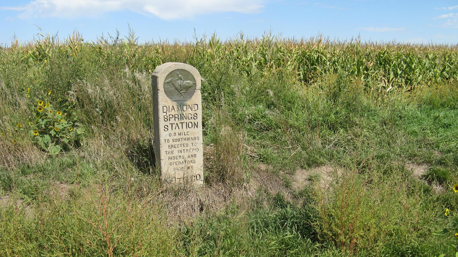
NPS Photo
Quick Facts
Location:
Three locations are associated with this station: 1932 Keith County station marker, 0.8 mile west of Brule on north side of US-30 and 0.8 mile north of the historical site, GPS 41.0909444444, -101.9045833333 2021 granite marker placed by the Pony Express Trail Association, about 4 miles west of Brule, highway turnout on north side of NE-30 at intersection with West County Rd M. The monument stands beside a Nebraska State historical sign for California Hill. GPS 41.0910333333 -101.97885. Diamond Springs site, 0.8 mile west of I-80 interchange 117 at Brule. Site is about 100 feet north of the freeway. GPS 41.078665 -101.905462
Significance:
Diamond Springs Station was a relay station for the Pony Express and the Overland Stage ca. 1859-1868
Designation:
Historic site on the Pony Express National Historic Trail.
Amenities
1 listed
Historical/Interpretive Information/Exhibits
Diamond Springs Station was established in 1859 for the Central Overland California and Pike’s Peak Express, a stagecoach mail service that later launched the Pony Express. From April 3, 1860, to November 20, 1861, it served as a Pony Express relay stop where riders changed horses, until the transcontinental telegraph made rapid long-distance communication possible and the Pony Express, now obsolete, came to a close. Stagecoach “heavy mail” and passenger service continued.
In 1863, Hester Ann Brown, the station managers wife, gave birth at Diamond Springs during a fierce thunderstorm. She described her delivery room as “an old adobe house with just part of a roof on it, which was conducted as a stage station.” Two Sioux women, the wives of chiefs Red Cloud and Spotted Tail, attended the birth. She recalled in her autobiography that they “took as good care of me as anyone could have.”
By August 1865, all stage stations between Julesburg, Colorado, and Cottonwood Springs (later Ft. McPherson), Nebraska, were abandoned due to repeated harassment by Sioux and Cheyenne warriors. Employees fled with the livestock, leaving behind other property. Diamond Springs reported the loss of 28,000 sacks of feed corn and 15 tons of hay, altogether worth $6,200, the equivalent of about $127,000 in 2026 dollars.
Personnel eventually returned, but stage and wagon travel dwindled over the next several years as construction of the transcontinental railroad progressed across Nebraska. No information specific to Diamond Springs Station is available for that time period, but most stage stations shut down in 1868-1869.
Site Information
Location (Three locations are associated with this station:
1932 Keith County station marker, 0.8 mile west of Brule on north side of US-30 and 0.8 mile north of the historical site, GPS 41.0909444444, -101.9045833333 2021
granite marker placed by the Pony Express Trail Association, about 4 miles west of Brule, highway turnout on north side of NE-30 at intersection with West County Rd M. The monument stands beside a Nebraska State historical sign for California Hill. GPS 41.0910333333 -101.97885.
Diamond Springs site, 0.8 mile west of I-80 interchange 117 at Brule. Site is about 100 feet north of the freeway. GPS 41.078665 -101.905462)