Last updated: December 30, 2021
Place
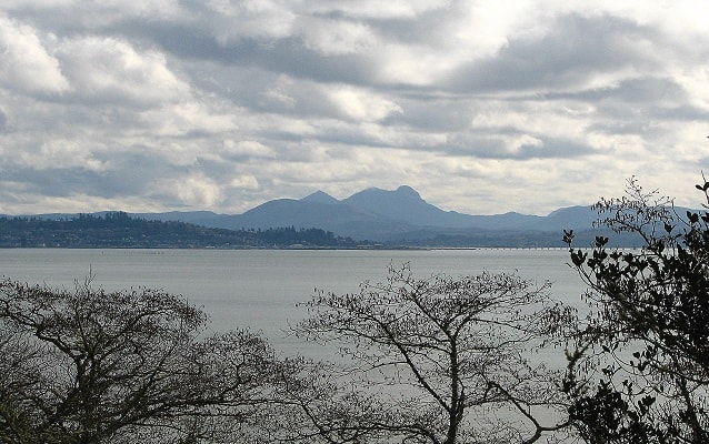
Chinook Point
Ian Poellet
Quick Facts
Location:
Fort Columbia State Park, Chinook WA
Significance:
Location where Corps of Discovery saw the Pacific Ocean
Designation:
National Historic Landmark
MANAGED BY:
Lewis and Clark NHT Visitor Centers and Museums
This map shows a range of features associated with the Lewis and Clark National Historic Trail, which commemorates the 1803-1806 Lewis and Clark Expedition. The trail spans a large portion of the North American continent, from the Ohio River in Pittsburgh, Pennsylvania, to the mouth of the Columbia River in Oregon and Washington. The trail is comprised of the historic route of the Lewis and Clark Expedition, an auto tour route, high potential historic sites (shown in black), visitor centers (shown in orange), and pivotal places (shown in green). These features can be selected on the map to reveal additional information. Also shown is a base map displaying state boundaries, cities, rivers, and highways. The map conveys how a significant area of the North American continent was traversed by the Lewis and Clark Expedition and indicates the many places where visitors can learn about their journey and experience the landscape through which they traveled.
On November 15, 1805, after a year and a half of traveling west, the Corps finally saw the Pacific Ocean near Chinook Point. Intense thunderstorms finally subsided on the 15th, which allowed them to move four miles west toward Chinook Point. Boards from a temporarily deserted Chinook Indian village nearby were used to erect shelters. For the next 10 days the Corps used Chinook Point as a base camp to explore the surrounding area, and find a site for their winter encampment.
The Chinook suggested the south bank of the Columbia River where game and edible roots were more plentiful. The Corps also discussed returning upstream on the Columbia River, though it would be colder and salt would be scarce. Lewis and Clark decided to let the Corps vote on the camp location - including York and Sacagawea. This was significant because, at that time, African Americans and women were generally not allowed to vote.
On November 24, 1805 they decided to investigate the south side of the Columbia River:
“. . . we have every reason to believe that the nativs have not provisions Suffient for our Consumption, and if they had, their price's are So high that it would take ten times as much to purchase their roots & Dried fish as we have in our possession, ... They generaly agree that the most Elk is on the opposit Shore, and that the greatest numbers of Deer is up the river at some distance above. added to-, a convenient Situation to the Sea coast where we Could make Salt, and a probibility of vessels Comeing into the mouth of columbia ("which the Indians inform us would return to trade with them in 3 months["]) from whome we might precure a fresh Supply of Indian trinkets to purchase provisions on our return home: together with the Solicitations of every individual, except one of our party induced us Conclude to Cross the river and examine the opposit Side.the Climate which must be from every appearance [must be] much milder than that above the 1st range of Mountains, The Indians are Slightly Clothed and give an account of but little Snow, and the weather which we have experienced Since we arrived in the neighbourhood of the Sea coast has been verry warm, and maney of the fiew days past disagreeably So. if this Should be the Case it will most Certainly be the best Situation of our naked party dressed as they are altogether in leather.”
On November 25, 1805, the Corps of Discovery left their base camp near Chinook Point and traveled to the more favorable location of Fort Clatsop.