Last updated: April 15, 2021
Place
Cascade Pass Trail
NPS / Deby Dixon
Quick Facts
Location:
Cascade River Road
Significance:
Hiking Trail
Amenities
3 listed
Parking - Auto, Toilet - Vault/Composting, Trailhead
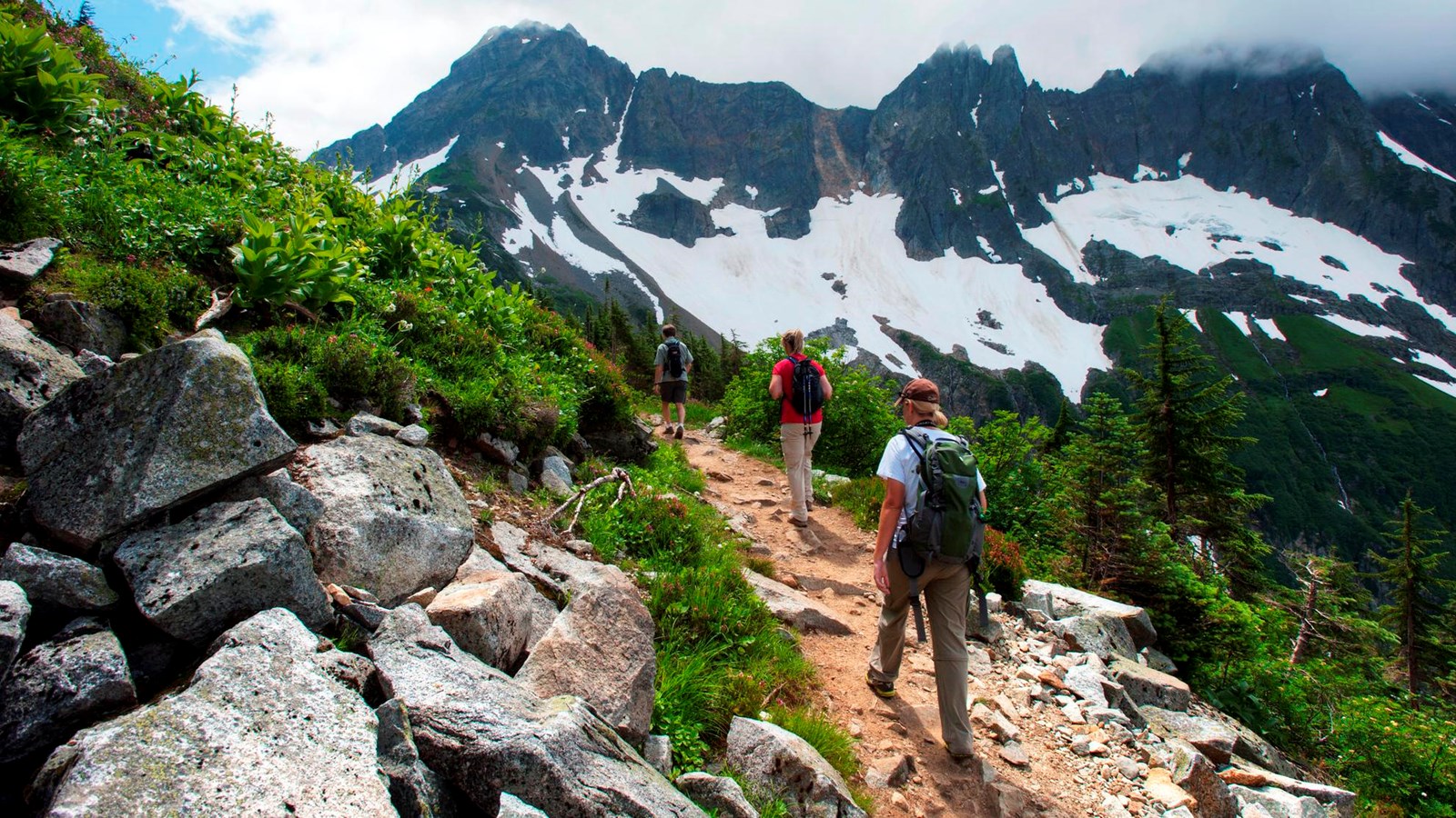
Cascade Pass is the most popular day hike in the national park and can be quite busy on summer weekends. The trail switchbacks through cool forests, traverses through meadows, and ends at a spectacular viewpoint at the pass. From the pass, hikers may return back to the trailhead or explore in several directions. Just to the east of the pass, the strenuous Sahale Arm Trail veers steeply north for another 2.2 miles (3.5 km) to the toe of the Sahale Glacier.
- Difficulty: Moderate to Cascade Pass; strenuous to Sahale Glacier.
- Distance and elevation: 3.7 miles (6 km) one way / 1700 ft (550 m) elevation gain (to Sahale Glacier: 5.9 miles (9.5 km) one way / 3940 ft (1200 m) elevation gain)
- Access: The Cascade River Road leaves State Route 20 at Marblemount and extends 23.1 miles (37 km) to the trailhead, about an hour's drive. The road is paved for the first third and then becomes gravel, with some narrow and steep sections near the end. The road typically opens to the Cascade Pass parking lot by the end of June, except in heavy snow years when it may not open until early July.
- Dogs are not allowed.
- The trail and parking area can be very crowded during summer months.
- This area has very fragile vegetation. Please take care to protect the plants by hiking and resting only on durable surfaces such as the trail, snow or rocks.