Last updated: January 17, 2023
Place
Candy Mountain
© REBECCA BURGHART
Quick Facts
Location:
West Richland, WA
MANAGED BY:
Amenities
4 listed
Benches/Seating, Historical/Interpretive Information/Exhibits, Pets Allowed, Trailhead
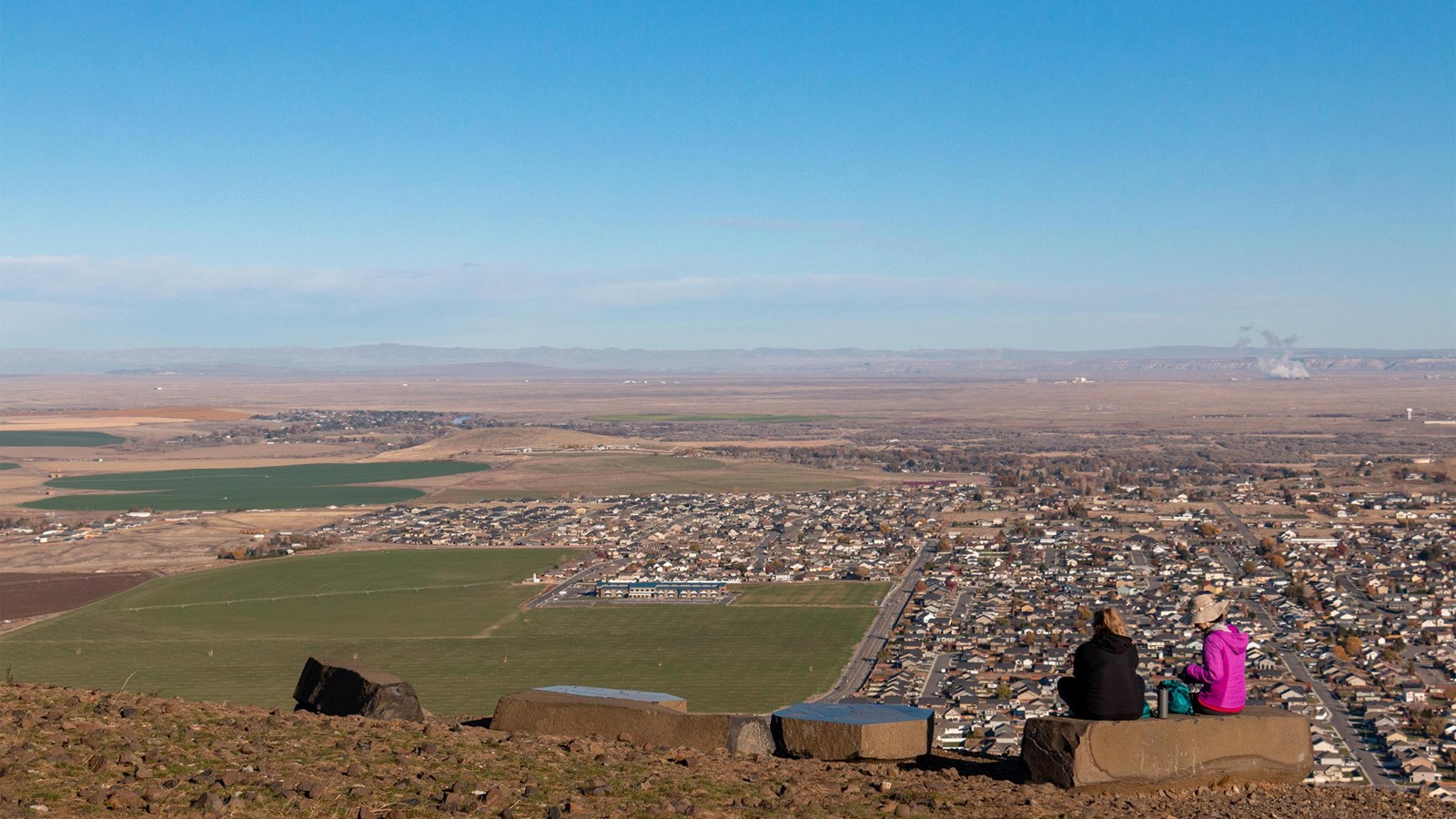
On a clear day the summit of Candy Mountain reveals panoramic views of the Tri-Cities region and the Hanford Site. As you enjoy the 3.6 mile (5.8 km) roundtrip hike, you will pass markers that explain the impact of the ice age floods on area geography. The summit offers sweeping 360-degree views and a sign that identifies the areas of the Hanford Site involved in plutonium production.
The mountain itself was once an island in the massive glacial Lake Lewis during the last ice age 15,000 years ago. Interpretive signs along the trail tell the story of the ice age floods. A rock monument on the trail at elevation 1,250 feet (381 meters) marks the highest shoreline of ancient Lake Lewis. Remnants of the ice age floods visible along the trail include large boulders called “erratics,” transported hundreds of miles in icebergs that melted and dropped their heavy cargo in the ancient lake. Other signs along the trail point out native plants and animals.
The summit offers one of the best views of the Hanford Site, allowing you to understand the vastness of the area the government appropriated for the Manhattan Project, the American effort to develop an atomic bomb. In 1942, General Leslie R. Groves, military leader of the Manhattan Project, directed Lieutenant Colonel Franklin T. Matthias to search the United States for a place to produce plutonium. After viewing several locations, Matthias visited Hanford on December 22 and knew he found an ideal place to produce plutonium. Groves wanted a large, sparsely populated area with ready access to water and electricity. The towns of Hanford, White Bluffs, and Richland were near the site, but all were small farming communities. The Columbia River could supply the water needed to cool the nuclear reactors. The project could get the massive amounts of electric power required for plutonium production from Grand Coulee Dam, which began operating in 1942. On January 16, 1943, Groves approved the Hanford Site as the center for plutonium production.
From the summit, you can see the 300 Area north of Richland. The 300 Area Fuel Fabrication Site turned hundreds of thousands of tons of uranium into fuel slugs that the Hanford nuclear reactors irradiated to produce plutonium for the war effort. In the west along the river, the 100 Area contained the nuclear reactors, including B Reactor, the world's first full-scale nuclear reactor. T Plant and the other plutonium separation facilities were in the 200 Area on the central plateau. The complicated chemical reactions that extracted plutonium from the uranium left vast quantities of chemical and radiological waste held in solid waste burial grounds and leak-prone underground storage tanks. Much of the Department of Energy’s cleanup effort at Hanford today addresses safe disposal of that waste.
Continue Your Journey
There are many places in the Tri-Cities to enjoy the outdoors. Bike or walk the Sacagawea Heritage Trail to see the Columbia River waterfront up close. Hike the White Bluffs North Trail and South Slope Trail to picture what the landscape looked like before settlement and to view Hanford Site. Drive to the top of Saddle Mountain for a similar panorama view of the Tri-Cities region.