



Last updated: October 2, 2026
Place
Blue Mound
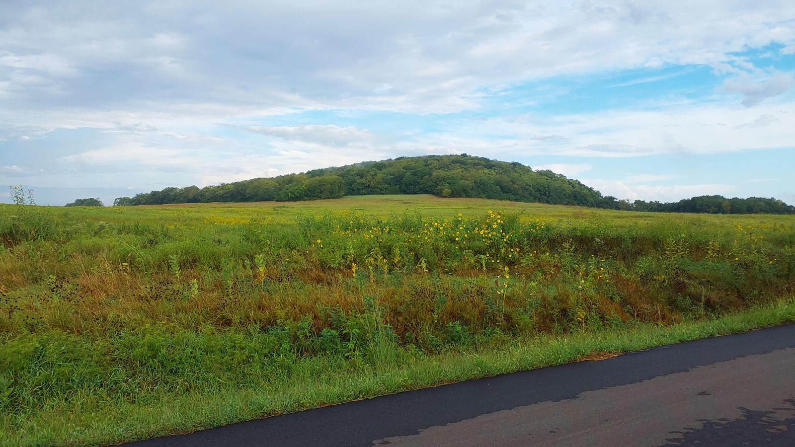
NPS Photo
Quick Facts
Location:
Blue Mound can be viewed by looking south from KS-10 while traveling south of Lawrence. For a closer look, go to N 1100 Rd between E 1750 Rd and E 1700 Rd. (1700 Rd north of 1100 Rd is a private lane.) GPS Mound (private) 38.90447 -95.18266
Significance:
Blue Mound (1,054’ el.) was a major camping area and the first natural landmark encountered by westbound emigrants, many of whom climbed to the top for the view.
Designation:
Historic site on the California and Oregon National Historic Trails.
OPEN TO PUBLIC:
No
MANAGED BY:
Private
Amenities
1 listed
Scenic View/Photo Spot
Westbound emigrants on the Oregon and California Trail encountered their first trailside landmark, Blue Mound, about 2 miles southeast of present-day Lawrence, Kansas. The butte, a natural formation roughly half a mile long and rising about 230 feet above the surrounding prairie, was visible from a great distance. A branch of the trail passed near its southern base, and many wagon trains camped nearby.
During the “Bleeding Kansas” years leading up to the Civil War, Lawrence’s “free state” residents stationed lookouts atop Blue Mound to watch for pro-slavery raiders approaching from Missouri. (One such band, some 400 men led by William Quantrill, arrived undetected in darkness on August 21, 1863, leaving Lawrence in ruins.) A century later, local investors built a ski resort on the mound’s northwestern slope, a popular attraction until its closure in 1983.
Today, Blue Mound is a privately owned, forested butte surrounded by farmland. Travelers driving south of Lawrence on KS‑10, as well as those on nearby local roads, can readily see this historic landmark.
Site Information
Location (Blue Mound can be viewed by looking south from KS-10 while traveling south of Lawrence. For a closer look, go to N 1100 Rd between E 1750 Rd and E 1700 Rd. (1700 Rd north of 1100 Rd is a private lane.) GPS Mound (private) 38.90447 -95.18266)