Last updated: April 14, 2020
Place
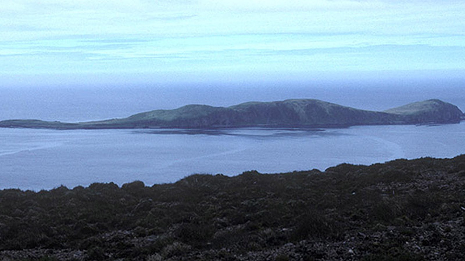
Anangula National Historic Landmark
Courtesy of D. Veltre
Quick Facts
Location:
Western Aleutian Islands, Alaska
Significance:
The Anangula Site has information about the peopling of the Americas. It represents the earliest known human settlement of the Aleutians.
Designation:
National Historic Landmark, since June 2, 1978
OPEN TO PUBLIC:
No
MANAGED BY:
Old World Origins and the Oldest Archeological Site in the Aleutian Islands
The Anangula Archaeological District National Historic Landmark is on the tiny, one-and-a-half mile long, Ananiuliak Island (or Anangula Island) of the Aleutian Island Chain. In profile, the elevation relief of Ananiuliak Island resembles a seal swimming north.
The Anangula Archaeological District is made up of two precontact sites: The Anangula Village site and the Anangula Core and Blade manufacturing site. The Core and Blade site sits atop a bluff that provides a view of fish, sea mammals, and boats that might be passing by. A ridgeline protects the site from strong Aleutian winds. The Village site was built on an even higher sea cliff than the Core and Blade site, and has views of Nikolski Bay and Umnak Island. Climbing ridgelines surround the village on the north and west, protecting it from wind.
The Aleutian Chain faces the Bering Sea to the north and the Pacific Ocean to the south. The archipelago follows the arc of the Aleutian Trench, where the Pacific Plate meets the North American Plate. The Aleutian Islands encompasses 52 volcanoes, 27 of which are active (Alaska Volcano Observatory). Ananiuliak Island is within the Alaska Maritime National Wildlife Refuge. Migratory seabirds nest in the island’s rocky cliffs while rabbits roam the island’s grassy slopes. The rabbits were introduced as prey for commercial fox breeding in the 1930s, but the foxes were eventually removed when the area became a wildlife refuge.
Ancient Tool Factory or Igaghsiilugh (the place for making stone blades)
The Core and Blade site is around 9,000 years old. It represents one of the earliest known human occupations in the Aleutian Chain (Davis and Knecht 2010) and the earliest known ancestors of the Unangan (Alaskan Aleut). Researchers note, “The name for Anangula [Island] is so old that the [Unangan] no longer have any cognizance of its meaning…" (Laughlin and Marsh 1954).
The Core and Blade site covers an extensive horizontal area. The most common stone tool making technique at the site is the type to produce lamellar flakes (long narrow blades), which yield polyhedral shaped cores. Many of the blades are retouched (finer flaking perpendicular to the edges to create a sharper blade). Other stone tools include scrapers and abraders. The tools are fashioned from chert, shale, basalt-andesite, and obsidian, none of which are available in the immediate area. Another curious feature of this specialized manufacture site is the absence of hammerstones. The absence of striking tools at this manufacturing site leads to three possibilities: First, the same materials that the blades were fashioned from were also used as striking tools. Second, organic materials were used as hammers and since then have decomposed. Or third, the artists carried their tool-making tools away with them when they left the factory.
The Core and Blade factory was eventually covered by multiple layers of volcanic ash, in some places up to 6 feet thick.
A Bygone Aleutian Village
The large ancestral Anangula Village site is younger than the Core and Blade site. The Anangula Village site was built on a bluff over 70 feet above the sea. Here are the ruins of dozens of semi-subterranean houses, storage pits, tool scatters, and a few densely packed midden features. Another smaller village site is on the opposite side of the island from the main village. This smaller village is thought to be a seasonal camp used by folks from the main village.
At the main village site, archaeologists have recorded up to 24 depressions in the ground that indicate the location of house ruins and many more smaller depressions revealing the locations of storage pits. The houses are arranged in three rows along the edge of the bluff. A small stream, supplying fresh water, runs down the cliff face to a narrow beach below. Only six of the houses have been excavated; each is semi-subterranean and roughly rectangular-ovoid in shape. The ruins range in size from 13 to 20 feet across and 20 to 30 feet wide. Archaeologists also excavated some of the contents of a midden feature.
On a slope at the edge of the village are a handful of additional archaeological ruins. These ruins have stone paved floors and narrow trenches on two sides that meet to form a V-shape, with the point of the V on the uphill side of the ruin. The V-shaped trenches drained moisture from the floors (Laughlin and Marsh 1954). These structures were probably used as food storage facilities, especially for umqan (a root plant).
Anangula Village was buried beneath deep layers of volcanic ash that have grown over with ryegrass and monkshood. The ash layers protected the site from wind erosion. Archaeologists found hammerstones, anvil blades, scrapers, retouched blades, and even tools made for right-handed or left-handed use. Seemingly, these artifacts were preserved in their original positions at the time of the ash fall. Outside the houses are several intact stone tool workshops where thousands of stone flakes had been left behind by these ancient craftspeople. Over 20,000 artifacts were recovered from less than one-percent of the site area (Laughlin and Marsh 1954).
The Way of the Sea
Nearby, on Umnak Island is Nikolski Village where the residents trace their ancestry back to the Anangula Village site. The Aleutian-Eskimos have transferred cultural practices, technology, and artistic style from generation to generation for thousands of years. This makes Aleutian culture an extraordinary segment of aboriginal cultures in the Americas.They geared their technology toward a maritime environment, traveling across the sea and creating shelter in a treeless environment prone to powerful sea storms and windstorms.
Archaeologists estimate around 200 people at a time lived at this village over a period of about 500 years, practicing a maritime economy. Their stone tools bear little resemblance to contemporaneous sites in interior Alaska. Instead, they resemble tools found in Hokkaido, Japan and eastern Siberia.
The technology seen at the Igaghsiilugh site (Core and Blade site) is related to Upper Paleolithic tool technology of Siberia (McCartney 1984). DNA studies (mtDNA and nucleic DNA) that compare contemporary and precontact Aleutian Islanders demonstrate that an “overall cultural continuity with notable incursions and excursions of people and cultural elements into and out of the eastern Aleutians” took place (Davis and Knecht 2010).
A Changing Landscape
During occupation of the Core and Blade site, Ananiuliak Island was a peninsula of Umnak Island, forming the northern cape of Nikolski Bay. Geological studies reveal that Early Holocene deglaciation in the region occurred about 10,000 years ago and the regional climate was warmer and drier. Prior to 8,000 years ago, sea-levels were similar to today’s and the area was the first deep, ice free pass between the Bering Sea and the Pacific Ocean. Ancient settlers reached this area by boat, bringing their maritime culture and technology with them.
The Okmok eruption ended the earliest occupation of Anangula Island when over six feet of ash accumulated on the island.
After 8,000 years, the sea-level rose and peaked at about 6 and a half feet higher than today’s levels, and began to lower again around 3,000 years ago. The sea-level rise after 8,000 years ago played a significant role in wiping out many of the archaeological remains of the earliest settlements of Beringia. Unique preservation conditions make Anangula Archeological District National Historic Landmark an especially valuable resource.
Additional Information
More National Historic Landmarks in Alaska
Studies in the Early Prehistory of Nikolski Bay: 1937-1971
By Jean S. Aigner, Anthropological Papers of the University of Alaska 16(1): 9-25, 1974
Dating the Early Holocene Maritime village of Anangula
By Jean S. Aigner, Anthropological Papers of the University of Alaska 18:51-62, 1976
Alaska Volcano Observatory
Geology and Ancient Aleuts, Amchitka and Umnak Islands, Aleutians
By Robert F. Black, Arctic Anthropology 11(2): 126-140, 1974.
Late Quaternary Sea Level Changes, Umnak Island, Aleutians: Effects on Ancient Aleuts and Their Causes
By Robert F. Black, Quaternary Research 4:264-281, 1974
Holocene Prehistory of the Northernmost North Pacific
By Don E. Dumond and Richard L. Bland, World Prehistory 9:401-451, 1995
Archaeology of Prehistoric Native America: An Encyclopedia
Edited by Guy E. Gibbon and Kenneth M. Ames
Published by Taylor & Francis, 1998
Anangula Blade Site Excavations: 1972 and 1973
By Sara B. Laughlin, William S. Laughlin and Mary E. McDowell, Anthropological Papers of the University of Alaska 17(2):39-48, 1974.
The Lamellar Flake Manufacturing Site on Anangula Island in the Aleutians
By William S. Laughlin and G. H. Marsh, American Antiquity 20 (1): 27-39, 1954
Stratigraphy of the Anangula Unifacial Core and Blade Site
By Allen P. McCartney and Christy G. Turner II, Arctic Anthropology 3(2):28-40, 1966
Anangula Core and Blade Site
By Allen P. McCartney and Douglas W. Veltre, American Beginnings: The Prehistory and Paleoecology of Beringia (ed. F.H. West)
Published by University of Chicago Press, 1996