Last updated: January 17, 2023
Place
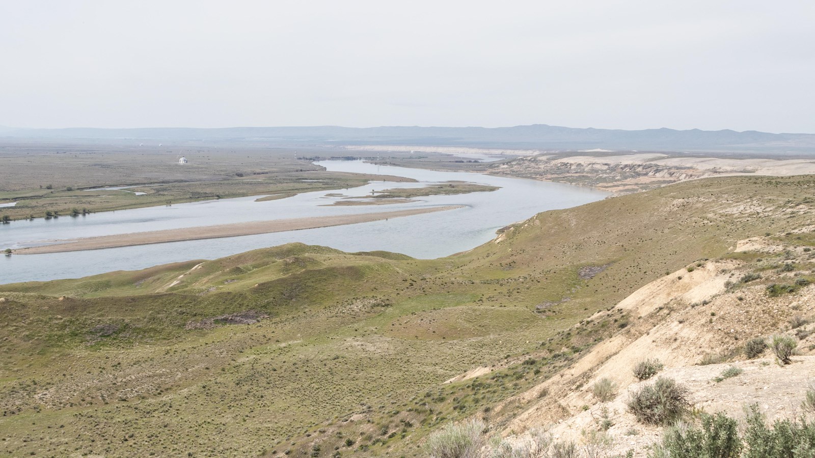
White Bluffs Overlook
NPS/BURGHART
Quick Facts
Location:
Mattawa, WA
MANAGED BY:
Amenities
2 listed
Historical/Interpretive Information/Exhibits, Scenic View/Photo Spot
This overlook, located within the Hanford Reach National Monument, provides a place to observe geology, plants, animals, and World War II history. Dotted with sagebrush and bunch grass that crunches underfoot during the hot dry summers, this arid landscape is the improbable home to beavers, osprey, salmon, and other iconic wildlife of the Pacific Northwest. Sustaining human and animal life in the dry shrub steppe of eastern Washington for millennia, the Columbia River also provided water to cool the plutonium production nuclear reactors during the Manhattan Project and Cold War.
Millions of years ago, during the Pliocene Epoch, the ancestral Columbia River laid down the deposits that became the white bluffs. Around three million years ago, plate tectonics raised the area, and the Columbia River began cutting down through the deposits. These deposits were further shaped by the Ice Age floods, a series of cataclysmic floods at the end of the last Ice Age some 12,000 to 17,000 years ago. These floods left lasting dramatic and distinguishing features on the landscape in parts of Idaho, Montana, Oregon, and Washington.
The Nez Perce, Umatilla, Wanapum, and Yakama tribes have called the Hanford area home since time immemorial. Fur trappers arrived in the 1820s to purchase pelts from area tribes. White settlers began arriving about 30 years later, displacing many Native American communities. Settlers relied on extensive irrigation to grow a wide array of agricultural products, including cherries, asparagus, alfalfa, peppermint, and many other marketable commodities.
On January 16, 1943, General Leslie R. Groves, military leader of the Manhattan Project, approved the Hanford Site as the center for plutonium production displacing tribal and settler communities. The federal government appropriate 670 square miles (1740 sq kilometers) of land for the Hanford Site. Atomic Energy Commission, which assumed management of the nation’s nuclear weapons program from the Army Corps of Engineers at the end of the World War II, greatly expanded Hanford’s plutonium production capacity during the Cold War. Plutonium production at the Hanford Site ended in 1987. Since then, the area has been the focus of extensive environmental cleanup work.
Continue Your Journey
At the White Bluffs Overlook, you may walk across the white bluffs themselves. You may also enjoy of a tour of the historic buildings on the Hanford Site. The Department of Energy offers tours of the B Reactor and the Pre-War Historic Sites Tour that visit sites such as the Bruggemann Ranch, the White Bluffs Bank, Hanford High School, and the Allard Pumphouse where local people lived, worked, and came together as a tight-knit community prior to the arrival of the Manhattan Project.