Last updated: October 4, 2023
Place
Echo Meadows

Historical/Interpretive Information/Exhibits, Trailhead
A map of Passport and Places to Go locations for National Historic Trails.
The primary route of the Oregon Trail passed through Echo Meadows from 1847-1860. Just four miles from the Umatilla River crossing, emigrants did not stop or camp here, but they left signs of their passing nonetheless. Deep wagon swales were created as the emigrants passed through the meadows, which remain to this day.
Site Information
Location (Highway 320 west of Echo, Oregon)
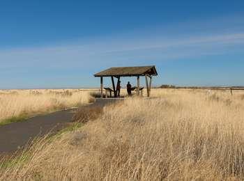
Echo Meadows is a 320 acre site managed by the Bureau of Land Management. Walk the site's half-mile (one way) paved path to visit the remaining one mile long stretch of swales. If you walk the swales, stop at the property line; do not trespass onto the adjacent farm. A pavilion near the parking lot contain interpretive exhibits that tell the stories of the trail and the area's native people. No water or restrooms are available. Echo meadows is open year-round.
More Site Information
Oregon National Historic Trail
