Last updated: May 6, 2021
Place
Blackrock Summit Trailhead
Quick Facts
Location:
Blackrock Parking Area (mile 84.4)
Amenities
1 listed
Trailhead
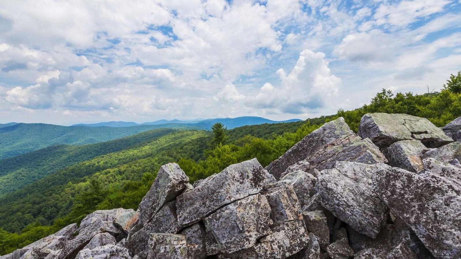
A short hike to a viewpoint on top of a rocky talus slope with incredible views of the Shenandoah Valley, Massanutten Mountain, and beyond. Pets must be on a physical leash no longer than 6 feet at all times.
This hike is also a designated TRACK Trail, featuring a self-guided brochure and informational sign that turns your visit into a fun and exciting outdoors experience for kids of all ages. To find out more information about TRACK Trails and to log your adventure,visit the Kids in Parks website.
Distance: 1-mile circuit hike
Difficulty: Easiest (explanation of our hiking difficulty scale)
Hiking Time: 45 minutes
Elevation Gain: 175 feet
Hike Description
- From the Blackrock Parking Area (mile 84.4), follow the Appalachian Trail south.
- At the trail post, turn right and continue to the boulder field with a great view.
- Continue south on the A.T. around the slope.
- At the intersection, turn left onto the Blackrock Hut Road-Trayfoot Mountain Trail and follow back to the parking lot