Last updated: May 21, 2024
Place
Anacapa Island — 'anyapax
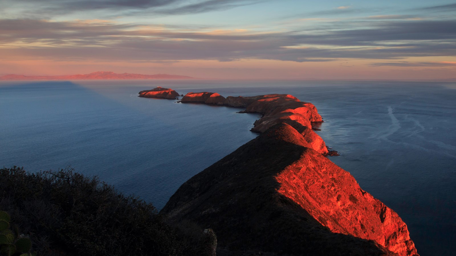
Tim Hauf, timhaufphotography.com
'anyapax is the Chumash word for Anacapa. It means mean 'mirage' or 'illusion' and refers to the atmospheric phenomena that occasionally distorts the appearance of the island when viewed from the mainland.
Please see "Ethnographic Island Place Names" below for more information on island place names.
Crossing the channel to Anacapa Island, one begins to understand why the island's name was derived from its Chumash Native American Indian name ’anyapax . Seeming to change shape in the summer fog or afternoon heat, the three islets of Anacapa look like an island of deception or a mirage. Almost five miles long, these islets (appropriately named East, Middle, and West Anacapa Islands) are inaccessible from each other except by boat. They have a total land area of about one square mile (700 acres). Waves have eroded the volcanic island, creating towering sea cliffs, sea caves, and natural bridges, such as forty-foot-high Arch Rock-a symbol of Anacapa and Channel Islands National Park.
Exploring East Anacapa's two-mile trail system allows visitors to experience the island's native vegetation, wildlife, and cultural history. Although for much of the year the island vegetation looks brown and lifeless, the winter rains transform the landscape. Emerging from dormancy, the native plants come alive with color. The strange tree sunflower, or coreopsis, blossoms with bright yellow bouquets that are so vivid and numerous they can sometimes be seen from the mainland. Vibrant red paintbrush, island morning glory, and pale buckwheat add touches of color to the island's palette.
Seabirds are probably the most conspicuous wildlife on Anacapa Island. Thousands of birds use Anacapa as a nesting area because of the relative lack of predators on the island. While the steep cliffs of West Anacapa are home to the largest breeding colony of endangered California brown pelicans, all the islets of Anacapa host the largest breeding colony of western gulls in the world. Western gulls begin their nesting efforts at the end of April, sometimes making their shallow nests just inches from island trails. Fluffy chicks hatch in May and June and fly away from the nest in July.
The rocky shores of Anacapa are perfect resting and breeding areas for California sea lions and harbor seals. The raucous barking of sea lions can be heard from most areas of the island. Two overlooks (Cathedral Cove and Pinniped Point) provide excellent spots to look down on seals and sea lions in the island coves.
Anacapa's rich kelp forests (ideal for kayaking, snorkeling, and diving) and tidepool areas provide visitors with the opportunity to meet some of the resident ocean animals up close. Visitors may also catch a glimpse of the fascinating undersea world of the kelp forest without getting wet. During the spring and summer, park rangers dive into the Landing Cove on East Anacapa with a video camera. Visitors can see, through the eye of the camera, what the diver is seeing-bright sea stars, spiny sea urchins, and brilliant orange Garibaldi-by watching video monitors located on the dock, in the mainland visitor center auditorium, in classrooms, or via the Internet. And, divers can answer questions from visitors as part of this distance learning program.
Anacapa Island has a rich human history as well. Shell midden sites indicate where Chumash people camped on the islands thousands of years ago. In addition, visitors can view the 1932 light station whose mission revival style buildings include the lighthouse, fog signal building, one of four original keeper's quarters, a water tank building, and several other service buildings. The original lead-crystal Fresnel lens, which served as a beacon to ships until an automated light replaced it in 1990, is on exhibit in the East Anacapa Visitor Center.
Island Facts
- Located in Ventura County.
- Fourteen miles from Ventura.
- Five miles long and 1/4 mile wide.
- Average rainfall is between eight and thirteen inches per year.
- Supports 265 species of plants, including two found only on Anacapa and 20 found only on the Channel Islands.
- The Anacapa deer mouse is only found on Anacapa Island.
- West Anacapa is home to the largest breeding colony of California brown pelicans.
- Scripps's murrelet colonies are recovering following rat eradication in 2002.
- Frenchy LeDreau lived at Frenchys Cove from 1928 to 1956.
- The Anacapa lighthouse, turned on in 1932, was the last permanent lighthouse built on the West Coast.
- Harbor seals and California sea lions rest and breed on the island.
- Home to 30 sea caves.
Things to Do
Anacapa Island is the perfect place for a half-day, one-day, or short overnight camping trip. If you have time to visit just one island, this may be the place. As with all the Channel Islands, visiting Anacapa Island is an exercise in preparation and self-reliance. Since there are no services on the islands, there are no remedies for poor planning once you have arrived. For more information than what is listed below visit: nps.gov/chis
Boat Transportation
Island Packers offers trips year round. Travel time is about one hour.Almost all trips are to East Anacapa Island. A limited number of trips are offered throughout the year to Frenchys Cove on West Anacapa Island. Visitors must climb from the boat up a steel-rung ladder to a dock. Once ashore, visitors must climb 157 stairs to the top of the island. Non-landing trips are also available.
Goods and Services
There are no goods, services, or accommodations (lodging) available on the island. Visitors must bring all their own food and supplies. Public phones are not available.
Water
There is no water available on the island. Visitors must bring all their water with them.
Picnicking
Picnic tables are available at the visitor center.
Visitor Center
A small visitor center is located in one of the historic Coast Guard buildings. Features include displays on the natural and cultural resources of the island and the original lead-crystal Fresnel lens from the Anacapa Lighthouse.
Interpretive Programs
On days that the concessionaire boats run to the islands, guided hikes may be offered by national park volunteers or concessionaire naturalists. If they are not available to lead hikes, self-guided interpretive trail booklets are available. Hikes generally begin 30 minutes after Island Packers boats arrive on the island. During the spring and summer, Channel Islands Live programs are offered where park rangers with special microphone-equipped dive masks and underwater video cameras descend into towering kelp forests and interact with you on this virtual underwater hike.
Hiking
Although hiking options are limited with only two miles of trails, the scenery is unmatched. Except for the staircase to the top of the island, the figure eight-shaped trail system is relatively flat and easy while meandering over gentle slopes to dramatic overlooks, magnificent coastal views, and the last permanent lighthouse built on the West Coast. Hikers must stay on trails to protect fragile vegetation and nesting seabirds and for visitor safety. Middle Anacapa and West Anacapa are not open to hiking. They are set aside for the island wildlife except for Frenchys Cove on West Anacapa that can be reached only by boat.
Camping
Primitive camping is available (seven sites; $15 per night per site; reservations required). Picnic table, food storage box, and pit toilet are provided. No water is available. Distance from landing to campground is one-half mile and includes a 157-stair climb.
Watersports
Ideal place for swimming, diving, snorkeling, and kayaking, but there are no lifeguards on the island. Since Anacapa is a cliff island, access to the water is only at the Landing Cove on East Anacapa via a dock. There are no other accessible beaches unless you have a watercraft. Excellent watersports can be experienced at the Landing Cove. The underwater visibility is usually very good and the water is teeming with life since it is located within a marine reserve. Kayaking east towards Arch Rock or west towards Cathedral Cove provides great wildlife viewing, sea caves, and arches.
Fishing
No fishing is allowed within the marine reserve that is located on the north side of Anacapa Island, including in the the Landing Cove. Also, no fishing is allowed (except for commercial and recreational lobster and pelagic finfish) in the marine conservation area on the north side of West Anacapa Island. Fishing is allowed outside these marine protected areas. To fish in Channel Islands National Park,m possession of a valid California state fishing license with an ocean enhancement stamp is required and all California Department of Fish and Game regulations apply.
Wildlife/Wildflower Viewing
There is excellent wildlife viewing on Anacapa. A variety of seabirds can be seen throughout the year, including brown pelicans, cormorants, pigeon guillemots, and western gulls (gull nesting and chicks can be observed from the end of April through July). Seals and sea lions may also be viewed from Pinniped Point, Cathedral Cove, and the boat. During a normal year of rainfall, wildflowers are best viewed in late winter and spring. The brilliant yellow coreopsis flowers usually peak between late January and March. In addition, some plants like gumplant, buckwheat, poppies, and verbena continue to bloom during the summer. The only accessible site on Anacapa Island for tidepooling is at Frenchys Cove on West Anacapa Island. A limited number of trips are offered throughout the year by Island Packers.There is no access to Frenchys Cove or any other tidepools from East Anacapa.
Channel Islands Live: Webcams and Broadcasts
Remote, isolated, rugged, and sometimes inaccessible, the park can be challenging to experience. Now, through advanced technology, Channel Islands Live brings the park to you.
Join rangers as they dive through Anacapa Island's towering kelp forests and hike it's dramatic trails.
Channel Islands Live includes interactive broadcasts where visitors can talk to the rangers and ask questions, curriculum-based presentations for schools, and webcams for monitoring island and underwater features. By bridging the channel through technology we are helping plant the seeds of understanding that can grow into the desire to preserve and protect this extraordinary place.
Park visitors and students can join us for these programs on Anacapa Island, at the Robert J. Lagomarsino Visitor Center in Ventura Harbor, in classrooms, and on the Internet.
Live Broadcasts
Ocean Webcam
Anacapa Island Webcam
History and Culture Overview
Just 13 miles from the Channel Islands National Park Visitor Center in Ventura, Anacapa Island is the second smallest of the Channel Islands at roughly five miles long and one-half mile wide. The native Chumash once called this island "Ennepah," a word meaning deception or mirage which alluded to this island's changing shape when viewed at different times from the mainland and other islands. Anacapa is actually a narrow chain of three islands appropriately called East, Middle, and West Anacapa. Emerging from the fog of the Santa Barbara Channel, Anacapa Island drifts in and out of sight, beckoning visitors from the mainland as it has for centuries.
Chumash on Anacapa
Archeological evidence suggests that the native Chumash people were visiting Anacapa Island as long as 5,000 years ago. Abalone and mussel shells, bones from fish, birds, and pinnipeds, and human artifacts such as bone tools, shell beads, projectile points, and fish hooks all suggest extensive human activity on the island. Due to the absence of fresh water on the island, it is likely that seasonal camps were used for fishing and other activities.
Despite the lack of archeological evidence of permanent settlements on the island, Chumash legend holds that the American Indian population of the Channel Islands began on Anacapa. In the early 20th century, anthropologist John Harrington extensively interviewed a Mission San Buenaventura Chumash man named Fernando Librado who told Harrington a story passed on orally through generations of Chumash Indians. According to the story, eight families traveled to Anacapa Island after a civil war on the mainland and settled on the north side of the middle island. For water, they dug a hole and used seepage at Indian Cave on West Anacapa. After a time, the eight families left Anacapa for Santa Cruz Island, eventually spreading to all the northern islands.
European Contact
Juan Rodriguez Cabrillo was the first European explorer to make contact with the Channel Islands in 1542. Although he passed Anacapa, he and his crew never settled there. Cabrillo named the northern Islands Las Islas de San Lucas, which included Anacapa.
Learning that there were no American Indians on the island, few European explorers visited Anacapa the following decades. Its small size and relative unimportance left the island largely unrecorded for a period of 250 years. The 1793 expedition by Englishman George Vancouver standardized the names of the Channel Islands. Vancouver recorded Anacapa as "Enecapa" and the present spelling appeared on maps in 1854.
Ranching
Like many of the other Channel Islands, Anacapa Island was used for sheep ranching during the latter half of the 19th century. It is uncertain exactly when ranching began on Anacapa. It is believed that three men owned ranches prior to the first recorded lease which began in 1902. H. Bay Webster, himself a sheep rancher on the island, recalled that the first sheep ranch had been established by George Nidever before 1885, although he may have been confused with events on San Miguel Island.
Ranchers used Middle Anacapa for the main headquarters of their sheep operations and the livestock were landed on the northwest side of the island. Sheep survived year-round, but on a marginal basis. With no dependable supply of fresh water, many recalled the somewhat dubious story that the sheep would lick the moisture from the morning fog off of each other's coats. To improve grazing, sheep ranchers introduced exotic grasses to the island. By the 1930s the sheep had destroyed most of the native plants and had begun to eat the endemic Astragalus miguelensis. As a result, many of the sheep died, bringing an end to sheep herding on Anacapa.
Residents
Heaman Bayfield Webster, a former island seal hunter, long-time Ventura resident and assistant postmaster, established residence on Middle Anacapa with his wife and two sons in 1907. For $31 per year, he leased all three of the islands "for grazing and farming only," establishing the first government-recorded ranch on Anacapa. The family spent summers and two winters on the island tending to a flock of nearly 300 sheep. In the fall of 1911, Webster set up a school in a tent for his children and hired a governess to teach them, the first school house on the Channel Islands. Most of Webster's income came from tourism and wool.
Perhaps the most illustrious resident of Anacapa Island was Raymond "Frenchy" LeDreau. The Frenchman made his way to the island in 1928, taking up the life of a fisherman and hermit. He built several huts perched on a ledge overlooking the area now called Frenchy's Cove. Focusing on lobster fishing, Frenchy sold fish to passing Larco Company boats and hosted visitors and fisherman passing by. Friends old and new brought him food and supplies in return for lobster, abalone, and conversation. He was an educated man, apt to discuss literature and sing an aria in a tenor voice. During prohibition he made money by watching over caches of liquor stored in many of Anacapa's caves by rumrunners and bootleggers.
When the US Government created the Channel Islands National Monument in 1938, which included both Anacapa and Santa Barbara islands, it appeared that Frenchy might be forced to leave. So impressed, however, was National Park Service biologist Lowell Sumner with LeDreau's concern for the natural history and welfare of the island that Lowell suggested LeDreau "be allowed to remain on the island as long as he desires." Frenchy became the de-facto caretaker of Anacapa Island for the National Park Service until 1956 when, at the age of 80, he was forced to leave after a fall left him with severe injuries. He had lived on Anacapa Island for 28 years.
In 1932, the Anacapa Island Light Station was completed on East Anacapa Island. The lighthouse and fog signal are still operated by the US Coast Guard and the original Fresnel lens is on display in the island's visitor center.
The National Park Service
On April 26, 1938, the Channel Islands National Monument was established. It included both Anacapa and Santa Barbara islands. Nearly twenty years later, in July 1959, Anacapa Island opened to visitors and provided park ranger services. Closest to the mainland, Anacapa is the second most visited island of the Channel Islands National Park.
Ethnographic Island Place Names
Ethnographic island place names aid in native language revitalization, illustrate cultural values, and provide tangible connections to cultural landscapes and seascapes.
Many of these place names were recorded by ethnographers and anthropologists in the late 1800 and early 1900s. J.P. Harrington was an ethnographer who worked for the Smithsonian Institution in Washington, D.C., from 1915 to 1955. He interviewed American Indian consultants, including Chumash and Gabrielino Tribal members, and recorded information about native languages and culture.
Chumash Indians Fernando Librado (Kitsepawit) and Juan Estevan Pico were the main sources for island place names. They were both born and raised in Ventura. They learned of the island places from Chumash elders, most notably Ursula (of wima) and Martina (of limuw.) Pico's interviews of Martina resulted in a list of island place names given in order from east to west (or vice/versa,) to anthropologist, H.W. Henshaw. Anthropologists have cross-referenced Pico's list with the archeological record, baptismals, and marriage patterns.
Twenty-six new place names were recently identified and mapped by Matthew Vestuto (Barbareño/Ventureño Band of Mission Indians; Advocates for Indigenous California Language Survival) with assistance from Kristin Hoppa (Archeologist, Channel Islands National Park) and the Chumash community. These names reference island peaks, water, landforms, islets, trails, caves, and beaches.
Please note that lowercase is used because capitalization is a convention in English which poses problems in the writing of native languages.
Visit our keyboard shortcuts docs for details
- Duration:
- 15 minutes, 6 seconds
Ten years after removing nonnative rats the ecosystem on Anacapa Island, including rare seabirds, is showing profound results of recovery.