

Survey of Historic Sites and Buildings
 |
CHIRICAHUA NATIONAL MONUMENT Arizona |
 |
| ||
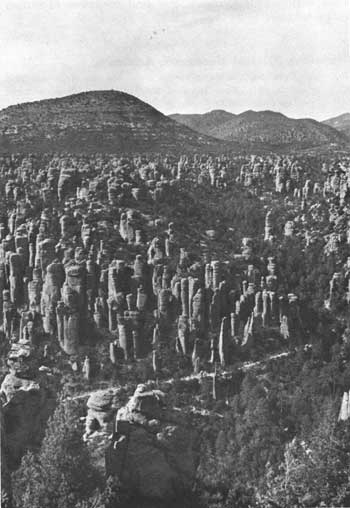
This national monument on the western flank of the Chiricahua Mountains is a 17-square-mile wonderland of pinnacles, ridges, canyons, and unique volcanic rock formations. The mountains, rising sharply from the dry grasslands of southeastern Arizona and southwestern New Mexico, are a verdant island of trees, plants, and wildlife in a sea of brown desert. Although primarily significant for its geological features, Chiricahua National Monument is located in an area that was the haunt of the Chiricahua Apaches and is also pertinent to the phases of history discussed in this volume.
The mountain ranges of the Southwest were the home of the nomadic Apaches and earlier men. Following the coming of the Spaniards to the Southwest in the 16th century, the Apaches moved into the Chiricahua Mountains and the Dragoon Mountains to the west and descended to plunder cattle, horses, and grain. Beginning in 1693 the Spaniards sent punitive expeditions into the mountains, but as the Spanish frontier receded and in 1821 passed into the possession of Mexico the Chiricahua Apaches felt less pressure.
 |
| Upper Rhyolite Canyon, Chiricahua National Monument. From haunts in the Chiricahua and Dragoon Mountains, the Chiricahuas lashed at the invaders of their homeland. (photo by H. Parent, National Park Service) |
After the U.S. acquisition of the Southwest in 1848, gold seekers, settlers, and troops became a new threat. The Chiricahuas, led by Cochise, Natchez, and Geronimo, courageously resisted until late in the 19th century. They clashed regularly with troops from Fort Bowie, about 15 miles to the northwest of the present national monument, and attacked wagon trains and stagecoaches passing through Apache Pass. Patrols from the fort fought many battles in the Chiricahua Mountains, near which the agency for the Chiricahua Reservation (1872-76) was situated at several different sites. But various bands of Chiricahuas escaped from the reservation and the White Mountain (Fort Apache) Reservation, some 125 miles north of Fort Bowie, to which the Chiricahuas were relocated in 1876. Often hiding in the Chiricahua Mountains, they terrorized settlers and eluded troops in Arizona, New Mexico, and Mexico until Geronimo's surrender in 1886 ended the Apache wars. "Big Foot" Massai, however, staged several one-man escapades in later years.
Exhibits at the monument headquarters, about a mile east of the entrance, interpret the natural history and history of the area. Cochise Head, Massai Point, and Massai Canyon immortalize the names of the Chiricahua Apache leaders. Massai Point Exhibit Building, at the far eastern side of the monument, presents geological exhibits. More than 15 miles of trail, many self-guiding, provide access by foot or horseback to unusual natural features.
 |
 |
http://www.cr.nps.gov/history/online_books/soldier-brave/sitea2.htm
Last Updated: 19-Aug-2005