

Survey of Historic Sites and Buildings
 |
NEZ PERCE NATIONAL HISTORICAL PARK Idaho |
 |
| ||
Situated in the ruggedly beautiful Nez Perce country, which encompasses 12,000 square miles of northern Idaho, this new and unique park allows today's traveler to see the land almost as Lewis and Clark described it well over a century and a half ago. Scene of many colorful and significant events in the history of the Rocky Mountain frontier, the park interprets the prehistory, history, and culture of the Nez Perce Indians, including their religion; missionary efforts among them; the Lewis and Clark Expedition; the invasion of fur traders, miners, and settlers; and the Nez Perce War (1877).
Meriwether Lewis and William Clark, on their westward journey in 1805, were the first white men to contact the hospitable Nez Perces. In 1811 they also aided a small group of Astorians, a section of the overland party, who passed through the area on their way to found a fur post near the mouth of the Columbia River. The next year, personnel from Fort Astoria established trade relations with the Nez Perces, and other American and British traders soon visited them.
In 1836 the Reverend and Mrs. Henry H. (Eliza) Spalding, the first U.S. missionaries to the Nez Perces, arrived. On Lapwai Creek they founded a sister mission to the Whitman (Waiilatpu) Mission. The latter had been established the same year among the Cayuse Indians, about 110 miles farther west, in present Washington, by their fellow American Board missionaries Marcus and Narcissa Whitman. Two years later the Spaldings moved their mission about 2 miles down the creek to its juncture with the Clearwater River.
The Spaldings made only limited progress in converting their charges to Christianity and persuading them to abandon nomadic hunting in favor of sedentary farming. Jeopardizing their efforts was Spaldings defensively critical attitude toward the other missionaries, especially the Whitmans. The personalities of the two men clashed, and Spalding's philosophy of missionary work resulted in arguments with his fellow workers.
Spalding nevertheless built the first white home, church, school, flour mill, sawmill, blacksmith shop, and loom in Idaho. In 1839 the mission received the first printing press in the Pacific Northwest, donated by American Board missionaries in Honolulu. This press, today in the museum of the Oregon Historical Society, printed the first books in the Nez Perce language, as well as one in the Spokan tongue. For this purpose, the missionaries devised phonetic renderings of the languages.
At the time of the massacre at the Whitman Mission, in November 1847, Spalding closed his mission and he and his wife moved to the Willamette Valley. In later years they returned to the Nez Perce country, where he taught school and preached until he died in 1874.
 |
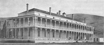
| Barracks at Fort Lapwai, Idaho. Date unknown. (National Archives) |
Despite the Cayuse animosity, relations between the Americans and the Nez Perces remained good until the 1860's, when miners and settlers poured into their ancestral homeland of north-central Idaho, northeastern Oregon, and southeastern Washington. In 1863 most of them reluctantly agreed to a major reduction in their reservation, to north-central Idaho. But for years several bands, known as the nontreaty Nez Perces, lived outside the reservation and resisted Army and Indian Bureau attempts to confine them with their acquiescent brethren. In 1876 a committee appointed by the Secretary of the Interior met with representatives of the two factions at the Lapwai Agency, Idaho, and later recommended to the Government the use of force if necessary to move the recalcitrants onto the reservation. Finally, under duress, in 1877 they began to migrate there. En route in June a few revengeful warriors murdered some settlers along the Salmon River south of the reservation. Brig. Gen. Oliver O. Howard, in charge of the relocation, sent two companies of cavalry under Capt. David Perry, from Fort Lapwai, Idaho, to restore order.
The warriors who had committed the murders belonged to a group camped on Camas Prairie, who subsequently moved to White Bird Canyon. As the troops rode down the canyon on June 17 toward the camp, about 60 or 70 of the Indians took cover at a point between the camp and the approaching soldiers, and the Battle of White Bird Canyon broke out. Assaulted vigorously on the flanks, Perry's men retreated in disorder up the canyon. Thirty-four of them died, but not a single one of their opponents. The victory here proved to be the Indians' undoing, for it emboldened them to follow a course of defiance that eventually resulted in the destruction of their power. A series of skirmishes ensued between troopers and various Nez Perce bands that culminated in the Battle of the Clearwater, on July 11-12.
That battle was indecisive, but it marked the beginning of an epic fighting retreat by the Indians in an effort to find a haven in Montana or, as they knew Sitting Bull had done, in Canada. The episode is one of the more dramatic in the long struggle of the U.S. Government to force the Indians off lands coveted by white settlers and confine them to ever-diminishing reservations.
The leaders of the march were Chief Joseph, later the statesman-diplomat of his people; Frog (Ollokot), his brother; Chief White Bird; Chief Looking Glass; Chief Sound (Toohoolhoolzote); and Chief Rainbow. They guided 700 people with their possessions, transported by thousands of horses, across the Bitterroot Mountains over the Lolo Trail, the route of their past annual treks to the buffalo range in Montana. In 2-1/2 months they were to travel 1,700 miles, trying to avoid conflict whenever possible, either dodging or fending off the 2,000 troops trying to catch them. Although impeded by many women and children, they evaded General Howard's pursuing party of cavalry and hopelessly outdistanced his slow-moving infantry and artillery. Once across the trail, the Indians headed southward and then slightly eastward. Losing men and resources at the Battle of the Big Hole, Mont., they passed through Yellowstone National Park and turned northward but met disaster at the Battle of Bear Paw Mountains, Mont., in the fall of 1877.
During the campaign about 120 Indians had died and 88 had been wounded. They killed about 180 whites and wounded 150. Confined at Fort Leavenworth, Kans., between November 1877 and July 1878 and enduring much suffering because of the abysmal conditions, the Nez Perces were then exiled to a reservation in Indian Territory and not allowed to return to the Pacific Northwest until 1885.
Nez Perce National Historical Park, authorized by Congress in 1965 and in the initial phase of development when this volume went to press, represents a new concept in a national park. It is a joint venture of the National Park Service, other governmental agencies, the State of Idaho, the Nez Perce Tribal Executive Committee, private organizations, and individuals. Of the 24 sites involved, 20 will remain in the hands of their present owners or under a protective scenic easement. Folders available to visitors at National Park Service units give exact locations of all sites and routing information.
 |
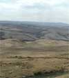
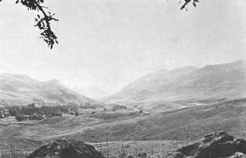
| Part of White Bird Canyon Battlefield, Idaho. View from Volunteers Knoll toward the mouth of White Bird Creek. (National Park Service) |
The National Park Service administers four major sites: Spalding, East Kamiah, White Bird Battlefield, and Canoe Camp. At Spalding are a Nez Perce campsite of archeological significance; the remains of the Spalding (Lapwai) Mission (1838-47), consisting of traces of the millrace and ruins of two chimneys; site of the original Lapwai Indian Agency (1855-84) for the Nez Perces; a Nez Perce cemetery, where a large tombstone marks the graves of Henry and Eliza Spalding; and Watson's Store, a typical general store of the 1910-15 period that served the Nez Perces until only a few years ago. Extensive archeological excavation is planned at Spalding.
In 1992 an additional 14 sites were added in the adjoining states of Oregon, Washington, and Montana. The 38 sites of Nez Perce National Historical Park have been designated to commemorate the stories and history of the Nimiipuu (Nez Perce) and their interaction with explorers, fur traders, missionaries, soldiers, settlers, gold miners, and farmers who moved through or into the area.
A prominent feature at East Kamiah is the "Heart of the Monster," a rocky hump protruding from the level valley to a height of 50 to 60 feet that figures strongly in Nez Perce mythology. Also situated at East Kamiah is the McBeth House, a small framehouse that was the residence of missionaries Susan and Kate McBeth in the 1870's. White Bird Battlefield was the site of the first battle of the Nez Perce War, on June 17, 1877. Canoe Camp, a 3-acre roadside park along the bank of the Clearwater River, was the location of a Lewis and Clark campsite in 1805.
Many of the 20 sites (expanded to 38 sites in 1992) among the non-Park Service group are related to the phases of history treated in this volume. Fort Lapwai, the Army's major post in Nez Perce country, was founded by Volunteers in 1862 about 3 miles south of the Clearwater River in the Lapwai Valley. The post prevented clashes between Indians and whites on the Nez Perce Reservation, and played a prominent role in the Nez Perce War. Made a subpost of Fort Walla Walla. Wash., in 1884, Fort Lapwai was abandoned the following year and became the headquarters of the Nez Perce Indian Agency. In recent years this agency was replaced by the Northern Idaho Indian Agency, which serves all the northern Idaho tribes. The parade ground may still be seen, as well as a frame officers' quarters on its southwestern corner, now used by the Indian agency staff, and the stables.
Two natural formations east of Lewiston, Coyote's Fishnet and Ant and Yellow Jacket, are associated with Nez Perce legend and mythology. Weippe Prairie, a National Historic Landmark because of its relationship with the Lewis and Clark Expedition, was a favorite place for the Nez Perces to gather camas roots, an important part of their food supply. At this place Lewis and Clark, descending the Bitterroots in 1805, first encountered the tribe.
At the site of the city of Pierce, a prospecting party headed by E. D. Pierce made the first significant gold discovery in Idaho in 1860. The ensuing gold rush brought thousands of miners and settlers onto Nez Perce lands and within 3 years resulted in the creation of Idaho Territory. Two engagements of the Nez Perce War are commemorated at other cooperative park units; the site of the Cottonwood Skirmishes and Clearwater Battlefield. On the steep bluffs overlooking the Clearwater River are remains of stone breastworks used by Indians and soldiers during the Battle of the Clearwater. Also associated with the Nez Perce War and Nez Perce culture is Camas Prairie, a plateau-valley in the heart of the Nez Perce country, indicated by a highway marker. Once a sea of blue-flowered camas and grass, it was the place where the warriors who murdered the settlers on the Salmon River were camped with their group before it moved to White Bird Canyon.
The Lolo Trail, Idaho-Montana, a National Historic Landmark described separately in this volume, was the traditional route of the Nez Perces across the Bitterroot Mountains to their buffalo hunting grounds in Montana and the avenue of the non-treaty faction of the tribe in 1877. It was also the westward and eastward route of Lewis and Clark in 1805 and 1806. Some other sites in the park area, much of which is located within the boundaries of the historic Nez Perce Indian Reservation, are associated with missionary activities among the tribe.
 |
 |
http://www.cr.nps.gov/history/online_books/soldier-brave/sitea12.htm
Last Updated: 19-Aug-2005