.gif)
Historic Roads in the National Park System
MENU
Understanding and Managing Historic Park Roads
|
Historic Roads in the National Park System
|

|
|
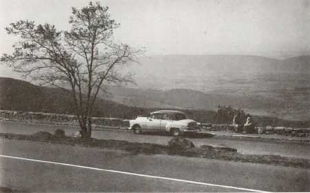
| Fig. 22. Scenic overlooks like this one at Stony Man were characteristic of Skyline Drive at Shenandoah. The stonework of the guardrail and curbing blended well with the boulders and native tree placed in a naturlistic fasion in the grassy island separating the road from the turnout. Of paramount importance along Skyline Drive were the vistas. (National Archives, Record Group 30) |
|
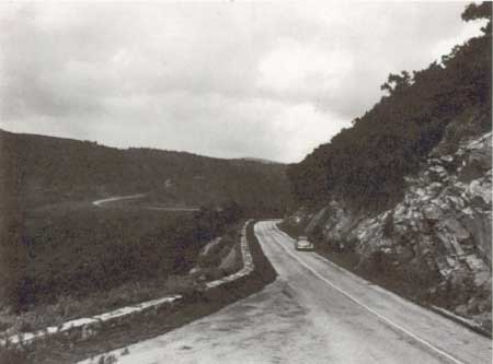
| Fig. 23. The overall layout of a road on the land, the way in which it followed the topography, the native stone guardrail, and the variations between bedrock, thick forest vegetation, and open meadow land provided a variety of natural features that contributed to the park experience along the road. This was Skyline Drive near Bacon Hollow in the early 1950s. (National Archives, Record Group 30) |

|
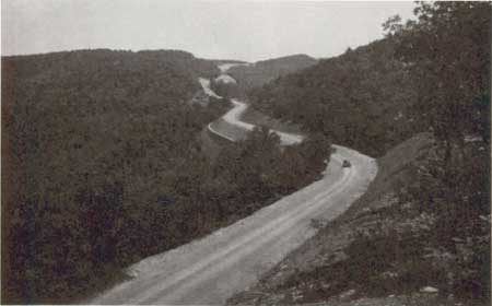
| Fig. 24. The entrance road at Carlsbad Caverns gently wound up the edge of the desrt mesa to the cavern entrance above. (National Archives, Record Group 79, Photo by Boles) |
|
| Fig. 25. Cut-and-fill and flat-fill slope operations were sometimes necessary to provide a more even path for the roadway along a slope or mountain edge. This was Skyline Drive at Shenandoah when it was under construction. (National Archives, Record Group 30) |
|
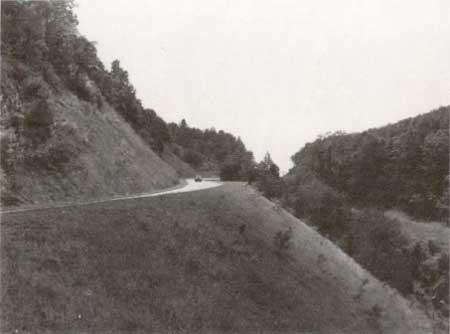
| Fig. 26. Sometimes placing the road so it traversed a mountain slope required disturbing a large amount of land. The finished slopes, however, were naturalized with native vegetation to minimize the impact of construction. The photograph was taken at Great Smoky Mountains National Park. (National Archives, Record Group 30) |
NEXT >>>
 Top
Top
Last Modified: Mon, Aug 23 2004 10:00:00 pm PDT
http://www.cr.nps.gov/history/online_books/harrison2/shsi1.htm
![]()