PU'UHONUA O HONAUNAU NHP
A Cultural History of Three Traditional Hawaiian Sites
on the West Coast of Hawai'i Island

|
PU'UKOHOLA HEIAU NHS • KALOKO-HONOKOHAU NHP • PU'UHONUA O HONAUNAU NHP A Cultural History of Three Traditional Hawaiian Sites on the West Coast of Hawai'i Island |
|
|
Site Histories, Resource Descriptions, and Management Recommendations |
CHAPTER IX:
PU'UHONUA O HONAUNAU NATIONAL HISTORICAL PARK (continued)
F. Description of Resources: South Keokea
1. Outskirts of Ki'ilae Village
After mounting the Alahaka ramp, Emory passed back of Pukakio Point and Hinalea Cove and headed through the outskirts of Ki'ilae Village. The village site stretches southward from the Alahaka horse ramp on the 1871 trail in the south Keokea ahupua'a, along the cliffs through Ki'ilae ahupua'a, to the park boundary and beyond. Emory's account of his findings will be presented later, but first this report will provide some background material on the settlement.
 |
| Illustration 196. Concrete tomb at Ahu homestead along the path to Ki'ilae Village. NPS photo, 1989. |
2. Ki'ilae Village
a) Research Accomplished and Types of Remains
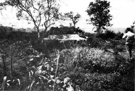
Numerous abandoned Hawaiian village sites can be found in the remote coastal areas of the Hawaiian Islands. Ki'ilae Village was one of the last isolated coastal villages where a few Hawaiian families chose to live a more traditional way of life rather than try to adjust to Western ways. After Emory's work, study concentrating on the village began with Russell A. Apple's interviews of former residents in 1963 and 1964 and continued with NPS archeological excavations by Edmund Ladd. Research and interviews conducted in 1965 by Historian Frances Jackson under contract with the NPS resulted in an oral history of Ki'ilae Village and life there. Ladd completed archeological maps of the village in 1968 that show all the major walls and stone structures.
Today the village site comprises a multitude of house lots, a few on the makai side of the "main street" 1871 trail and a vast number northeast of this on the mauka side of the trail. Remains consist of stone walls, house platforms, graves, animal pens, and other structures and features.
 |
|
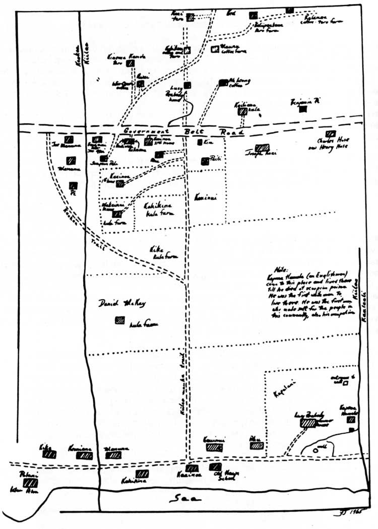
Illustration 197. Map of Ki'ilae ahupua'a. From
Jackson, "Ki'ilae Village, following p. 73. (click on image for an enlargement in a new window) |
 |
|
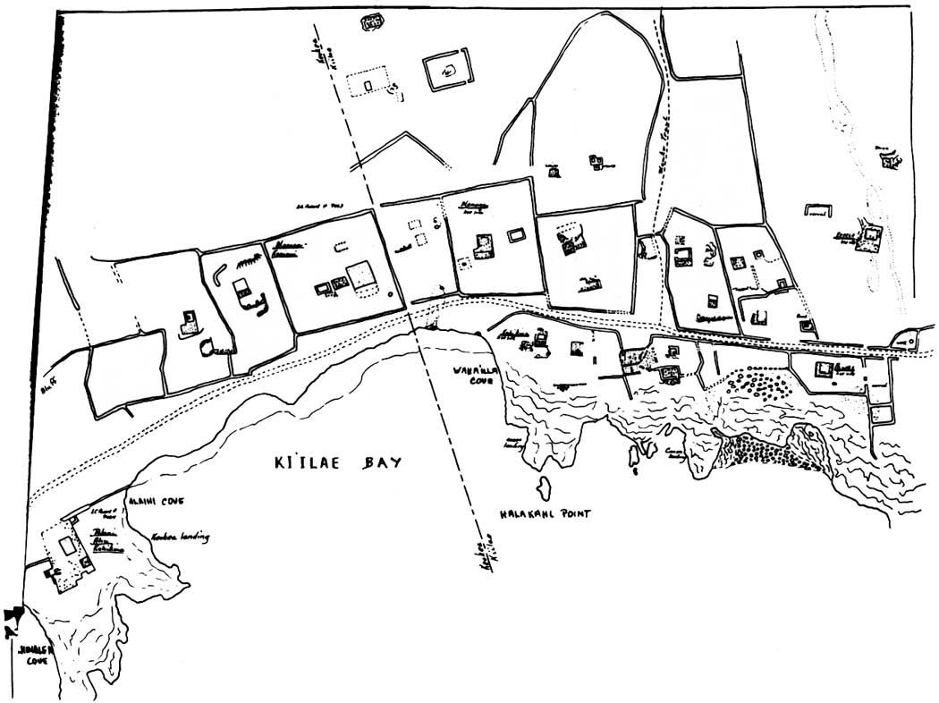
Illustration 198. Map of sites in Ki'ilae Village. From
Jackson, "Ki'ilae Village," following title page. (click on image for an enlargement in a new window) |
b) Anchorages
This village is located in the coastal section of two ahupua'a along the edge of Ki'ilae Bay. Some of the village is in south Kkea, but more is contained in Ki'ilae. Ki'ilae Bay is one of three anchorages in the area and the best developed. Alaihi Cove in Ki'ilae Bay is deep and sheltered. At its northern end a lava ledge somewhat protected a landing area equipped with a ramp and rollers. Canoes were stored on a flat on the south side of the point. The bay was deep enough for small steamers and whalers to use. The steamers landed there to unload lumber and other goods in exchange for salt and hides. Most of the year the natural rock shelf along the edge of the cove could be used to load and unload passengers and freight. [227] The missionary Cochran Forbes described the event of landing there in 1836:
After taking some refreshment we left for Honaunau, and on our way stopped at Kilae which, as many other villages, is perched upon high rocks almost inaccessible from the sea unless when smooth. In attempting to spring on the rocks, I unhappily stepped just as a surf raised the canoe some four or five feet from its position and of course missed my calculation, when having to descend instead of stepping up, I fell prostrate on the rocks and should have rolled into the sea had not one of the natives caught me & supported me till I recovered enough to sit erect. The shock was so great as to quite deprive me of all power for a time tho' no bones were broken. [228]
Other canoe landings existed on either side of Halakahi Point and at Popa'a Cove. These are not known to have had ramps or rollers and were probably used only by small fishing canoes. [229]
c) Early History
Kamehameha gave the ahupua'a of Ki'ilae to John Young as a reward for his faithful service. After his death, his children and those of Isaac Young, whom he had adopted after their father's death, shared in the distribution of his various properties. In 1848, when land ownership was being registered during the Great Mahele, the Privy Council approved the Ki'ilae lands passing to Davis's son, George Hueu. [230] He lived primarily at Waimea, but remained the taxable owner of Ki'ilae at least until 1893. By 1902 Lucy Peabody, the granddaughter of George Hueu Davis and the High Chiefess Kaha'anapilo, was listed as land owner with the notation that the ahupua'a had been let to the Ki'ilae Land Co. In 1905 Peabody was still listed as owner, having an agent, Edgar Henriques, with offices in Honolulu. Peabody died in 1929. No kuleana awards were registered for the house lots in Ki'ilae ahupua'a that were part of the village, although a few are listed for Ki'ilae villagers in Keokea ahupua'a. Most of the people in the village were squatters, but evidently established some sort of tax arrangement with Peabody until her death. [231]
It is unclear when the village first began, because it is not mentioned in legends, chants, or oral history and appears infrequently in historical records. This would have been, in many respects, a good place to live in early Hawai'i. Within easy access were the fishing grounds of the ocean, while fields mauka could be reached for procurement of supplemental food items. Water was not a major problem, with brackish wells located nearby and potable water available from the uplands. The village was also within reasonable walking distance of the large religious and cultural center of Honaunau. It is not unreasonable to assume that the area was inhabited from early times.
d) Later History
No frame houses had been built in Ki'ilae or Keokea by 1889. According to the 1890 tax records, Ki'ilae and Kauleoli ahupua'a immediately to its south supported eight landowners between them. Livestock consisted of cattle, horses, donkeys, and dogs. The land was used for pasture and as house lots. A year later the first Japanese resident was listed; Chinese had been present since 1871. By 1892 John H. Ahu paid taxes on land and some type of store. The village only had one other house that was taxed. [232] Keokea had more crops, some animals, and several taxable houses. [233] The Ahus had become the major taxpayers in Ki'ilae by 1896, owning several houses and assorted livestock. Nine other Hawaiians and five Chinese were also taxpayers in Ki'ilae. Keokea showed the wealth distributed more widely. [234] During the last two years of the century, Ki'ilae had seventeen taxable residents, including eight Chinese and two Japanese. Keokea contained a larger number of Orientals, listing several as "tramps." By 1906 depopulation of the coast had occurred, with only three taxable persons living in Ki'ilae and few in Keokea. [235]
Former residents of the area provided Frances Jackson with miscellaneous information on life in Ki'ilae Village and surrounding areas. By the turn of this century, about one hundred people lived in Ki'ilae Village, comprising ten extended families. Kealia ahupua'a to the south had the highest coastal population at this time; the landowner of Keokea ahupua'a to the north, the Bishop Estate, meanwhile, had permitted people to build shacks on the beach there. A great change occurred in the area between 1890 and 1900 with the construction of houses of ohi'a wood, measuring about twenty-two feet square. A mauka-makai trail system served Ki'ilae, connecting the upland agricultural area of the ahupua'a with the coastal village. The cross trails in Ki'ilae, located at several levels to connect various houses in the kula gardens, were later bulldozed during McCandless Ranch activities mauka of Ki'ilae. Both economic and decorative plants grew in the village. [236] Its paths remained fairly clear of vegetation due to constant use and animal grazing, except for low lantana and some kia we. These trails have since become overgrown with a thick vegetative cover.
 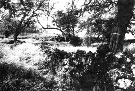 |
| Illustrations 199 and 200. Walls at site of Ki'ilae Village. NPS photo, 1989. |
| <<< Previous | <<< Contents >>> | Next >>> |