PU'UHONUA O HONAUNAU NHP
A Cultural History of Three Traditional Hawaiian Sites
on the West Coast of Hawai'i Island

|
PU'UKOHOLA HEIAU NHS • KALOKO-HONOKOHAU NHP • PU'UHONUA O HONAUNAU NHP A Cultural History of Three Traditional Hawaiian Sites on the West Coast of Hawai'i Island |
|
|
Site Histories, Resource Descriptions, and Management Recommendations |
CHAPTER IX:
PU'UHONUA O HONAUNAU NATIONAL HISTORICAL PARK (continued)
F. Description of Resources: Pu'uhonua Area
1. Palace Grounds
The royal palace grounds are located in the vicinity of Keone'ele Cove, inland from the pu'uhonua. Once filled with numerous grass huts, the area still contains evidence of chiefly occupation, including He-lei-palala pond, fed by underground springs, which held fish for royal consumption, and a papamu stone for playing konane, a game similar to checkers. This constituted a sacred area in ancient times and commoners could not walk across it or even cast their shadows upon it without risking death. Keone'ele Cove was the spot for landing royal canoes and was kapu to commoners. The royal residential area was separated from the refuge by the eastern segment of the Great Wall. Another tongue of lava, called Ka-ule-lewalewa, adjacent to Keone'ele Cove on the west, shows a line of four vertical holes along its eastern border. These were probably for a row of images that acted as guardian sentinels for the mausoleum. [67] (The palace grounds and other features noted within the pu'uhonua may be seen on Map 1.)
A local informant in 1919 provided information that the royal precincts comprised Lots 18-20 and part of 22 (see Podmore 1918-19 map). The house platform on Lot 19 at the edge of the bay was the site of part of King Keawe's "palace" (Kauwalamalie), probably the reception hall, with living quarters nearby. Two other house platforms were found at that time, in Lots 18 and 20. The former held a grass house in 1888 and on the latter in 1919 stood an old wooden house inhabited by the caretaker of the grounds. The informant stated that this house of Keawe's was the site of the 'awa party at which Kamehameha broke relations with Kiwala'o. (Kamehameha had arrived in Honaunau to mourn and pay respects to his dead uncle Kaiani'opu'u and to perform the 'awa ceremony for his cousin Kiwala'o to purify him from contamination caused by association with the corpse.) Lots 20 and 22 contain the royal fishponds. Between 1860 and 1870 (probably ca. 1867), Lot 18 was the site of a cocoanut "planting bee" and luau held by Bernice P. Bishop, as chiefess of the land. (Stokes believed this was not just an ordinary planting of a coconut grove, but involved the ceremonial taking possession of the land by the new owner.) At that time the lot was the village gathering place. The enclosing walls on Lots 18-20 were modern (within the previous seventy years). However, this informant did mention an ancient boundary line there that was regarded as very sacred; any commoner whose shadow fell on it was killed. Stokes found many holes in the solid pahoehoe that might have supported kapu sticks. [68] (As late as 1919 people in the Honaunau area could remember being told that while the kapu system was in effect, the common people had to detour around the royal precinct, passing along the shore in the morning and around back of the village in the afternoon hours to insure that their shadows did not fall upon that sacred ground.) [69] According to this same 1919 informant, a building on Lot 19 in this area served as a school ca. 1830. The structure had a framework of ohia logs bound together with coconut rope and was covered with ti leaves. [70]
The National Park Service removed several early stone walls from the royal compound area in 1963.
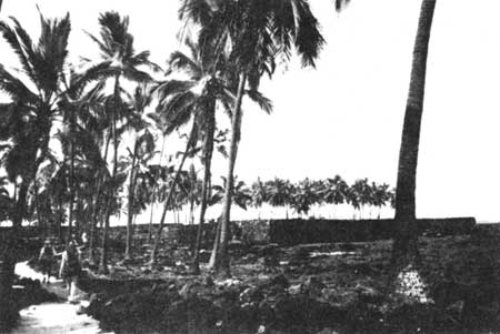 |
| Illustration 163. Refuge area enclosed by Great Wall. NPS photo, 1989. |
 |
| Illustration 164. Cross-section of Great Wall showing pao construction (three tiers bridging space between outer and inner walls). Figure 3.18 in Stokes, "Archaeological Features of the Pu'uhonua Area," p. 70. |
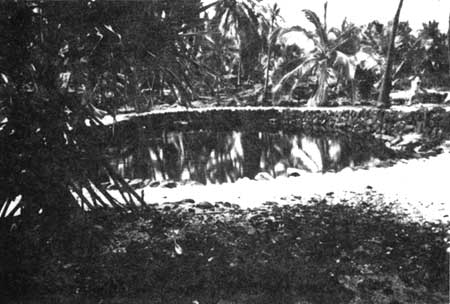 |
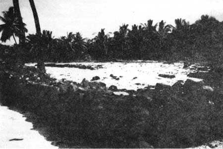
| Illustration 165. Fishpond in Palace Grounds. NPS photo, 1989. |
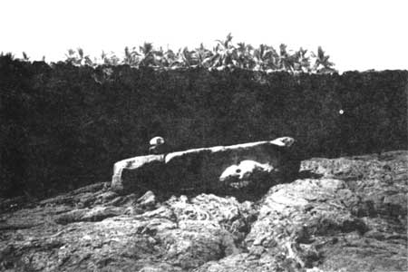 |
| Illustration 166. Keoua Stone. NPS photo, 1989. |
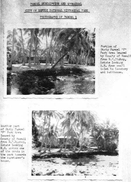 |
| Illustration 167. Old lavatory, bathhouse, and caretaker's house at Pu'uhonua o Honaunau. Part of area taken by Territory of Hawai'i for U.S. Government to preserve as City of Refuge. From Devine et al., Appraisal Report, p. 17. |
 |
| Illustration 168. Corner of Great Wall, looking into refuge area. NPS photo, 1989. |
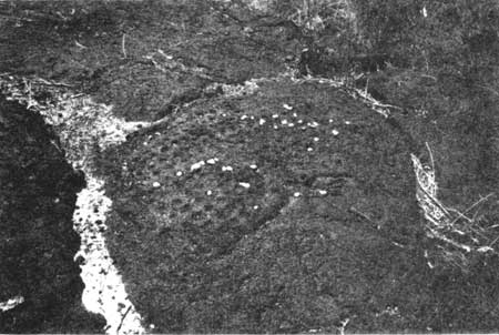 |
| Illustration 169. Konane board in refuge. NPS photo, 1989. |
| <<< Previous | <<< Contents >>> | Next >>> |