PU'UHONUA O HONAUNAU NHP
A Cultural History of Three Traditional Hawaiian Sites
on the West Coast of Hawai'i Island

|
PU'UKOHOLA HEIAU NHS • KALOKO-HONOKOHAU NHP • PU'UHONUA O HONAUNAU NHP A Cultural History of Three Traditional Hawaiian Sites on the West Coast of Hawai'i Island |
|
|
Site Histories, Resource Descriptions, and Management Recommendations |
CHAPTER VII:
PU'UKOHOLA HEIAU NATIONAL HISTORIC SITE (continued)
J. John Young Homestead
1. Lands Given to John Young by Kamehameha
John Young received properties from Kamehameha in accordance with the ancient custom of a victorious chief distributing conquered lands among his loyal supporters for services rendered. [163] After the battle of Nu'uanu on Oahu, further land distributions were made, including the ahupua'a of Kawaihae 2 (East Kawaihae) to Young. Sometime prior to 1827, a segment of Kawaihae 1 was included in Young's property in recompense for the murder of one of his men by an agent of the king. [164] The lands given to prominent early foreigners such as Young, Davis, and Don Francisco de Paula Marin were generally acknowledged to belong to them in as full and legal a sense as the king's land belonged to him. [165] In the early 1820s the Reverend Tyerman noted that "Mr. Young occupies so much land that his contribution [taxes to the king for use rights of the land] amounts to a hundred dogs per annum." [166]
Young's Hawai'i Island property included three estates at Waiakea in the Hilo district and one in Puna district. These properties were scattered, as were those given to other high chiefs, as Kamehameha sought to impede the possible consolidation of a rival's resources. In addition to having a residence in the area of Kamehameha's court at Kealakekua Bay for his use when conducting business there, Young established a permanent residence on his plantation at Kawaihae. At the time of his death, Young possessed twenty-nine estates on Hawai'i Island, five on Maui, one each on Lana'i and Moloka'i, and two on O'ahu. His possession and use of these lands continued to be endorsed by succeeding rulers after Kamehameha's death, with more formal legal recognition of the family's interest in these lands resulting finally from the Mahele of 1848. Although Young had died by the time of that land division, his property was awarded to his wife and children, including the children of Isaac Davis that he had adopted. According to Apple, "Young's service to Kamehameha was considered to be so great that Young's heirs did not have to pay commutation for their mahele awards." [167]
 |
|
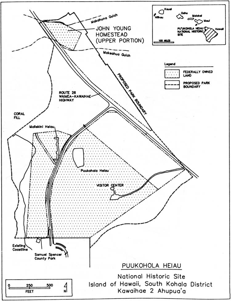
Illustration 61. Location map of John Young homestead
(upper portion). Figure 1 in Rosendahl and Carter, Excavations at
John Young's Homestead, p. 2. (click on image for an enlargement in a new window) |
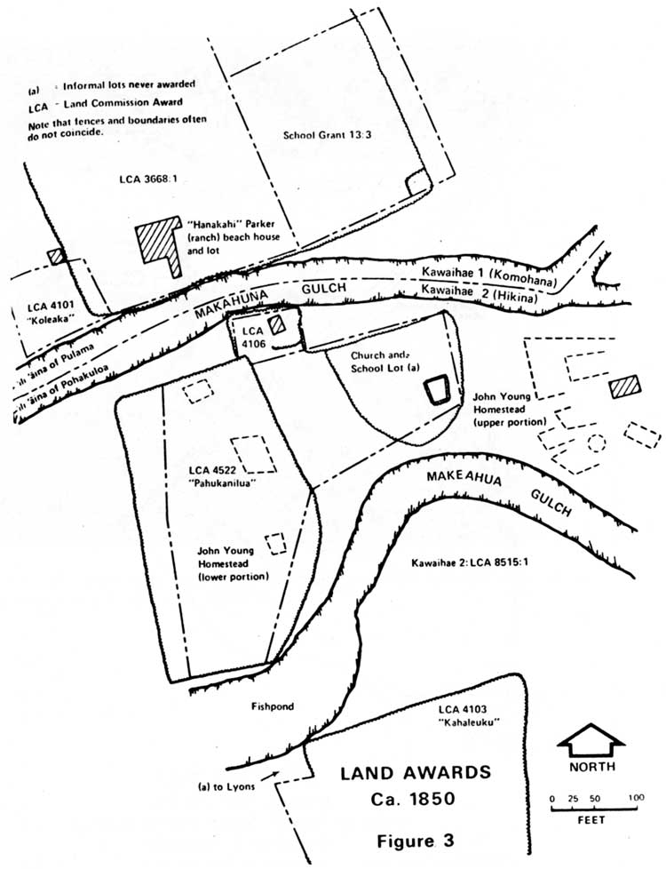
2. Kawaihae Land Divisions
One of the ahupua'a Kamehameha gave his prime minister Kalanimoku, who has been mentioned previously in connection with the early history of Kawaihae, was that known as Kawaihae Komohana now referred to as Kawaihae l. This became Kalanimoku's principal residence and he its resident chief. Upon his death in 1827, the throne reclaimed his property, which became a part of the crown lands. The Young family homestead was Kawaihae Hikina (Kawaihae 2), containing Pu'ukohola Heiau. [168]
The boundary between Kawaihae Komohana and Kawaihae Hikina underwent various changes. When these lands were first awarded to Kalanimoku and John Young, both were good friends and both in the service of Kamehameha. At that time the boundary between the two properties lay along Makahuna Gulch, which carried a considerable amount of water. At some time during this period, a staff chief under Kalanimoku murdered a staff chief loyal to Young. As compensation, Kalanimoku suggested moving the boundary to add a considerable portion of his land to that of Young. Accordingly the boundary moved north to Kauhuhu Gulch, also a flowing stream most of the time. By the 1870s, however, the functional local boundary had reverted to the traditional one of Makahuna Gulch. Older residents who cared having died, and memories of the earlier agreement having faded, the boundary was formally changed back to Makahuna Gulch in 1903. [169]
 |
|
Illustration 62. Land awards in area of John Young
homestead, ca. 1850. Figure 3 in Apple, Pahukanilua, p.
13. (click on image for an enlargement in a new window) |
| <<< Previous | <<< Contents >>> | Next >>> |