
|
Washington Department of Natural Resources Geology and Earth Resources Division Bulletin No. 72 Washington Coastal Geology between the Hoh and Quillayute Rivers |
PART II
GEOLOGIC OBSERVATIONS AND INTERPRETATIONS ALONG THE COAST
(continued)
GOODMAN CREEK AREA
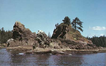
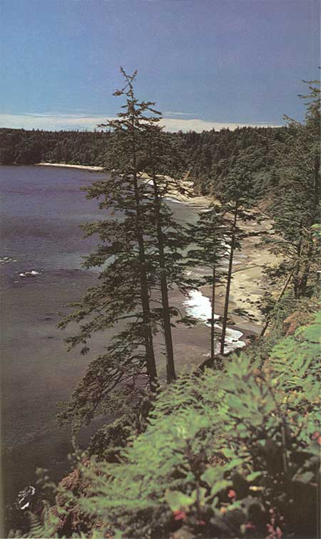
From Goodman Creek northward for a mile, large outcrops of conglomerate and sandstone form inaccessible sea cliffs some 200 feet in height (fig. 35). A major fault trending northeastward, generally up the Goodman Creek valley, separates these rocks from the melange rocks to the south (fig. 25). Conglomerate and sandstone are also well exposed along the stream course for a short distance inland from the mouth of Goodman Creek (fig. 34) and also form the small offshore rocks and islands at the mouth of this stream (fig. 42). Furthermore, these rock strata trend or strike generally north-northwestward and have been mapped in an inland area northward to the Bogachiel River.
|
| PICTURESQUE ROCKS of Hoh sandstone and conglomerate off the mouth of Goodman Creek (fig. 42). |
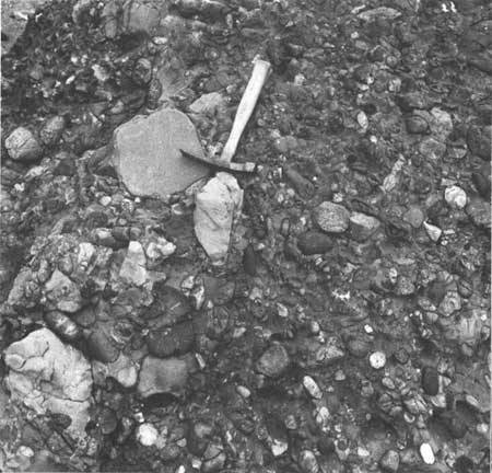
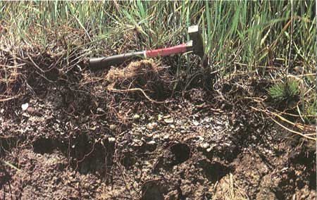
The conglomerates are composed of fairly well-rounded pebbles and cobbles of various rock types including several kinds of igneous rocks, mainly dark-colored basalt and the more crystal line lighter colored, granite-like diorite, together with fragments of white tuff or volcanic ash (fig. 44). Sedimentary rock pebbles are also present including sandstone, siltstone, and limestone nodules. All stones are set in a matrix of fine- to medium-grain sandstone.
|
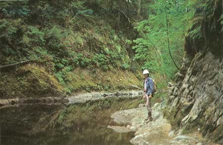
| GOODMAN CREEK GORGE, some 3 miles inland, has been carved in massive sandstone of the Hoh sedimentary rock sequence (fig. 43). |
|
| CONGLOMERATE that forms the cliffs north of Goodman Creek (fig. 35) is composed of rounded pebbles and boulders set in a matrix of sandstone. These materials have been cemented together by secondary minerals to form a solid rock mass. The pebbles are of various rock types including dark colored basalt, light-colored crystalline granitics, sandstone, calcareous siltstone, and fragments of white volcanic ash (fig. 44). |
Bedrock outcrops are not particularly abundant upstream from the trail crossing, but the few that are present, for a distance of 3 miles, consist largely of melange rocks, similar to those exposed along the coast to the south. Upstream beyond the logging bridge some 3 miles inland, bedrock outcrops are more frequent. Outstanding exposures of massive fractured and recemented sandstone form a very picturesque moss-covered gorge about a mile up the main stream from the bridge and half a mile beyond the confluence of Minter Creek (fig. 43). Other excellent outcrops of Hoh rocks are exposed in Minter Creek, particularly in an area 1-1/2 miles upstream from Goodman Creek. In a distance of 1 mile the stream in this area flows over several thousand feet of steeply upturned rock strata known as the Minter Creek section. These strata can be traced at least 4 miles to the east and for several miles to the north where they cross the main branch of Goodman Creek. They delineate a large steeply plunging SYNCLINE (downfold). The structural configuration is manifested not only on the geologic map (fig. 25) but the upturned beds of resistant conglomerate and sandstone form a pronounced curved ridge that can be traced on a topographic map as well.
In relatively recent geologic times immediately following the last advance of valley glaciers and during the late part of the Pleistocene Epoch (fig. 1), the floor of Goodman Creek valley stood 100 feet or so higher than it does today. It had been filled during a previous advance and retreat of the glaciers with sand and gravel outwash materials that were carried by melt waters from glaciers. The elevation of the floor of Goodman Creek at that time corresponded approximately with the very apparent flat surface on Alexander Island of today. Since that time the stream has cut downward through this debris either because base level for this stream has been lowered or because the distance to the sea has been shortened by the eastward migration of the coast, thus increasing the stream's rate of flow as well as its eroding power. Remnants of the old higher valley floor level, as well as intermittent levels, are preserved along the present valley and form elevated nearly flat terrace areas. Today, only in places such as the mouth of Goodman Creek (fig. 34), the gorge 4 miles upstream, and occasionally in the sharp river bends has the stream completely cut through the overlying sand and gravel to expose the older Hoh bedrock. In the gorge, bedrock is relatively high and the stream in its downward cutting process reached bedrock relatively soon after the close of the Pleistocene Epoch (fig. 43). Therefore, the stream in this area has had a longer period of time to cut deeply into the bedrock.
HIKING INFORMATION
TOLEAK POINT TO THIRD BEACH
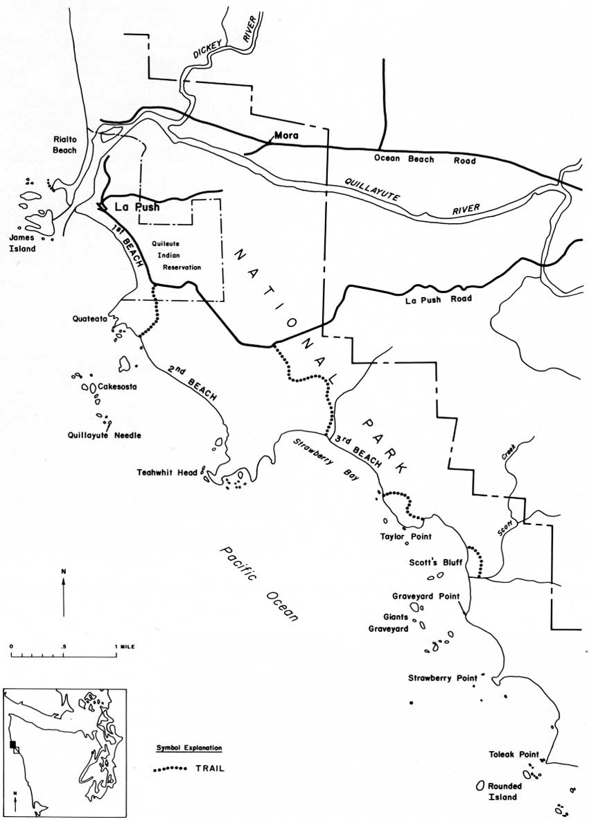
Open beaches, mostly with hard packed sand at low tide or loose dry sand and gravel at high tide, lie northward of Toleak Point for 11-1/2 miles to Graveyard Point (fig. 45). Several small headlands in this area cannot be rounded during high tides, but if necessary, can be easily climbed over. Once past these headlands, Scott Creek Shelter lies a short distance to the north. Scott's Bluff, immediately north of Scott Creek, restricts beach passage to times of low tide only. However, a trail is available inland around this point, from Scott Creek. Another very small rock point 100 yards south of the beginning of the trail over Taylor Point is also impassable at high tide but is no problem on medium or low tides. A short but steep route behind this point can be climbed.
|
| ROUTE MAP—Toleak Point to La Push (fig. 45). (click on image for an enlargement in a new window) |
For a mile the beach at Taylor Point is impassable during all times. Nearly vertical cliffs extend over 150 feet in height above the sea. The well-traveled inland trail rises steeply from the beach. At an elevation of approximately 175 feet above the sea, the trail is relatively level and provides a pleasant walk through the woods for half a mile. Then it descends to cross a major stream valley. Once out of this valley on the north side, the trail passes close to the cliff above the beach, thus an excellent view to the north and west is available from some 200 feet above the sea (fig. 46). The trail descends northward through the woods and then steeply over an open area to sea level at the south end of Third Beach.
|
| THIRD BEACH, viewed from the top of Taylor Point, is underlain by a major zone of Hoh melange rocks (fig. 46). |
HISTORICAL NOTES
TOLEAK POINT-SCOTT CREEK AREA
Toleak Point, an anglicized Indian name meaning Hole in the Rock Place (Powell, Penn, and others, 1972), is one of the few remaining sites along this part of the coast where evidence of native inhabitants of the past is still apparent. Kitchen middens (concentrations of shell material left by the Indians) erode from the low-lying bluff above the elevated wave-cut bedrock surface (fig. 47). Until the early 1900's two small buildings stood on this surface and Indians were known to bring their canoes through the offshore rocks to land at this point (Davidson, 1889).
|
| KITCHEN MIDDENS, eroding from the terrace surface at Toleak Point, are evidence of native inhabitants of the past (fig. 47). |
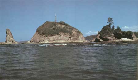
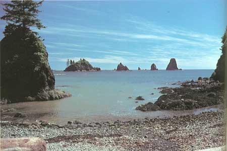
Numerous islets and rocks lie off Toleak Point (fig. 48). Rounded Island, the largest and farthest out, is due west of Toleak Point. The intriguing cluster of rocks lying offshore between Strawberry Point and Taylor Point are known as the Giants Graveyard (fig. 49). Although picturesque, it takes very little imagination to visualize how treacherous these rocks would be to a troubled sailing vessel. At least one Spanish ship is believed to have been wrecked in this immediate vicinity, probably in the late 1700's.
|
| BLOCKS OF MASSIVE SANDSTONE form the many islets and rocks off Toleak Point (fig. 48). |
|
| THE GIANTS GRAVEYARD, viewed from the beach just south of Taylor Point. This group is among the many offshore rocks that extend from Toleak Point to Taylor Point (fig. 49). |
In the more recent past this seemingly isolated coastline was more populated than it is today by natives and early settlers, particularly during the latter part of the 1800's. Homesteading brought many people to the Olympic coastal area. Among them was an H. Scott who established his home at the mouth of Scott Creek. Others took up even more remote claims nearby where they made clearings and built modest homes. Evidence of their struggle with nature may be found in the surrounding wooded inland areas. During World War II, Toleak Point was patrolled by a small group of men with dogs.
| <<< Previous | <<< Contents >>> | Next >>> |
state/wa/1980-72/sec2-5.htm
Last Updated: 28-Mar-2006