|
Challenge of the Big Trees
|

|
|
Chapter One: The Natural World of the Southern Sierra (continued)
Why the structure of the Sierra varies so distinctly at its southern end is not entirely obvious. A study of the surface rocks alone certainly does not disclose a clear answer. In most of the southern Sierra the bedrock is granitic—hard, crystalline rock that cooled slowly from a molten state while still deep within the earth. Revealed by erosion these rocks usually appear as speckled ("salt and pepper"), massive, light-colored granites, which when closely inspected consist entirely of small, hard crystals. Other types of rock sometimes appear with the granites. Most often these are brown or reddish with strong visible layering, and usually the layers are severely deformed. These layered rocks are customarily older than the granites and are more common in the foothills than the high country. Occasionally in the south, and more frequently to the north, a third type of rock appears, surface volcanics in the form of weathered lava flows and cinder cones. After a century of study, the origins of these three rock types can now be explained. At the end of the Paleozoic geological era, about 225 million years ago, the region that would become today's Sierra Nevada was near the oceanic edge of North America. According to plate tectonic theory, two large moving plates collided at this continent-ocean edge. One plate, of relatively heavy rock, formed the floor of a large oceanic basin; the other, lighter, plate was mostly the North American continent. The two plates were being slowly forced against each other with the result that the heavier, oceanic plate dove beneath the lighter, continental plate. Geologists say it was "subducted." Minerals trapped in the intense heat and pressure of the collision (subduction) zone eventually melted and began moving upward through the earth's crust. As the large bubbles of molten minerals moved upward, several events occurred. First the molten rocks began to deform the oceanic sediments above them. Some sediments hardened and recrystallized; others probably were completely melted and became part of the magma pool. Eventually some portions of the magma reached the surface and vented as volcanos, forming an island chain similar to modern Japan. From these eruptions extensive beds of marine and terrestrial volcanic sediments accumulated, each subject to deformation by the next eruption. Some of these eruptions were extremely violent and entire mountains exploded and disappeared, leaving behind empty craters, or calderas, which filled with sediments from yet other eruptions. Much of the magma did not reach the surface, however, and began slowly to cool beneath the surface of the earth. This process continued for tens of millions of years until ultimately an enormous mass of cooled igneous material was trapped near the coastal edge of the continental plate. Eventually the zone of magma intrusion and formation moved off to the east, apparently because the angle of collision between the two large plates shifted. By roughly eighty million years ago, both major rock types that now form the southern Sierra had been formed and positioned. On the surface, weathering away, could be found an extensive, severely distorted mass of volcanic and marine sediments. Generally beneath these rocks, but sometimes nearly surrounding them, were even larger amounts of now-cooled magma. Today geologists call the distorted sediments "metamorphic," or "changed" rocks, while the cooled magmas are grouped together as "igneous" ("fire-caused") rocks. The cooled, igneous magmas of the Sierra are what we now see on the surface and call granites.
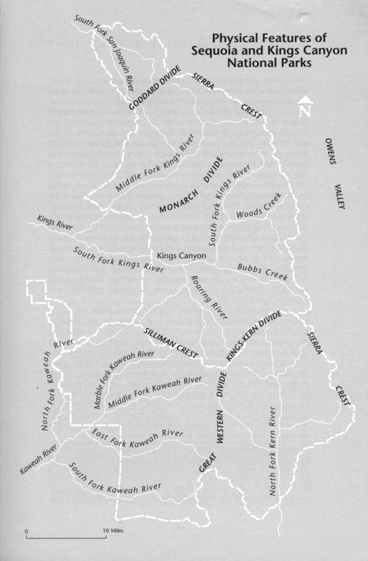
The mechanism that caused the Sierra to rise to its current height is less well understood than the forces that created the range's rock types. It is known, however, that about twenty-five million years ago the tectonic plate collision ended that had been going on for so long along the western edge of North America. In its place new forces were exerted. Instead of collision, the dominant mode became continental stretching and uplift. The brittle continental plate began to fracture and volcanics again came to the surface through these cracks. The northern Sierra was buried beneath flows and even the southern portion of the range saw scattered eruptions. Then, for reasons that are highly debatable, the gigantic block of cooled magma began to rise up out of the continental plate. One contemporary explanation for this phenomenon is that the relatively light granites had been "frozen" into the continental plate at the time of their formation, and they had thus long been held in place, as a block of ice might hold a cork embedded within it as long as the ice was solid and intact. When tectonic stretching "broke the ice," so to speak, the granite was freed and began to float upward. For the past ten million years the granite block we call the Sierra has been rising rapidly, at least in the geologic sense. Most of the uplift has occurred on the eastern edge of the block, explaining the strongly asymmetrical shape of the range. Nowhere is the power of this process more apparent than in the Owens Valley along the eastern edge of the Sierra in the Kings and Kern rivers regions. Here the obvious displacement along the fault is more than two vertical miles. And the uplift almost certainly is not over. Every several hundred years the Sierra jumps farther into the sky in a violent earthquake that shakes most of California. The last one occurred in 1872, when the vertical difference between the summit of Mt. Whitney and the floor of Owens Valley immediately below the peak to the east, increased by more than twelve feet. |
|
| ||
| <<< PREVIOUS | CONTENTS | NEXT >>> |
|
| ||
Challenge of the Big Trees ©1990, Sequoia Natural History Association dilsaver-tweed/chap1a.htm — 12-Jul-2004 | ||