NPS
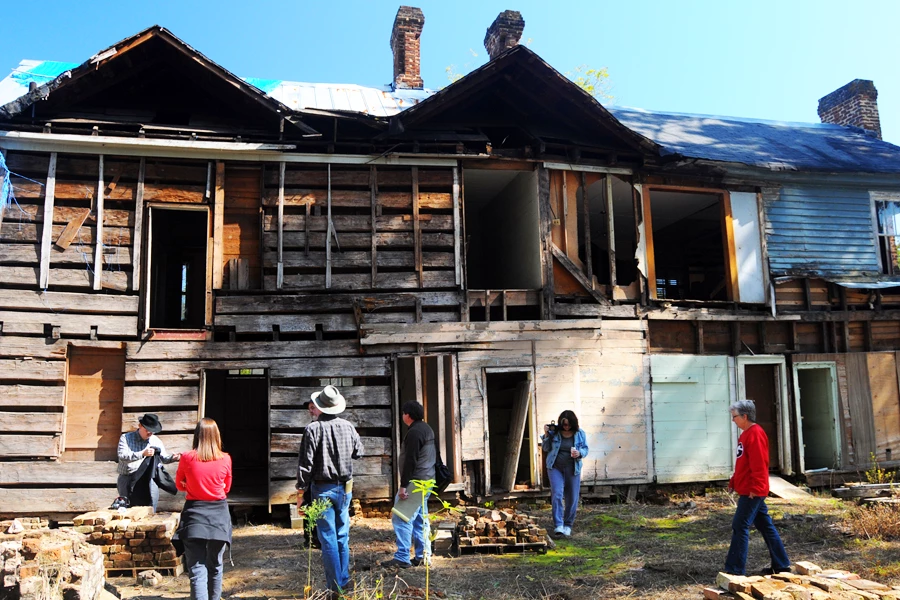
Historic Building Survey Along the Trail of Tears National Historic Trail
National Trails staff has been collaborating with the Center for Historic Preservation at Middle Tennessee State University to locate, document, and identify preservation needs for historic buildings and structures along the Trail of Tears in the nine states through which it passes. The inventory of properties associated with the trail has grown from the initial list of 32 to over 230. The project has been implemented in close cooperation with the various state chapters of the Trail of Tears Association, as well as state historic preservation offices, and local governments. The results of the project will help to identify priorities for preservation and interpretation along the national historic trail.
Since this posting, two restoration guide booklets have been produced:
- one for historic masonry buildings
- one for historic log buildings
Check out this BLOG on the project.
NPS
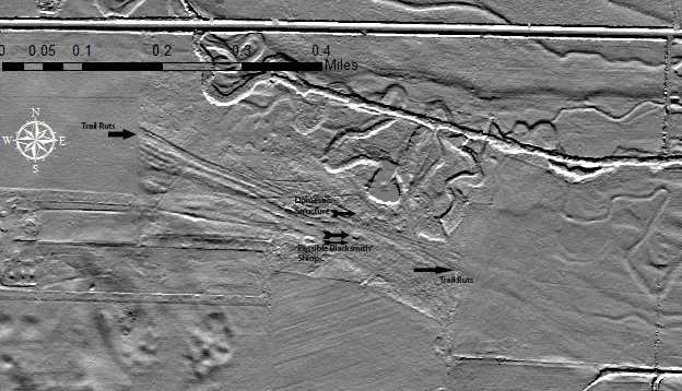
Archeology on the Pony Express National Historic Trail
In 2013-2014, National Trails staff cultural resources team supported a partnership among retired NPS archeologist Douglas Scott, the University of Nebraska-Lincoln (UNL), the NPS Midwest Archeological Center, and private landowners to investigate the archeological evidence for the Alkali, Mud Springs, and Cold Springs Pony Express stations, and related 19th-century military activities in western Nebraska. Remote sensing technologies helped the UNL archeological field school locate, metal detect, and test potential trail ruts and structures at the sites. The final project report is in preparation.
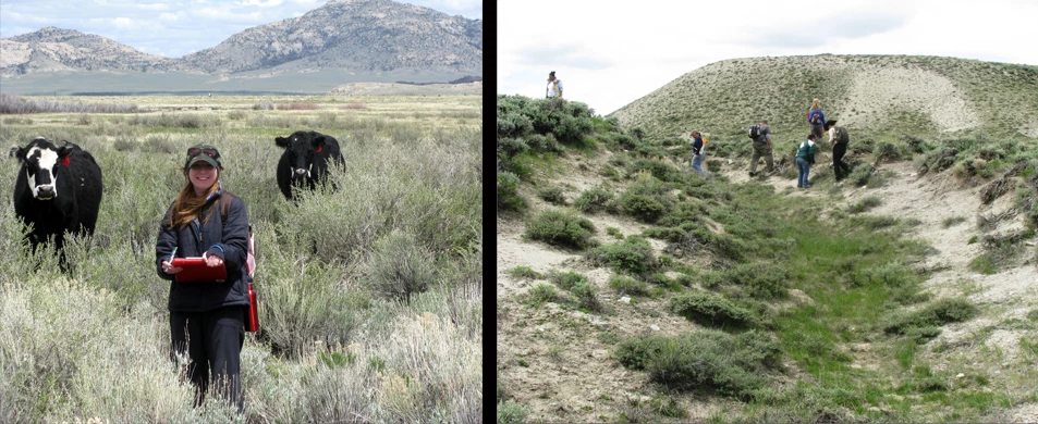
Central Wyoming College
Archeological survey on the Oregon, California, Pony Express, and Mormon Pioneer national historic trails
The National Trails office provided financial and technical support to Central Wyoming College in 2009-2011 for an archeological survey of the combined Oregon, California, Pony Express, and Mormon Pioneer national historic trails along the Middle Sweetwater River in Wyoming. While learning archeological field methodology, the students documented dozens of sites, including swales, possible graves, and a place where a wagon rolled and spilled its contents. Several of the students eventually obtained professional jobs in archeology as a result of their experience on the Sweetwater.
NPS
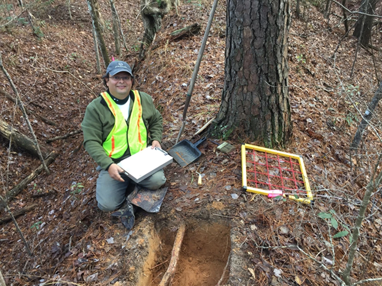
Lobanillo Swales Along El Camino Real de los Tejas National Historic Trail
In close collaboration with El Camino Real de los Tejas Trail Association (ELTEA) and other volunteers, National Trails staff conducted a multidisciplinary assessment of archeological, interpretive, and site development needs at Lobanillo swales in East Texas. The four-acre site consists of deep parallel swales (grassed over trail ruts) heading up a tree-covered slope. Lobanillo swales were created by historic trail traffic (caravans of people and animals) on El Camino Real de los Tejas National Historic Trail that once connected two capitols, Monclova and Los Adaes, from about 1690-1821. An archeological survey and test excavations were conducted at the site by environmental consultants GTI Environmental, LLC, with considerable assistance from the ELTEA and NPS. Results from the archeological investigations will guide interpretive and visitor experience needs at the site.

NPS Lynne Mager
Last updated: April 23, 2025