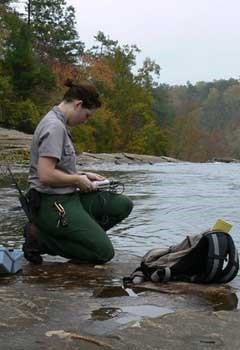
NPS Photo
Background
Protecting park aquatic resources from impairment requires ongoing data collection, analysis, communication, and archiving to demonstrate status and trends and provide a credible foundation for resource management. Data and information are vital organizational assets that must be managed properly to ensure the investment made in their collection and analysis was not squandered. The Water Resources Division’s Information Management Program supports parks and networks in the management, dissemination, and archiving of hydrologic data including database design, data management, and GIS applications. Program staff support systems to enable parks and networks to manage and disseminate continuous and discrete water quality and quantity data; facilitate archiving discrete water quality data in the National Water Quality Monitoring Council’s (NWQMC) Water Quality Portal (WQX/STORET) to make the data publicly accessible; recommend standards for hydrographic data sets; conduct water body and water quality inventories for parks; and help acquire digital hydrographic data.
Highlights and Accomplishments
Commercial off-the-shelf software and their associated databases, Aquatic Informatics’ Aquarius system for continuous time-series data and EarthSoft’s Environmental Quality Information System (EQuIS) for discrete (i.e. less than daily) data, have been stood up to support servicewide water quality and quantity data management.
The NPS’ Aquarius system includes Aquarius Time Series for data entry, editing, and analysis; Aquarius Connect for automating connections to external data sources; and the Aquarius WebPortal for disseminating published data. NPS staff have entered more than 3,000 monitoring locations in Aquarius that house more than 24 thousand continuous time-series datasets (and their associated field visit data) containing more than 1 billion results.
The servicewide, discrete EQuIS water quality database (archived within the NWQMC’s Water Quality Portal (WQX/STORET) now contains more than 11 million results from 1891 to present for more than 1,600 physical, chemical, and biological characteristics from more than 54,000 monitoring locations in support of more than 1,290 different projects conducted in or near 269 units of the National Park System. This represents one of the largest sources of data in the NWQMC’s Water Quality Portal (WQX/STORET). These data are used by the states and Environmental Protection Agency (EPA) to determine whether waters are attaining state water quality standards under the Clean Water Act and by the NPS and others to monitor the status and trends of park aquatic ecosystems to help ensure they remain unimpaired.
NPSTORET is a complete water quality database management system, suitable for parks, networks, watershed groups, and others, that allows users to enter information about their water quality monitoring projects, stations, metadata, and results in a Microsoft Access database. Users can generate reports, statistics, and graphics describing entered data. Data can be imported from a variety of data sources and formats. Data can also be exported in the Water Quality Exchange (WQX) format for upload to the NWQMC’s Water Quality Portal (WQX/STORET) or in EarthSoft’s NPS WQX electronic data deliverable format for import into EQuIS. Users can use their own water quality standards, display analytical results on maps, and perform trend analysis.
Program staff maintain a Hydrographic and Impairment Statistics (HIS) system that provides summary statistics of surface hydrography within and adjacent to each national park unit using the U.S. Geological Survey's (USGS) high-resolution National Hydrography Dataset (NHD), the NPS Administrative Park Boundary Dataset, and other sources. Information regarding water impairments is supplied by state management agencies and attributed to NHD to derive impairment statistics for each national park unit. Impaired waters are identified by states according to the federal Clean Water Act Sections 303(d) and 305(b). HIS users can obtain estimates of the total miles of waterway (rivers, streams, canals, etc.), acreage of waterbodies (lakes, reservoirs, ocean, etc.), impairment status, number of lakes, the acreage of icemass, and much more about any national park unit or summarized across the entire National Park System.
The Water Resources Division’s Information Management Program, in conjunction with the Inventory and Monitoring Division, issued a series of Baseline Water Quality Data Inventory and Analysis Reports summarizing data available from national data systems to document water quality conditions at 236 parks. These reports are all available in NPS’ Data Store.
Program staff cooperated with the USGS to help produce the high-resolution NHD - basically digital GIS maps of the nation’s surface water hydrography - for all subbasins containing national park units. This effort included incorporating enhanced NPS hydrography into NHD where available.
Status and Future
Program staff continue to support the use of Aquarius for managing servicewide continuous water quality and quantity time-series datasets and associated field visits. The NPS uses the latest release of Aquarius Time Series for entering, editing, analyzing, and visualizing data. Public dissemination of published continuous and field visit data is supported by the latest release of the Aquarius WebPortal. Linkages to other data systems via Aquarius Connect allow third-party data to be seamlessly reflected or stored in Aquarius.
Program staff continue to work with parks and networks to flow their discrete water quality data from either NPSTORET or their own custom database system to the NPS’ EQuIS system using the NPS’ WQX electronic data deliverable format. Once archived in EQuIS, the data are transferred to the NWQMC’s Water Quality Portal (WQX/STORET) through the Environmental Information Exchange Network via the WQX format. Work continues toward enabling parks and networks to upload their data directly into EQuIS using EQuIS Enterprise.
NPSTORET development continues with emphasis on enhancing WQX and EQuIS compatibility, supporting a SQL Server back end, correcting data, and incorporating new functionality requested by users.
Program staff continue to facilitate NHD stewardship while updating the HIS database with the latest hydrographic, outstanding national resource water designations, and state Clean Water Act information for parks and NPS Wild and Scenic River units. Linkages between HIS and the EPA’s ‘How’s My Waterway’ have been established.
Last updated: August 22, 2024
