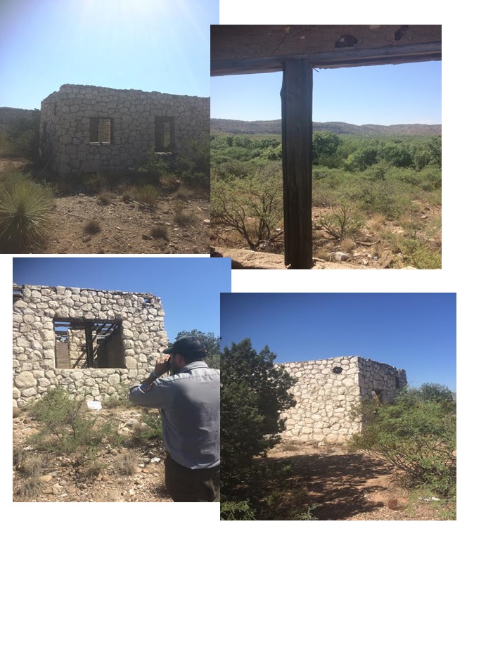
I met Matt Guebard and Lucas Hoedl at the Montezuma Castle Visitor center and we headed out to a huge plot of Park Service land in the Camp Verde area. The goal was to go to various sites on the land and assess the sites for any changes involving damage, garbage, or signs of wildlife. The first site we visited was to a house built by a miner named Everett Franklin Hare in 1920. It is definitely an awesome piece of history and I am amazed that the man was able to build the house all on his own. Matt and Lucas plan to put the house in the National Register of Historic Places! Supposedly Everret made his main source of income by raising fighting cocks.
To keep a record of the house assessment, Lucas took multiple pictures of the inside and outside of the house. In each picture there had to be a white board with various pieces of information about the area being photographed and a north facing arrow. I was tasked with setting up the white board and also using a compass to place the north facing arrow in front of the white board so that anyone who looks at the photograph can tell where the photo was taken and what is was taken of.
Because many of the sites are so remote, Lucas and Matt use GPS devices to find them. After the 1920 house was assessed we moved on to the next site, which would be extremely difficult to locate without a GPS. The site wasn't much to look at because there isn't much there;the only indication of anyone previously living there is a pile of rocks. Again, I set up the white board and north facing arrow while Matt took pictures.
Getting to each site required a lot of hiking through dense vegetation, and most of the trees and bushes have thorns. The best way to get around is to just walk right through each plant, otherwise nothing would get done. Unfortunately, we were unable to get to the third site as we were blocked by a large body of water and getting around it would have taken too much time. Because of this, we just moved onto the fourth site which happened to be right by the miner's house where we originally were. We went to the site because someone found an arrow point there from the archaic age, dating back to about 7,000 years old!
I really enjoyed hiking around with Matt and Lucas. I got to see some beautiful historical areas while getting a good work out! It was really exciting being able to go to areas where few people have been. The rest of my day was spent working on interpretation at Montezuma Castle. Unfortunately, there was a bunch of bees swarming a tree right by the main viewing area so part of the trail had to be taped off for the last stretch of the day. Another great day interning with the National Parks Service!

