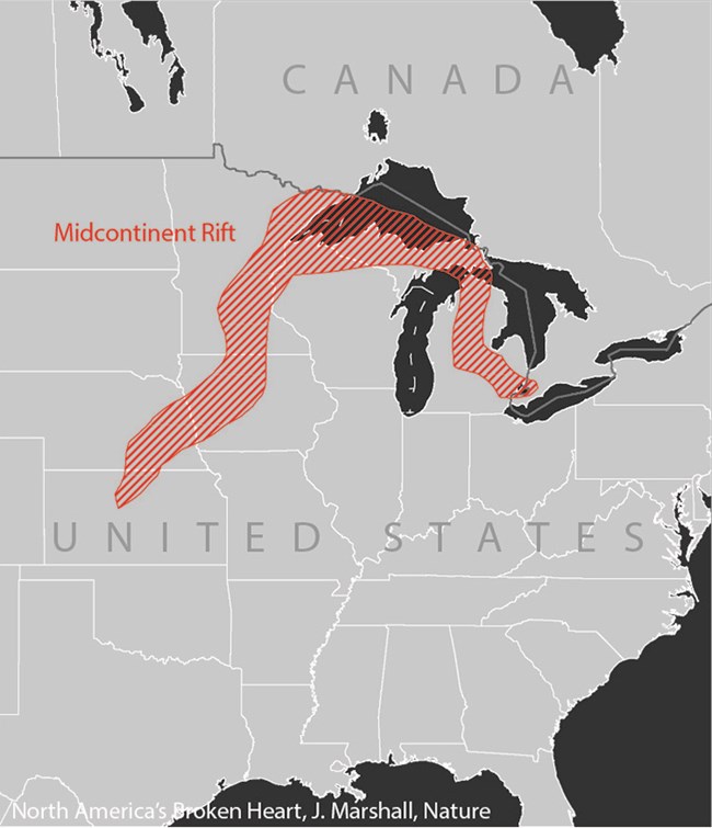
The copper that was mined in the Keweenaw formed during a spectacular period in Earth's history—at a time when the North American continent was splitting apart. This separation began about 1.1 billion years ago and at its peak had a length of over 3,000 kilometers. During this time, huge amounts of lava poured out of the earth's crust, forming sequences thousands of feet thick. In the present day, these massive flood basalts are only exposed in the Lake Superior region. Throughout the rest of the country they are buried in thousands of feet of sediments, but we can still detect them. 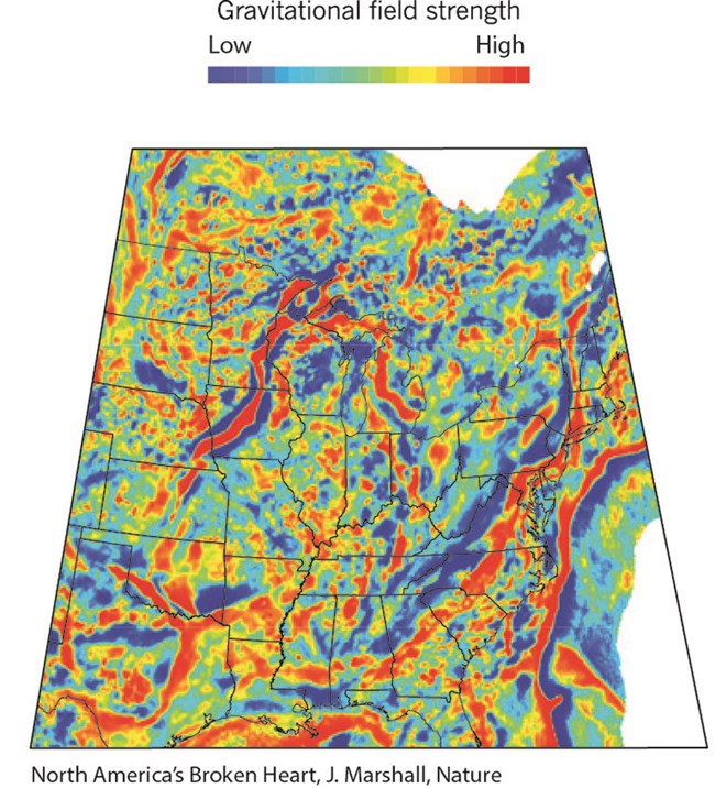
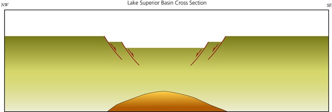
Rifts form as a result of extensional forces. When a continent is pulled in separate directions it will tear somewhere, but pre-existing weaknesses will control where it will begin breaking. The Midcontinent Rift may have formed where it did because a large hot spot first weakened the earth's crust. 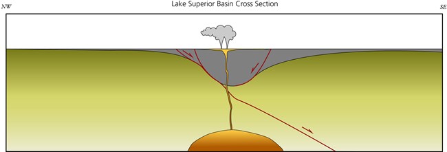
As rifting progressed, fissure type eruptions produced lava lakes hundreds of feet thick. The weight of these dense basalt sequences caused the rift valley to sink further. 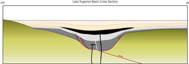
As either the magma chamber was exhausted or extension slowed, eruptions began to wane. Between eruptions, there were periods of sedimentation. Eventually all volcanic activity stopped, and only sedimentary rocks accumulated in the still sinking basin. 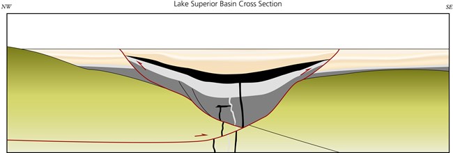
Following rifting, there was a period of compression. This reversed the motion on existing faults, causing the uplift of the deeply buried basalts. It is also thought that the native copper of the Keweenaw was deposited at this time. 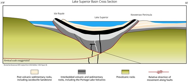
The present landscape was mostly shaped by the past 2.5 million years, with repeated glaciations scouring the landscape. The removal of thousands of feet of rock exposed the copper bearing layers at the Earth's surface, allowing them to be found and mined. |
Last updated: January 21, 2023
