NPS Photo
Overview
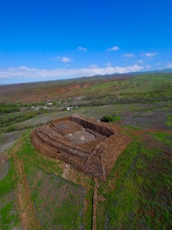
Pu‘ukoholā Heiau National Historic Site encompasses approximately 32 ha on the western coast of the island of Hawai‘i. The park was established to preserve and protect three important ancient Hawaiian heiau or temples and other historical and cultural features. The Site is situated on a vast lava field supporting 104 vascular plant species including examples of coastal strand and wetland native plants that are actively managed. Most of the remaining vegetation has been extremely altered over the years and consists primarily of non-native buffelgrass and kiawe trees/shrubs.The Pu'ukoholā Heiau National Historic Site Vegetation Inventory Project delivers many geospatial and vegetation data products, including an in-depth project report discussing methods and results, which include descriptions to vegetation associations, field keys to vegetation associations, map classification, and map-class descriptions. The suite of products also includes a database of vegetation plots, and accuracy assessment (AA) sites; digital images of field sites; digital aerial imagery; digital maps; a contingency table listing AA results; and a geodatabase of vegetation, field sites (vegetation plots, and AA sites), aerial imagery, project boundary, and metadata.
Products
The products of vegetation mapping projects are stored and managed in the National Park Service's Data Store, a repository for documents and publications relating to park resources. From the highlighted items below, click on the type of information you are looking for.
Last updated: October 19, 2018
