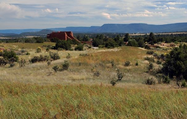
NPS Photo / Yvonne Chauvin
Overview
The monument is located in the foothills of the Sangre de Cristo Mountains in north-central New Mexico (between Santa Fe and Las Vegas). At 2,423 ha (5,988 ac) in size, the park is known for its rich tapestry of historical Native American, Spanish, and Anglo-American cultural legacies set against a backdrop of rolling plains, mesas, mountain foothills, and stream and river valleys. In this complex landscape, we find Douglas-fir and ponderosa pine forests at the higher elevations and northern aspects of the foothill canyons and ridges, pinyon-juniper woodlands extending down the southfacing slopes, and plains and mesas at the mid elevations. Intermixed among the woodlands are extensive grasslands dominated by blue grama-dominated grasslands.The Pecos National Historical Park Vegetation Inventory Project delivers many geospatial and vegetation data products, including an in-depth project report discussing methods and results, which include descriptions to vegetation associations, field keys to vegetation associations, map classification, and map-class descriptions. The suite of products also includes a database of vegetation plots, and accuracy assessment (AA) sites; digital images of field sites; digital aerial imagery; digital maps; a contingency table listing AA results; and a geodatabase of vegetation, field sites (vegetation plots, and AA sites), aerial imagery, project boundary, and metadata.
Products
The products of vegetation mapping projects are stored and managed in the National Park Service's Data Store, a repository for documents and publications relating to park resources. From the highlighted items below, click on the type of information you are looking for.
Last updated: October 18, 2018
