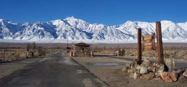
NPS Photo
Overview
Manzanar National Historic Site was established by the NPS in 1992 to help conserve and protect a former World War II relocation camp used for detaining and housing Japanese Americans. The Site represents a disturbed site that has been periodically inhabited and altered for nearly a century. Impacted by the continual manipulation of the water resources in the Owens Valley, the resulting vegetation at the Site is comprised of a mixture of natural and semi-natural plant communities. The recent history of Manzanar National Historic Site current vegetation likely begins in 1942 with the creation of the camp and the blading of the site to remove all existing vegetation with the exception of a few large cottonwood trees and fruit orchards.The Manazar National Historic Site Vegetation Inventory Project delivers many geospatial and vegetation data products, including an in-depth project report discussing methods and results, which include descriptions to vegetation associations, field keys to vegetation associations, map classification, and map-class descriptions. The suite of products also includes a database of vegetation plots, and accuracy assessment (AA) sites; digital images of field sites; digital aerial imagery; digital maps; a contingency table listing AA results; and a geodatabase of vegetation, field sites (vegetation plots, and AA sites), aerial imagery, project boundary, and metadata.
Products
The products of vegetation mapping projects are stored and managed in the National Park Service's Data Store, a repository for documents and publications relating to park resources. From the highlighted items below, click on the type of information you are looking for.
Last updated: October 18, 2018
