NPS Photo
Overview
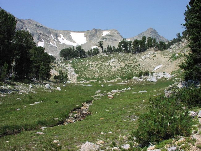
Over 1000 species of vascular plants grow in Grand Teton National Park and the surrounding area.The valley floor of Jackson Hole is comprised of loose rocky soil that allows water to percolate through easily. Silvery-green big leaf sagebrush blankets the valley. Moisture-loving plants find suitable growing conditions along the Snake River, its tributaries, and other wetland areas. Narrow leaf cottonwood and willows, both of which thrive in wet areas, grow along the watercourses, creating ribbons of bright green across the landscape. Wet meadows provide the conditions suited to grasses, sedges, and wildflowers. The canyons, mountainsides, and ridges formed of glacial debris, called moraines, contain soils capable of holding moisture. These conditions support the growth of trees. Conifers dominate these areas, coloring the slopes a dark green. The high alpine reaches of the park support plants specially adapted to the harsh growing conditions found there. Wind, snow, lack of soil, increased ultraviolet radiation, rapid and dramatic shifts in temperature, and a short growing season all challenge the hardy plants that survive here. Most plants adapt by growing close to the ground in mats like the alpine forget-me-not.The Grand Teton National Park Vegetation Inventory Project delivers many geospatial and vegetation data products, including an in-depth project report discussing methods and results, which include descriptions to vegetation associations, field keys to vegetation associations, map classification, and map-class descriptions. The suite of products also includes a database of vegetation plots, and accuracy assessment (AA) sites; digital images of field sites; digital aerial imagery; digital maps; a contingency table listing AA results; and a geodatabase of vegetation, field sites (vegetation plots, and AA sites), aerial imagery, project boundary, and metadata.
Products
The products of vegetation mapping projects are stored and managed in the National Park Service's Data Store, a repository for documents and publications relating to park resources. From the highlighted items below, click on the type of information you are looking for.
Last updated: October 10, 2018
