NPS Photo
Overview
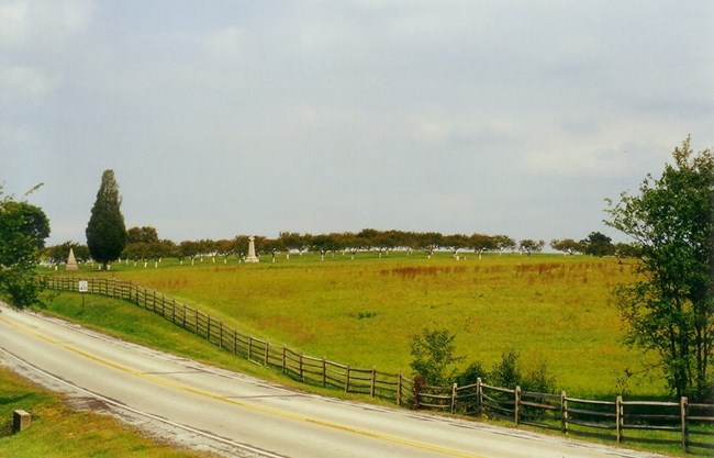
Gettysburg National Military Park is the site of the American Civil War Battle of Gettysburg, the Soldiers’ National Cemetery and the commemoration of the great battle of Civil War veterans. The park is situated in the Piedmont Province east of Appalachian Mountains in south central Pennsylvania, encompasses over 5,989 acres of land. The park is fifteen miles east of South Mountain, which rises to 2,000 feet above sea level. Within the park are gently rolling hills and valleys with elevations averaging between 500 to 580 feet above sea level. The landscape is a mosaic of mature and maturing woodlands and woodlots, agricultural fields, pasturelands and intermittent streams which provide habitat for 187 bird, 34 mammal, 17 reptile and 15 amphibian species documented to date. Floral inventories have recorded 553 species of vascular plants, of which 410 are native.Most of the 690 acres at Eisenhower National Historic Site are used for agricultural crops, cattle grazing, or for lawn and garden. However, tucked into the remaining forested land, grassland areas, and riparian areas are an interesting variety of native plant species. The forests on the park consist of secondary growth deciduous forest with typical tree species including oak and hickory, which are common to the Appalachian area. Common understory species include spicebush, black cherry, and white ash. Wildflowers that may be seen include trout lilly, spring beauty, cutleaf toothwort, wild geranium, bloodroot, wild ginger, rue anemone, yellow violet, yellow adders tongue, cardinal flower, hepatica, jack-in-the-pulpit, goldenrods, ironweed, mayapples, and more.
The Gettysburg National Military Park and Eisenhower National Historic Site Vegetation Inventory Project delivers many geospatial and vegetation data products, including an in-depth project report discussing methods and results, which include descriptions to vegetation associations, field keys to vegetation associations, map classification, and map-class descriptions. The suite of products also includes a database of vegetation plots, and accuracy assessment (AA) sites; digital images of field sites; digital aerial imagery; digital maps; a contingency table listing AA results; and a geodatabase of vegetation, field sites (vegetation plots, and AA sites), aerial imagery, project boundary, and metadata.
Products
The products of vegetation mapping projects are stored and managed in the National Park Service's Data Store, a repository for documents and publications relating to park resources. From the highlighted items below, click on the type of information you are looking for.
Last updated: October 16, 2018
