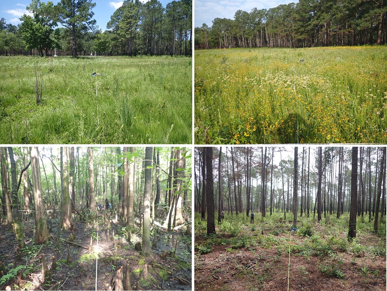
NPS photos / M. Forbes Boyle
Overview
Moores Creek National Battlefield is situated in the southeastern coastal plain of North Carolina, approximately 32 kilometers (20 miles) northwest of Wilmington, North Carolina. The primary purpose of the park is to interpret the pivotal Revolutionary War battle that occurred on the site; however, the park also hosts a variety of natural resources. The 36-hectare (88-acre) park contains a small portion of Moores Creek in the park’s western section, just north of the confluence of Moores Creek and Black River. Moores Creek is a tidally influenced blackwater stream with an approximate width of 8 meters (26 feet). Vegetation communities at the battlefield are characteristic of a coastal pine-flatwoods mosaic and include riparian areas, dry pine forests, and wet pine savannas. The riparian areas are generally dominated by bald cypress (Taxodium distichum), while the uplands are a mix of loblolly and longleaf pine (Pinus taeda and P. palustris) and sweetgum (Liquidambar styraciflua). Beginning in the 2000s, the park began successful active management program to improve the condition of the park’s natural communities by restoring natural hydrologic processes, reintroducing several native plant species, and reinstating periodic fires.
The Southeast Coast Network conducts the following monitoring at Moores Creek National Battlefield:
- Landbird community monitoring and Vocal anuran community monitoring is conducted on a rotating schedule every three years. These wildlife communities play critical roles in park ecosystems and interact with several trophic levels of food webs. The network uses automated recording devices (ARDs) to collect vocalization data during mornings and evenings in the spring, which are analyzed by bioacoustics specialists. Data collected from these vital sign monitoring efforts help assess the ecological integrity and diversity of park areas and how communities and park conditions may change over time. The landbird and vocal anuran monitoring efforts in network parks began in 2012.
- Vegetation community monitoring is conducted on a rotating schedule. Monitoring vegetation is important because it’s key indicator of overall ecosystem health. Changes in vegetation reflect the effects of stressors like extreme weather, disease, invasive species, fire, and land use change. Plant communities also provide structured habitat and food resources for other species. Vegetation monitoring data provides managers with information about the degree of change in their park’s natural communities. Vegetation plots are established across the following habitats: Coastal Plain Alluvial Wetlands, Coastal Plain Nonalluvial Wetlands, and Coastal Plain Open Upland Woodlands. Data reports include information about new occurrences and rare plants, species richness and abundance, tree health and regeneration, disturbance observations, soil nutrients, landform/geomorphology, and downed woody debris.
| Vital Signs | Examples of Measurement |
|---|---|
| Landbird and Vocal Anuran | Species occurrence, distribution |
| Terrestrial Vegetation | Plant community diversity, relative species/guild abundance, structure/age class, incidence of disease |
Source: NPS DataStore Collection 4012 (results presented are a subset). To search for additional information, visit the NPS DataStore.
Source: NPS DataStore Collection 4009 (results presented are a subset). To search for additional information, visit the NPS DataStore.
Source: NPS DataStore Collection 4010 (results presented are a subset). To search for additional information, visit the NPS DataStore.
Source: NPS DataStore Collection 4014 (results presented are a subset). To search for additional information, visit the NPS DataStore.
Source: NPS DataStore Collection 4013 (results presented are a subset). To search for additional information, visit the NPS DataStore.
Source: NPS DataStore Collection 4011 (results presented are a subset). To search for additional information, visit the NPS DataStore.
Last updated: November 11, 2024
