The following information is summarized from the Northern Colorado Plateau Network monitoring plan, published in 2004. Some details may have changed.
Park Purpose and History

NPS
Pipe Spring National Monument was established by President Warren G. Harding's proclamation No. 1663 (43 Stat. 1913) of May 31, 1923, “Whereas, it appears that the public good would be promoted by reserving the land on which Pipe Spring and the early dwelling place are located as a National Monument, with as much land as may be necessary for the proper protection thereof, to serve as a memorial of western pioneer life…”
The 1923 proclamation further addresses the spring water by clarifying that the availability of water at the site was one reason for its establishment as a monument, stating, “Whereas, there is in northwestern Arizona on the road between Zion National Park and the North Rim of the Grand Canyon National Park a spring, known as Pipe Spring, which affords the only water along the road between Hurricane, Utah, and Fredonia, Arizona, a distance of sixty-two miles…”
It also declares that, “in the administration of this Monument, the Indians of the Kaibab Reservation, shall have the privilege of utilizing waters from Pipe Spring for irrigation, stock watering and other purposes, under regulations to be prescribed by the Secretary of the Interior.” Although the proclamation does not speak to any other third-party use of water, it does state that monument establishment is “subject to all prior valid claims.”
Geologic processes produced these desert springs and made the site a focus for wildlife and a centuries-long continuum of human habitation. The springs were well known to Ancestral Puebloan people and bands of Southern Paiutes long before the arrival of Mormon missionaries in 1858. Following the ill-fated homesteading efforts of James Whitmore, the Mormon Church established a tithing ranch in 1870 and constructed a fort (Winsor Castle) for protection.In addition to ranching, Pipe Spring became an outpost for another church venture: the Deseret Telegraph. A spur line was established through Pipe Spring in 1871, creating the first telegraph station in the Arizona Territory. In 1909, the Kaibab Paiute Indian Reservation was established and surrounded Pipe Spring. But ranch buildings, springs, and grounds immediately around the springs remained in private ownership until transfer to the National Park Service in 1923.

NPS
Throughout the early years, descendants and associates of former ranch owners were allowed to continue using water for livestock. Through those same years, the Indian Agent for the Kaibab Paiute Tribe pointed out that the Tribe’s use was precluded or made extremely difficult. In 1933, after disagreement between the cattlemen, the Indian Agent, and the monument custodian, Assistant Secretary of the Interior Oscar L. Chapman signed “Regulations For The Division Of The Waters Of Pipe Springs,” stating, “The waters of the Springs shall be divided equally, one-third to the Pipe Springs National Monument, one-third to the Indians of the Kaibab Indian Reservation, and one-third to the stockmen represented by a memorandum agreement signed June 9, 1924, by representatives of the respective interests.”
In 1933, the flow of Tunnel Spring roughly approximated one-fifth of the total flow of all springs. As this presumably met the cattlemen’s needs (and as a matter of engineering convenience), the totality of Tunnel Spring flow was diverted to the cattlemen. After many years of discontent over water delivery to the Tribe, the National Park Service (NPS) and Tribe entered into a 25-year agreement in 1972 whereby, in exchange for the Tribe’s one-third of the spring flow, the NPS built and agreed to maintain a culinary water well and delivery system on reservation lands north of the monument. The NPS pays the Tribe for its use of water from this system.
Location
A 16-hectare (40-acre) historic site in the northeast part of Mohave County, Arizona, 16 kilometers (10 miles) south of the Arizona–Utah border, and entirely surrounded by the Kaibab-Paiute Indian Reservation. Primary access is provided by Arizona State Highway 389.
Elevation
Elevations range from 1,500 to 1,555 meters (4,923–5,100 feet).
Size
16 hectares (40 acres)

NPS
General Description
Pipe Spring National Monument is located on the Moccasin Terrace of the Markagunt Plateau, at the southern sloping base of the Vermilion Cliffs. From this site, a dry plain slopes southward for 48 kilometers (30 miles) before descending into Grand Canyon.
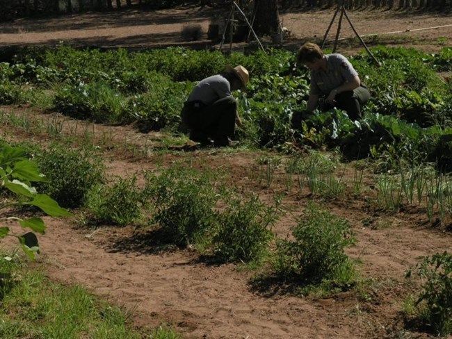
Culturally introduced plant materials include a variety of shade trees (ash, cottonwood, poplar, elm, locust, Ailanthus), fruit trees, a grape arbor, and a vegetable garden.
In summer, high temperatures range from 90 to 115° Fahrenheit. In winter, normal low temperatures range between 0 and 40° Fahrenheit.
There are three springs: Pipe Spring (the main spring, emerging from beneath the fort itself), Tunnel Spring (located just southwest of the fort), and West Cabin Spring (a seep spring once called the “calf-pasture spring”). The springs are fed by the Navajo Sandstone aquifer to the north and west, via the Sevier Fault. Only one spring, West Cabin, flows naturally, creating a very small riparian area (1/8 acre).
The monument also contains paleontological resources: three tridactyl dinosaur footprints, tentatively identified as Eubrontes.
Unique Features and Species of Special Concern
The most important natural (and cultural) resource is water. Prehistoric and historic American Indian people have used the spring waters for thousands of years. In the 1860s, the springs were claimed by Mormon pioneers and used for settlement and ranching purposes until 1923, when Pipe Spring was proclaimed a national monument and the ranch purchased.
In the second week of June 1999, the historic spring ceased to flow for the first time on record. This spring, located directly beneath the north building of Winsor Castle, is divided into two flows: one that proceeds through a historic subsurface trench to an emergence point outside the Castle’s west gate, known as Big Spring, and a second flow, piped beneath the Castle courtyard into and through the Castle’s Spring Room. The runoff from both Big Spring and the Spring Room feeds historic masonry ponds immediately south of the Castle. Spring flow is critical to the historic integrity of the monument and provides life-giving sustenance to acres of shade trees, a representative historic orchard, and wildlife.

NPS
Visitors may encounter a wide range of native and nonnative plant and animal species throughout the site. As one of few perennial water sources on the Arizona Strip, the springs provide a vital resource for resident bird populations and are important to migrating bird populations. A bird inventory has been completed.
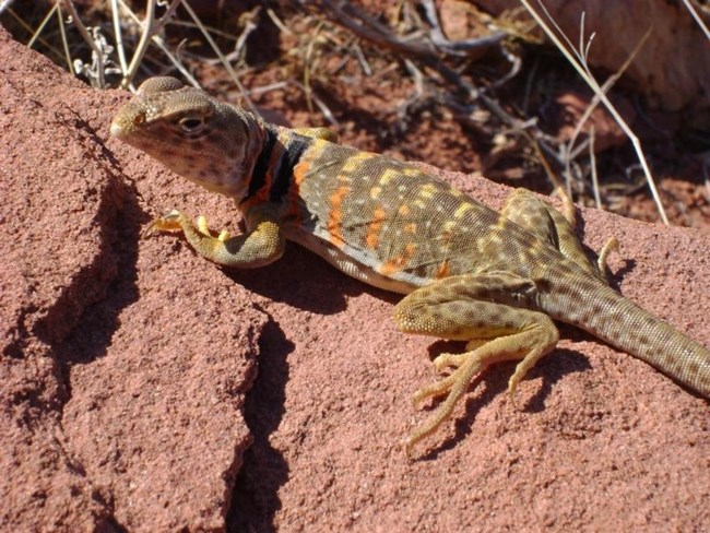
Water is important for all local fauna. Reptiles and small rodents are particularly abundant, as are bats.The climate is fairly temperate, and the plant and animal species are typically semi-desert. North of the monument is pinyon-juniper woodland. Intermingled with and at the edge of this woodland community is a sagebrush grassland, with sagebrush dominant on the more level areas of ground and pinyon-juniper occurring on the shallow rocky soils and broken country of adjacent higher elevations. Other on-site vegetation includes rabbitbrush, pricklypear cactus, and sagebrush. Nearly half the monument contains the aforementioned semi-desert plant species. Animal species include small rodents, reptiles, birds, bats, amphibians, and coyotes.
Resource Management Concerns
While the main emphasis of the monument is human history, there would be no human history here were it not for the natural resources. Pipe Spring National Monument is a critically important oasis for resident and migratory wildlife.
An important part of the story is the grazing lands (as well as the water) that attracted Euro-American pioneers to the Arizona Strip. Stories abound regarding “grass belly high to a horse.” Overgrazing reduced the range to dust by the 1890s, and what has managed to recover is mostly sage–saltbush desert scrub. A future resource management interpretation project will attempt to reseed with native grasses.
Exotic plant species, such as puncture vine, cheatgrass, Ailanthus, and Siberian elm trees, are of concern. However, trees, along with silver-leafed cottonwoods—none of which are native—provide the only shade. Most trees were planted by the NPS. Efforts should be made to eliminate exotics, but many shade trees in public areas will be retained.
Last updated: July 1, 2025
