The following information is reproduced from the Northern Colorado Plateau Network monitoring plan, published in 2004. Some details may have changed.
Park History and Purpose
NPS/Thomas C. Gray
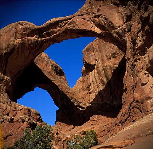
Arches National Monument was established by Presidential Proclamation No. 1875 on April 12, 1929. The proclamation states that the monument was established "to protect extraordinary examples of wind erosion in the form of gigantic arches, natural bridges, ‘windows,’ spires, balanced rocks and other unique wind-worn sandstone formations, the preservation of which is desirable because of their education and scenic value.” Research has established water as the primary erosional agent, although wind plays a role.
In 1938, the monument was enlarged to include a number of historic and prehistoric cultural sites. Boundary adjustments were made on November 15, 1938; July 26, 1960; January 21, 1969; and November 12, 1971. In 1971, the designation for Arches was changed from national monument to national park and the acreage was increased to 29,708 hectares (73,379 acres). In 1999, the Lost Spring section was added to the park, increasing the total area by 1,255 hectares (3,100 acres) to 30,979 hectares (76,519 acres).
Location
Southeast Utah along and north of the Colorado River in Grand County. The park is 8 kilometers (5 miles) north of Moab, Utah, 161 kilometers (100 miles) west of Grand Junction, Colorado, and 386 kilometers (240 miles) southeast of Salt Lake City, Utah. The park is accessible by major travel routes such as Interstate 70, located 32 kilometers (20 miles) north of the park headquarters. U.S. Highway 191 runs from I-70 south to Moab and accesses the park entrance road.
The area surrounding the park (Grand County) is sparsely populated, with a density of two people per square mile. Tourism is currently the most important economic activity.
Elevation
From approximately 1,219 meters (4,000 feet) in the canyons to 1,585 meters (5,200 feet) on the rims.
Size
30,966 hectares (76,519 acres)
NPS / Nicole Segnini
General Description
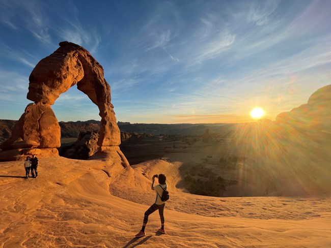
Arches National Park has the largest concentration of natural stone arches in the world. Examples of developing, complete, and collapsed arches are all evident within the park’s 114 square miles. Several arches are particularly noted for their outstanding size and erosional history. Landscape Arch is probably the longest natural stone arch in the world. Delicate Arch, a freestanding arch carved from what was once a freestanding fin, is internationally recognized.
The park is 26 kilometers (16 miles) from north to south and 13 kilometers (8 miles) from east to west. There are a total of 30,966 hectares (76,519 acres) of land within the legislative boundaries. The area’s topography is diverse, ranging from open flats to steep-walled cliffs. The area has been greatly affected by geologic activity associated with the salt intrusions of the Paradox formation, and the landscape has been carved by the effects of wind and water and preserved by the arid climate and lack of earthquake activity. This has produced a landscape dominated by red sandstone formations, such as arches, fins, balanced rocks, mesas, canyons, and spires. Major topographic features are Courthouse Wash, Courthouse Towers, The Windows Section, Salt Valley, Klondike Bluffs, Devil's Garden and the Fiery Furnace. Some of the more famous geologic structures are Landscape Arch, Delicate Arch, Tower Arch, the Marching Men, Skyline Arch, the Three Gossips, the Three Penguins, the Windows, the Parade of Elephants, Balanced Rock, and the Great Wall. There are more than 1,800 catalogued arches that have a span greater than one meter (3 feet).
Arches National Park is largely covered by exposed bedrock, weakly developed soils and sand dunes. Park geology is largely determined by the collapsed salt anticline in Salt Valley and, to a lesser extent, by the collapsed Moab and Cache Valley anticlines. There are ten major sedimentary formations exposed ranging in age from the Pennsylvanian Paradox formation to the Cretaceous Mancos Shale. In stratigraphic order, formations include Paradox, Honaker Trail, Cutler Group, Moenkopi, Chinle, Wingate Sandstone, Kayenta, Navajo Sandstone, Entrada, Morrison, Cedar Mountain, Dakota Sandstone, and Mancos Shale. The Paradox formation of salt and gypsum evaporates is a highly plastic formation that formed salt anticlinal structures, which collapsed when groundwater eroded the salt. The Navajo and Entrada Sandstones crop out over most of the park's surface, with the Entrada forming the majority of the outstanding geologic features. The cliff-forming Wingate Formation exposed along the Colorado River forms the south boundary. Together with the associated Kayenta, Chinle, and Moenkopi formations, it forms impressive, 800-foot cliffs.
Several areas of pictographs and petroglyphs exist within the park. Two archeological surveys have documented approximately 100 sites. Courthouse Wash Rock Art Panel is listed on the National Register of Historic Places. The panel represents the easternmost known occurrence of Barrier Canyon Style.
Physical remains of early ranching and mining pursuits, as well as traces of pioneer routes, exist.
The climate is arid and characterized by hot, dry summers and cool to cold winters. The average annual precipitation is 202 millimeters (7.95 inches). Mean annual temperature is 56 degrees Fahrenheit (13.3 degrees Celsius) and the extreme temperatures are -16 degrees Fahrenheit (-26.7 degrees Celsius) and 112 degrees Fahrenheit (44.4 degrees Celsius).
Potential evapotranspiration exceeds precipitation, making effective soil moisture a critical environmental factor. Precipitation peaks occur in March and August. Snow falls between November and March.
NPS
Plants and Animals
Visitors may encounter a wide range of native and nonnative plant and animal species throughout the site.
Flora
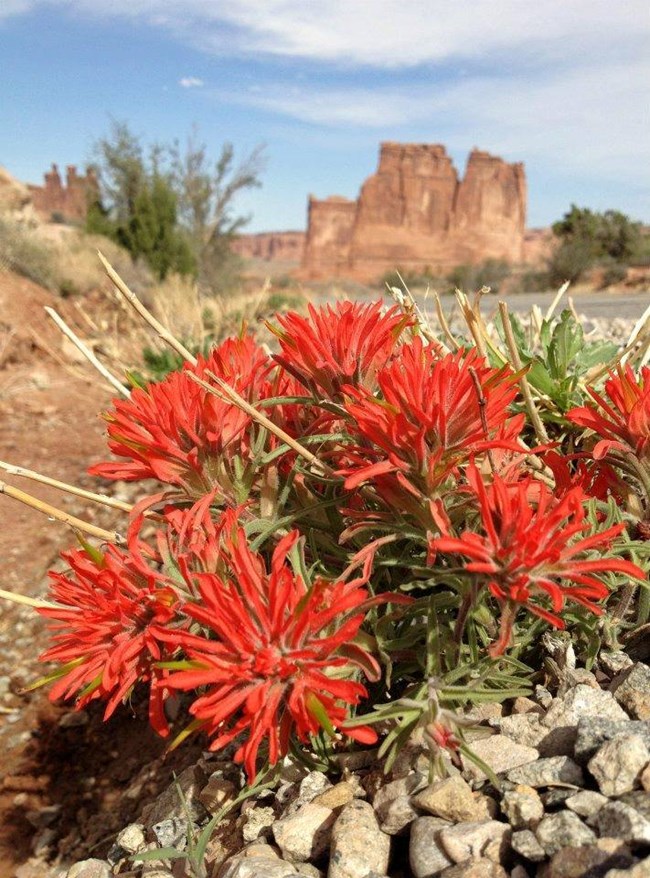
Previous research conducted in the area documented strong relationships between edaphic characteristics and the distribution and composition of plant communities. Six relatively distinct vegetation types have been mapped. These types include (1) shrublands dominated by blackbrush (Coleogyne ramosissima) on shallow (< 50 cm depth), weakly developed calcareous soils formed from sandstone or sandy shales, (2) shrublands dominated by shadscale (Atriplex confertifolia) on shallow soils formed from shales with high clay content, (3) grasslands dominated by needle-and-thread grass (Hesperostipa comata), Indian ricegrass (Achnatherum hymenoides), galleta grass (Pleuraphis jamesii), various species of dropseed (Sporobolus spp.), and cheatgrass (Bromus tectorum) on deep (> 50 cm depth) soils where plant roots cannot reach the water table or capillary zone, (4) shrublands dominated by fourwing saltbush (Atriplex canescens) and sagebrush (Artemisia tridentata) on deep, sandy soils where roots seasonally access the capillary zone, (5) communities dominated by cottonwood (Populus fremontii), willow (Salix spp.), tamarisk (Tamarix ramosissima), and other shrubs in riparian zones where there is immediate root access to the water table, and (6) sparse woodlands dominated by pinyon (Pinus edulis) and juniper (Juniperus osteosperma) on lithic soils where water availability is controlled by hydrological effects of bedrock joints and outcrops.
Other plant communities include Garrett saltbush / mat saltbush (Atriplex garrettii / Atriplex corrugata), fringed sage / purple mint / Indian ricegrass (Artemisia frigida / Poliomintha incana / Achnatherum hymenoides), snakeweed / shadscale / Mormon tea (Gutierrezia sarothrae / Atriplex confertifolia / Ephedra viridis), purple sage / shinnery oak / Utah juniper (Poliomintha incana / Quercus havardii / Juniperus osteosperma), and greasewood / fourwing saltbush (Sarcobatus vermiculatus / Atriplex canescens). Scattered springs and seeps are generally composed of maidenhair fern / Jones reedgrass (Adiantum capillus-veneris / Calamagrostis scopulorum).
NPS
Fauna
Mammals
Major common mammals are the western pipistrelle (Parastrellus hesperus), gray fox (Urocyon cinereoargenteus), bobcat (Lynx rufus), white-tailed antelope ground squirrel (Ammospermophilus leucurus), rock squirrel (Otospermophilus variegatus), Colorado chipmunk (Neotamias quadrivittatus), Apache pocket mouse (Perognathus flavescens), Ord kangaroo rat (Dipodomys ordii), canyon mouse (Peromyscus crinitus), deer mouse (Peromyscus maniculatus), piñon mouse (Peromyscus truei), northern grasshopper mouse (Onychomys leucogaster), desert woodrat (Neotoma lepida), porcupine (Erethizon dorsatum), black-tailed jackrabbit (Lepus californicus), desert cottontail (Sylvilagus audubonii), mule deer (Odocoileus hemionus), desert bighorn sheep (Ovis canadensis nelsoni), striped skunk (Mephitis mephitis), ringtail (Bassariscus astutus), and badger (Taxidea taxus).
Birds
Common bird species are the mourning dove (Zenaida macroura), common nighthawk (Chordeiles minor), white-throated swift (Aeronautes saxatalis), violet-green swallow (Tachycineta thalassina), ash-throated flycatcher (Myiarchus cinerascens), Say's phoebe (Sayornis saya), Woodhouse's scrub-jay (Aphelocoma woodhouseii), common raven (Corvus corax), piñon jay (Gymnorhinus cyanocephalus), oak titmouse (Baeolophus inornatus), canyon wren (Catherpes mexicanus), rock wren (Salpinctes obsoletus), loggerhead shrike (Lanius ludovicianus), gray vireo (Vireo vicinior), black-throated gray warbler (Setophaga nigrescens), black-throated sparrow (Amphispiza bilineata), dark-eyed junco (Junco hyemalis), Cooper's hawk (Accipiter cooperii), golden eagle (Aquila chrysaetos), red-tailed hawk (Buteo jamaicensis), and northern harrier (Circus hudsonius).
Herpetofauna
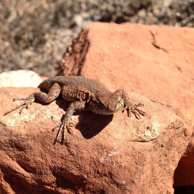
Common herpetofauna include the red-spotted toad (Anaxyrus punctatus), Woodhouse’s toad (Anaxyrus woodhousii), collared lizard (Crotaphytus collaris), short-horned lizard (Phrynosoma douglasii), sagebrush lizard (Sceloporus graciosus), eastern fence lizard (Sceloporus undulatus), tree lizard (Urosaurus ornatus), leopard lizard (Gambelia wislizenii), side-blotched lizard (Uta stansburiana), western whiptail (Aspidoscelis tigris), gopher snake (Pituophis catenifer), common garter snake (Thamnophis sirtalis), and the midget faded rattlesnake (Crotalus viridis concolor).
Aquatic Features
Some exotic fish species exist in Courthouse Wash and Salt Wash. The American bullfrog (Lithobates catesbeianus), an exotic amphibian, is firmly established in Salt Wash. The park boundary is adjacent to the Colorado River for approximately 16 kilometers (10 miles). There are four endangered fish in the Colorado River: bonytail chub (Gila elegans), humpback chub (Gila cypha), Colorado pikeminnow (Ptychocheilus lucius), and razorback sucker (Xyrauchen texanus). The northern river otter (Lontra canadensis) and the beaver (Castor canadensis) occur along the river. There is a great blue heron (Ardea herodias) rookery site along the river in the park.
Unique Features and Species of Special Concern
Plant Communities of Concern
Riparian, River, Relict Areas, Seeps, Springs, Hanging Gardens
NPS
Plants
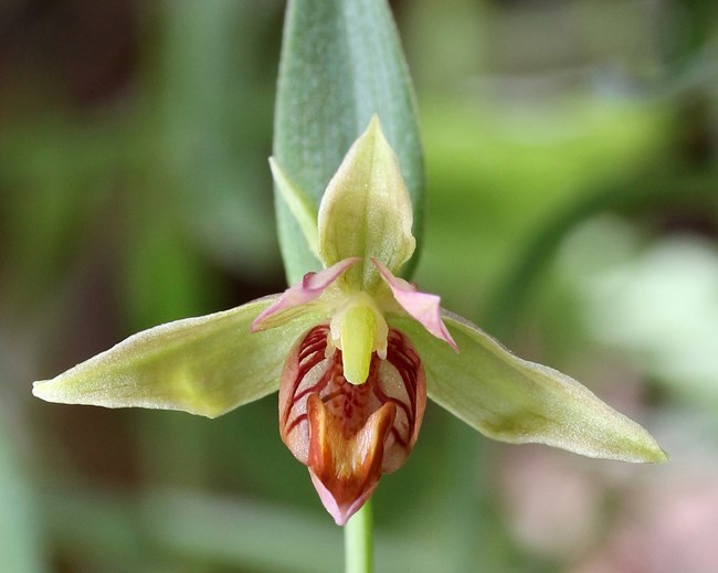
Arches National Park has a number of sensitive plant species, but none are federally classified as threatened or endangered. The Canyonlands desert parsley (Lomatium latilobum) is a sensitive endemic that probably should be listed. Although there are populations outside the park, its center of distribution is in Arches National Park. Other sensitive endemics include the southwestern cloakfern (Argyrochosma limitanea ssp. limitanea), Cutler milkweed (Asclepias cutleri), large-seeded milkweed (Asclepias macrosperma), alcove bog orchid (Habenaria zothecina), alcove rock daisy (Perityle specuicola), entrada rushpink (Lygodesmia entrada), helleborine (Epipactis gigantea), Howell scorpionweed (Phacelia howelliana), Trotter oreoxis (Oreoxis trotteri), alcove death camas (Zigadenus vaginatus), Osterhout's cryptanth (Cryptantha osterhoutii), Utah bladder fern (Cystopteris utahensis), wing-seed stickleaf (Mentzelia pterosperma), roseate gilia (Gilia roseata), Eastwood monkeyflower (Mimulus eastwoodii), Moab woodyaster (Xylorhiza glabriuscula var. linearifolia), and resinbush (Vanclevia stylosa).
Animals
Birds of special concern are the federally threatened southwestern willow flycatcher (Empidonax traillii extimus), the western burrowing owl (Athene cunicularia hypugaea), and the brown-headed cowbird (Molothrus ater). Arches also contains American peregrine falcon (Falco peregrinus anatum) territories.
The park has a number of sensitive bat species, including long-eared myotis (Myotis evotis), fringed myotis (Myotis thysanodes), and pale Townsend’s big-eared bat (Corynorhinus townsendii pallescens).
The northern river otter (Lontra canadensis) is a species of concern. Amphibians of concern include the northern leopard frog (Lithobates pipiens), the tiger salamander (Ambystoma tigrinum nebulosum), the western toad (Anaxyrus boreas), and the bullfrog (Lithobates catesbeianus). The bullfrog, an exotic species, successfully competes with native amphibians.
Paleontological Resources
Arches National Park is rich in paleontological resources. Surveys have discovered many dinosaur bones and track sites.
Resource Management Concerns
Increased recreational use, trespassing livestock, and exotic plant species invasion are the main natural resource management concerns. Damage to cultural resources is also a concern.
NPS/Andrew Kuhn
Recreation Use
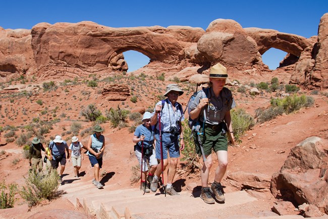
Visitor use increased rapidly during the 1980s and early 1990s, causing soil and vegetation damage in heavily used areas. Off-trail hiking destroys cryptobiotic soils, tramples vegetation, and increases erosion.
Land Use Impacts
Although uranium mining was one of the most important area economic activities from 1950 to 1980, it has largely dissipated due to depressed prices and the discovery of more economical sources of uranium-bearing ore in the world. Currently, the significant mineral extraction activities in the area are solution mining of salt and potash at the Texas-Gulf Mine at Potash, Utah, 10 kilometers (6 mi) southwest of the park, and exploratory drilling for oil and gas on Bureau of Land Management (BLM) lands between Canyonlands and Arches national parks.
Trespass livestock and the subsequent grazing and trampling are a problem. A boundary fence was finally completed in 1998, but livestock still enter areas where the fence is damaged by natural causes (flash floods) or intentionally cut. The park is surrounded by grazing allotments managed by the BLM.
Ambient noise levels are the lowest in the country. The degree of silence one encounters in most areas of Arches National Park is astounding and one of the park's great resources. Any noise detected may be associated with wildlife activity, other visitors, or an occasional aircraft. With increased oil and gas activity and mining potential, mineral development could add significantly to noise levels. Commercial development along U.S. 191 is also a concern. Monitoring and documenting background noise levels before mineral activity increases is essential.
Without lights from a nearby metropolitan area and the relatively clear air, the park’s night sky resources are outstanding. Numerous visitors, particularly those from the eastern United States or urban areas, comment on this resource. Commercial development along U.S. 191 and development in the Moab Valley have already impacted this resource.
Invasive Exotic Plant Species
Arches National Park has about 53 exotic plants. Tamarisk (Tamarix ramosissima) is a problem in riparian areas and along the river. There has been active and aggressive tamarisk management in the past ten years, and many areas are recovering with great success. Cheatgrass (Bromus tectorum), Russian olive (Elaeagnus angustifolia), and Russian knapweed (Centaurea repens) are also problems.
Content was edited and formatted by E. Rendleman.
Last updated: June 27, 2025
