
NPS Photo
Amistad National Recreation Area was created from the construction of Amistad Dam on the Rio Grande in 1969. It was established as part of a cooperative effort with Mexico to develop a combination of recreation, flood control, water storage, and power generation facilities. Lake Amistad includes the confluence of the Devils and Pecos rivers with the Rio Grande. The park encompasses 23,195 hectares (57,292 acres) of land and extends 118 kilometers (74 miles) up the Rio Grande River, 22 kilometers (14 miles) up the Pecos River, and 38 kilometers (24 miles) up the Devils River.
This region contains one of the densest concentrations of prehistoric American Indian rock art and artifacts in the New World. Several sites (including Panther and Parida caves) are preserved at Amistad National Recreation Area and are accessible to visitors by boat when water levels permit. Other recreational uses of the area include boating, swimming, fishing, and camping.
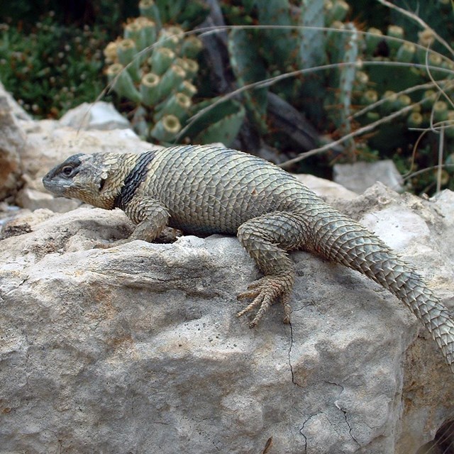
The park has a wide variety of plant and wildlife species due to its location at a convergence of the Chihuahuan Desert, the Edwards Plateau Savannah, and the Tamaulipan Mezquital ecoregions. The elevation range is 282–364 meters (915–1,194 feet) and average annual precipitation is 46 centimeters (18 inches). Amistad National Recreation Area is primarily located in the Tamaulipan thornscrub life zone and has 933 plant species from 112 families. Vertebrate taxa include 60 species of fish, 55 reptiles and amphibians, 67 mammals, and 291 species of birds. We monitor climate, invasive exotic plants, landbirds, and springs, seeps, and tinajas at this park.
-
 Species Lists
Find species lists for this park here
-
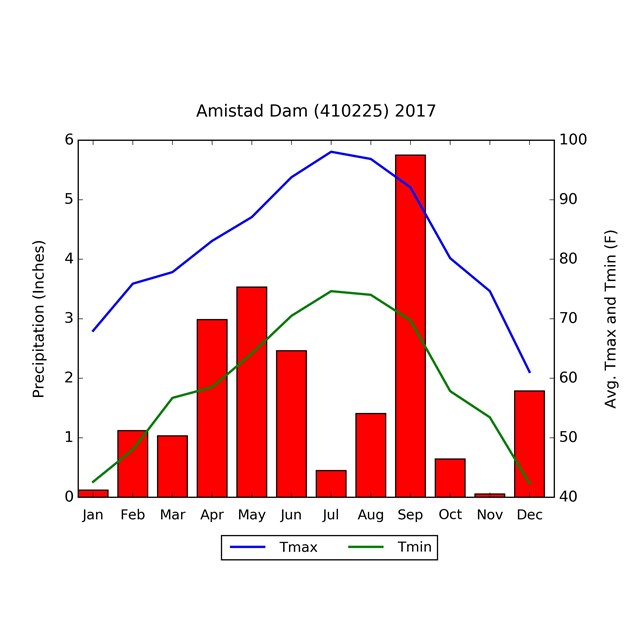 Climate Analyzer
Find climate data for this park here
Reports & Web Articles
Read more about our work at this park in the resource briefs (short summaries), monitoring reports (detailed results), condition assessment (natural resource conditions), and web articles below. An interactive bird checklist for this park is also available here. Inventories (baseline reports and lists of natural resources) and protocols (monitoring procedures) can be found on our reports & publications pages.
Source: NPS DataStore Collection 3788 (results presented are a subset). To search for additional information, visit the NPS DataStore.
Source: NPS DataStore Saved Search 3514 (results presented are a subset). To search for additional information, visit the NPS DataStore.
Source: NPS DataStore Collection 3705 (results presented are a subset). To search for additional information, visit the NPS DataStore.
Source: NPS DataStore Saved Search 1041 (results presented are a subset). To search for additional information, visit the NPS DataStore.
Source: NPS DataStore Saved Search 3353 (results presented are a subset). To search for additional information, visit the NPS DataStore.
Web Articles
Last updated: May 14, 2021