|
Seven days, 13,679 feet of elevation gain, and 74.9 miles through Hawaii Volcanoes National Park. As a backcountry intern for Hawaii Volcanoes National Park during the summer of 2013, I had the opportunity to hike from the coastline to Mokuaweoweo, the summit caldera of Mauna Loa. My friend Emily and I set out to fully experience this special place, not to make the first nor the fastest attempt at a sea to summit ascent. What follows are excerpts from the journal I kept on the trail, shared here in hopes of aiding and inspiring others to set out on this epic adventure. I include our distance, time, and elevation change, as well as daily route and campsite, to give a basic outline of our trip. I also note where we received water, food, and gear drops. Lastly, I share my reflections on each day’s journey and what I experienced along the way. Happy trails! – Lea, HAVO Backcountry Intern 2013. 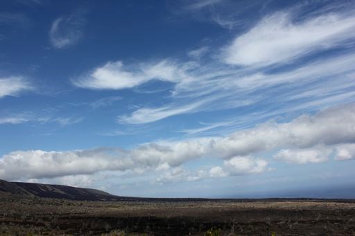
Keauhou, via Keauhou Trail Distance: 7.5 miles Time: 3.5 hours Elevation: - 2,274 ft. Campsite: Keauhou What a day, a day for beginning. Wind pushed us, guided us, forced us even, straight down towards the coast. Wind whipped the ocean below into whitecaps and bursts of sea spray exploding on the rocky shoreline. Whipped my hair out of a tightly woven braid and took my hat off my head. Painted the sky with long, thin brushstrokes of cirrus clouds. We guessed that we were being served the leftovers of tropical storm Flossie and wished for a kite or sail to harness the energy of the wind for ourselves. Started late, around 2 pm from Ainahou, but enough time for a leisurely hike down to Keauhou, stopping to admire the landscape and pua kala seeds. Making time to make photographs in the beautiful long light of the afternoon. Hard to believe that we are really doing this, what everyone else deems as crazy, but we claim as our enjoyment, this sea to summit hike. Planning and talking and dreaming of this for so long, and now we are doing it, a challenge I welcome. 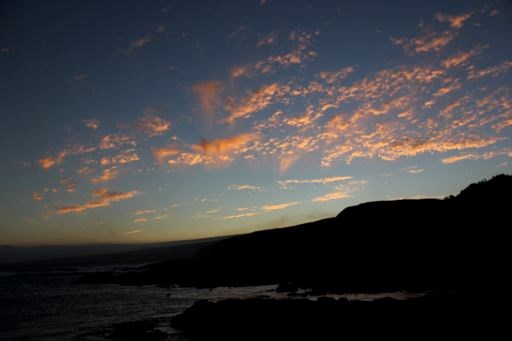
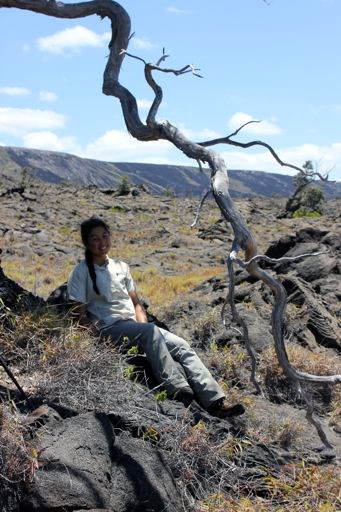
Distance: 9.1 miles Time: 5.5 hours Elevation: + 2,946 ft. Campsite: Off of Ainahou Road (backcountry) Water and food dropped at the end of Ainahou Road the previous day. First day of ascent, nine miles of constant effort required to move myself 3,000 feet up a mountain. Effort felt in gluteus maximus muscles. Effort better measured in sweat and heat and soreness of backs, not miles. Began around 8 am from Keauhou, sun already rising high overhead with hardly a cloud in the sky. Breeze blowing steadily, calmer than yesterday, but enough to have us appreciate its cooling effects. Favorite part of today: Emily and I both had the idea (reading each others minds!) to go off trail a bit to the only shade around, an ohia tree on top of a tiny lava hill. And on one side awaited a perfect chair made of lava, a throne with a view down the coast, an oasis from the heat. On the second long switchback up Poli o Keawe Pali, a koae bird soared right above us, backlit by the noon sun, light filtering through the edges of thin white feathers. So agile yet fragile in the updrafts of wind hitting the pali. A majestic bird to watch, it captivated me with its grace and ease of movement through a hostile environment. Got to the bottom of Ainahou at 1 pm exactly, hungry and tired and hot. Ready to stop and take a break. Turned into a three hour break, napping in the shade. I felt slightly dehydrated so I drank some electrolytes, and luckily my energy returned. Now in the tent, staying warm and out of the chilly wind. Enjoying the company of a good friend, a much needed component of this hike. I really don’t think I would want to do this alone. 
Distance: 14.0 miles Time: 8 hours Elevation: +1,126 ft. Campsite: Namakanipaio Campground Gear (cold-weather clothes) brought to Namakani by friends. Happy Birthday! Couldn’t choose a better way to celebrate my 23rd birthday than climbing mountains, learning a lot, laughing often, and loving much. Woke up to a silhouetted ohia against a sky tinted orange by sunrise, a beautiful way to greet the day I was born. Hiked 14 miles today, at first through aalii, mamane, pukiawe, and ulei, all plants that can tolerate dry conditions. Slowly gained elevation and made our way to the rainforest. Along Escape Road, we encountered uluhe fern thick amongst ohia trees, then thinning to make way for an understory of kawau, pilo, and uki. Finally hapuu tree ferns appeared near Nahuku (Thurston lava tube), and we enjoyed the beauty of the fullness of that rainforest, so many layers loosely arranged, overlapping and lacing together to create a comforting closeness of home. Re-entered a drier climate on the Crater Rim Trail, where rainforest gave way to sparse aalii and ohelo, with our first sighting of koa trees. All through the day, we talked as we walked, talked while we took long breaks, and enjoyed companionship on the trail. Easy grade, gained only 1,000 feet, and wide roads and trails made for a day of hiking side by side. We celebrated when we arrived at the summit of Kilauea, as mist rolled aside to reveal the uahi a Pele plume of Halemaumau. Tonight we held a party of sorts, with friends and family gathering at Namakani to re-fuel us with the warmth of company and good Hawaiian food. Emily’s mom even supplied a birthday cake and candles. The orange glow of Halemaumau just half a mile away lit up the night sky, providing another sense of warmth on this otherwise cool night. 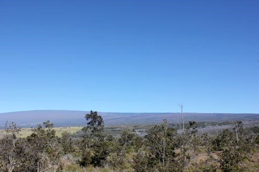
Distance: 13.0 miles Time: 8.5 hours Elevation: +2,698 ft. Campsite: near Mauna Loa Overlook (backcountry) Water, food and gear dropped off for us earlier in the week. We left behind extra gear not needed at cabins (tent and sleeping pad). Halfway there! We are on day four, right in the middle of our seven days on the trail, and halfway in terms of elevation gain and miles. Today began with an unobstructed view of Mauna Loa, and although it seemed to be just a little hill off in the distance, in reality it is the most massive volcano in the world. Somehow making it halfway makes the summit an attainable goal, no longer feeling so crazy for attempting this trip. As we arrived at Mauna Loa Overlook at about 4:30 this afternoon, clouds shifted to frame sweeping views of Kilauea caldera and Mauna Ulu. I asked Emily in disbelief, “were we really just down there yesterday?” It seemed too far away, like an unreasonable distance to hike, but my feet know the truth. Tired and sore, they have felt the land rising beneath them with each step, felt every shift in terrain. Yes, they say, we have really hiked that far. 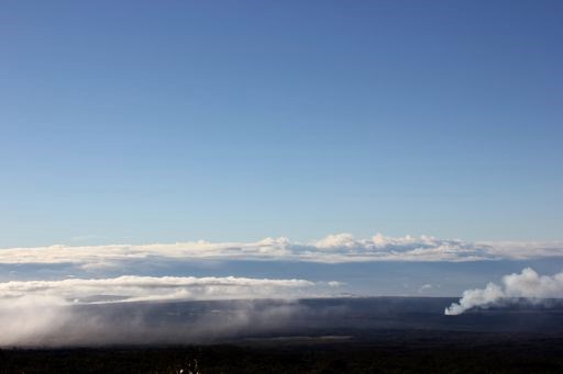
After sunset, we gazed at the glow of Halemaumau from thousands of feet up. Pele burning bright, stars burning too, pinpricks of light in a dark canvas of a moonless sky, all filtered through branches of koa trees. 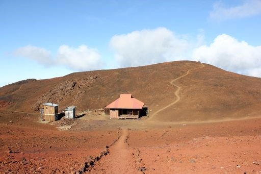
Distance: 8.5 miles Time: 7.5 hours Elevation: +3,053 ft. Campsite: Puu Ulaula Cabin Big yawn signals the end of a long day. Muscles are tight and my body is worn. Today, my thoughts were of challenge and overcoming and pushing through. An upset stomach after lunch made me question our sanity once again. Did I really want to keep hiking? But we made it to the cabin before 4 pm, taking our time after a late start at 9 am. Along with the sore stomach came thoughts of missing the comforts of home, and a realization of how important basic needs are to my happiness. I enjoy being away from those comforts if only to strengthen my appreciation of them when I return home. 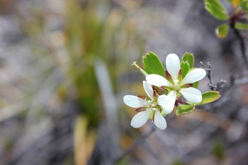
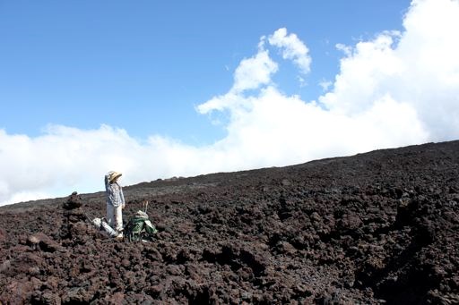
Distance: 12.2 miles Time: 9.5 hours Elevation: +3,285 ft. Campsite: Mauna Loa Summit Cabin Mauna Loa is called the long mountain for a reason, as we discovered today. It takes a long time to get to the top, 9.5 hours from Puu Ulaula Cabin, across the endless lava at an altitude that makes you pay attention to every breath. Reached Dewey Cone at 10 am, 2 hours and 4 miles of hiking behind us. Stopped for a break, and commiserated for the millionth time on our lack of salty snacks. Ran out of jerky two days ago, and our trail mix consisted of dried fruit, pumpkin seeds and health food store m&m’s. Too much sugar, we decided, for too many days. So we dumped some sea salt in the mix and carried on. Just as the hunger pains of lunchtime crept into our bellies, we spied the 12,000 foot sign. Hiking for six days straight gives you an intense appetite, we also discovered. Of course, a quick nap was also on order but soon got our bodies moving again. Rewarded with a view of the land we covered today, the east rift zone we travelled along never more apparent, lined with craters and cinder cones as far as my eye could see. Reds and blacks and browns, the colors of the day, became intense in their isolation. We couldn’t help but think of Mordor, that mythical Lord of the Rings locale, or Mars. Some other world, definitely, we visited today. 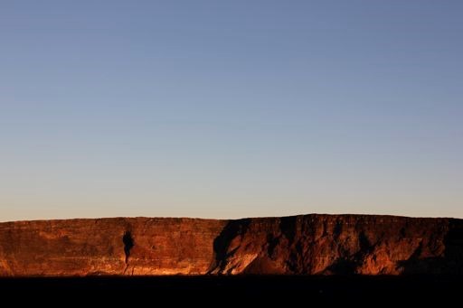
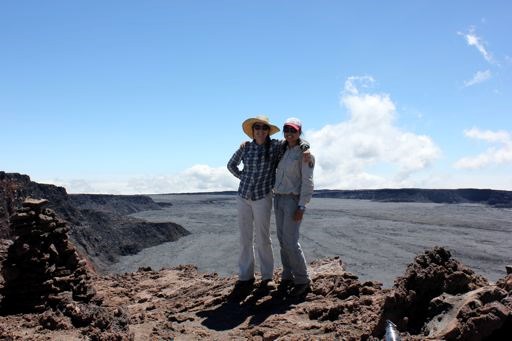
Day 7, August 6: Mauna Loa Summit Cabin to Mauna Loa Observatory (including side trip to the true summit of Mauna Loa) via Mauna Loa Trail, Summit Trail, and Observatory Trail Distance: 10.6 miles Time: 5.5 hours Elevation: +571, -2,000 (estimate) Campsite: None (Home sweet home!) 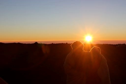
|
Last updated: June 29, 2017
