|
Hike Journal - April 26, 2004 by Annika The attached document recounts our experiences along the Napau Trail. The photos associated with the text are listed beneath each heading. Captions for some of the photos are highlighted.
Napau Trail Early on the misty morning of Monday, April 26, 2004, twenty-one geology students and two of their professors met in front of the famed fireplace at the Volcano House hotel. After discussing the day’s hike and making sure everyone had the necessary supplies (plenty of water, respirator, sunscreen, etc.), our convoy of SUV’s headed down Chain of Craters Road to the Mauna Ulu parking area. By 8:30 am, we were ready to follow the much-anticipated Napau Trail. According to the National Park Service, the Napau Trail is a challenging, 10-mile (one-way) hike from the Mauna Ulu parking lot to the Pu’u O’o (active vent) area. Other points of interest include:
What to Expect When preparing to hike the trail, plan to spend all day hiking across rough lava terrain and through muddy rain forests. The park service requires hikers to obtain a backcountry permit before entering the area and recommends carrying 4-6 quarts of water per person. Expect rain and wind, and stay on the trail to avoid brittle lava that cracks easily. 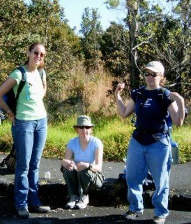
Trailhead The trailhead leaves from the Mauna Ulu parking lot, about 7 miles from the Visitors Center. After shuffling vehicles, we finally left the parking lot at 8:30 in the morning. 

From the Trailhead For the first section of the hike, we followed yellow markers attached to the lava surface. 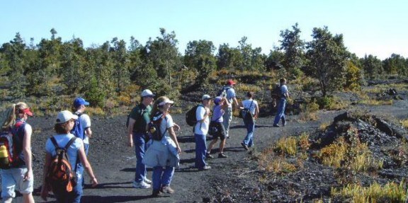
Pahoehoe and Kipukas The first part of the trail crosses pahoehoe lava from eruptions in the early 1970’s. “Pahoehoe,” the Hawaiian term for “ropy,” gets its name from its smooth, billowy texture. Ohia trees are the initial colonizers of these lava flows. The trail also leads through the occasional kipuka, an “island” of vegetation surrounded by younger flows. 
Lava Trees West of Pu’u Huluhulu, numerous lava trees and tree molds are scattered along the trail. Lava trees are formed when lava flows surround a standing tree. The lava level later recedes, leaving lava trees as tall monuments indicating the highest lava level, and the hollow center marking the size of the tree. Tree molds are the horizontal equivalent. When lava surrounds a downed tree, steam from the tree quenches the lava, often leaving the imprint of charred wood. 
Pu’u Huluhulu About one mile from the trailhead, the trail splits and leads up Pu’u Huluhulu, (“Hairy Hill” in Hawaiian). It required briefly hiking uphill, but the shade of the large trees that give the hill its name was welcome after walking across the sparsely vegetated lava. 
The Overlook We reached the viewing area at the top of Pu’u Huluhulu at 9:00 and took a few minutes to look around. 

A View of Pu’u O’o Pu’u O’o was visible along the rift zone to the east. The distant vent could be seen spewing sulfur and steam. 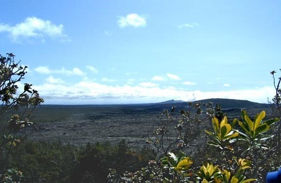
Pu’u Huluhulu to Makaopuhi Seeing Pu’u O’o in the distance gave us a renewed sense of how far we still had to hike, and we headed back down Pu’u Huluhulu and rejoined the main Napau Trail. The second segment of the trail leading to Makaopuhi continued east across pahoehoe from the 1973 and 1974 Mauna Ulu eruptions. 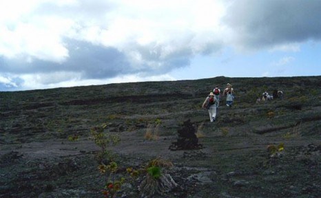
Flow Features We encountered many lava flow features along the trail, including pressure ridges and plateaus, inflated cavities and low spots in-between. 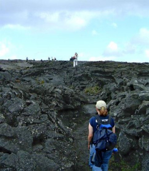
Steam Fields Around 10:00, we encountered a large field of steam along the trail. With all the warnings about sulfuric vog, some of us were at first hesitant to walk through the surreal steam, but were soon enjoying the steam bath and taking plenty of pictures. The steam rising from the surface of the lava results from the evaporation of heated rainwater. 


Makaopuhi Crater We reached the southwest rim of Makaopuhi Crater at 10:45 and took time to enjoy the scenery and pay homage to geologic history. Drilling on the crust of the Makaopuhi Lava Lake began in 1959 and revealed valuable information regarding the sequence of cooling and solidification of lava. The subsurface is still warm, so putting a hand over the drill holes yielded a blast of hot air. 


Into the Woods After a 15-minute break to enjoy the vista at Makaopuhi, we followed the trail into a rain forest of ohia trees and hapuu ferns. The shade was welcome, but avoiding the mud was a challenge that soon became futile. 

Pulu Factory After several miles of nothing but lava and vegetation, the walls of the old Pulu Factory came as an interesting surprise along the hike. 


The Campground Around noon we reached a fork on the trail, and followed one side to the primitive campground and the long-awaited latrine (BYOTP). We retraced our steps back to the main trail and were soon on the edge of Napau Crater. 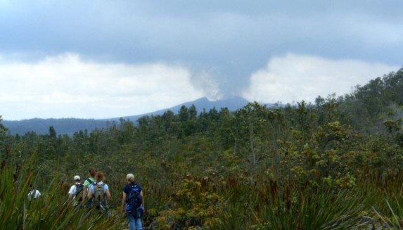
Napau Overlook By 12:30 we were gazing across the expanse of Napau Crater and through the haze toward Pu’u O’o. 

We reached the overlook just in time for lunch. After eating and taking care of oncoming blisters, we donned rain gear in response to the darkening skies. 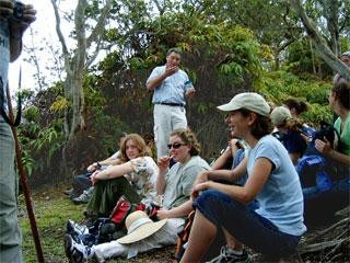
Into the Crater From the overlook, the trail heads northward and then follows a cascade of a’a lava into the crater. The descent was fairly steep, but only took about ten minutes. 
We followed the trail across the crater floor. The lava flow terrain in the crater is covered with a thin blanket of gravel-like tephra from the explosions of Pu’u O’o. We observed spatter ramparts, abundant reticulite, and a few patches of Pele’s hair. 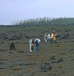
Reticulite Reticulite is a pyroclastic deposit that collects in low spots in the crater. It has a glassy framework and consists of mostly empty space. The light material was very fragile and crumbled in our hands. 

Crossing the Crater After about an hour, we were hiking back up the crater towards the looming vent of Pu’u O’o. 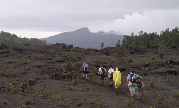
Tephra Fields At 2:00 we were hiking across large fields of tephra ejected from Pu’u O’o. It is important to follow the trail to avoid falling into cracks hidden by the blanket of tephra. 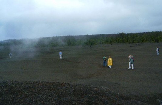
Solidified Flows As we approached the looming vent, we encountered recent lava flows of glassy basalt spilling out in tongues across the tephra. 
page 1 | 2
|
Last updated: August 15, 2017
